Carroll, New York
Carroll is a town in Chautauqua County, New York, United States. The population was 3,524 at the 2010 census.[3] The town is named after Charles Carroll, a signer of the Declaration of Independence.
Carroll, New York | |
|---|---|
Town | |
| Motto(s): Unity for our Community | |
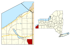 Location within Chautauqua County and New York | |
 Carroll Location within the state of New York | |
| Coordinates: 42°2′44″N 79°7′37″W | |
| Country | United States |
| State | New York |
| County | Chautauqua |
| Government | |
| • Type | Town Council |
| • Town Supervisor | Russell L. Payne (R) |
| • Town Council | Members' List
|
| Area | |
| • Total | 33.34 sq mi (86.36 km2) |
| • Land | 33.32 sq mi (86.30 km2) |
| • Water | 0.02 sq mi (0.06 km2) |
| Elevation | 1,453 ft (443 m) |
| Population (2010) | |
| • Total | 3,524 |
| • Estimate (2016)[2] | 3,388 |
| • Density | 101.68/sq mi (39.26/km2) |
| Time zone | UTC-5 (Eastern (EST)) |
| • Summer (DST) | UTC-4 (EDT) |
| ZIP code | 14738 (Frewsburg) |
| FIPS code | 36-013-12639 |
| GNIS feature ID | 0978796 |
| Website | carrollny |
The town of Carroll is in the southeast corner of Chautauqua County and is southeast of the city of Jamestown.
History
The area was settled around 1809. The town of Carroll was established in 1825 from part of the town of Ellicott. In 1853, part of Carroll was used to form the town of Kiantone. In 1900, the town had a population of 1,684.
Geography
According to the United States Census Bureau, the town has a total area of 33.4 square miles (86.4 km2), of which 0.023 square miles (0.06 km2), or 0.07%, is water.[3] The town is drained by Conewango Creek, a tributary of the Allegheny River.
The south town line of Carroll is the state boundary of Pennsylvania.
U.S. Route 62 passes through the northwest part of the town.
Adjacent towns and other areas
The town of Poland is to the north. The towns of Kiantone and Ellicott are to the west. The town of South Valley in Cattaraugus County is on the east. Pine Grove Township, Warren County, Pennsylvania, is across the south town line.
Demographics
| Historical population | |||
|---|---|---|---|
| Census | Pop. | %± | |
| 1830 | 1,015 | — | |
| 1840 | 1,649 | 62.5% | |
| 1850 | 1,833 | 11.2% | |
| 1860 | 1,525 | −16.8% | |
| 1870 | 1,548 | 1.5% | |
| 1880 | 1,718 | 11.0% | |
| 1890 | 1,787 | 4.0% | |
| 1900 | 1,684 | −5.8% | |
| 1910 | 1,564 | −7.1% | |
| 1920 | 1,761 | 12.6% | |
| 1930 | 1,972 | 12.0% | |
| 1940 | 2,086 | 5.8% | |
| 1950 | 2,286 | 9.6% | |
| 1960 | 2,661 | 16.4% | |
| 1970 | 3,115 | 17.1% | |
| 1980 | 3,579 | 14.9% | |
| 1990 | 3,539 | −1.1% | |
| 2000 | 3,635 | 2.7% | |
| 2010 | 3,524 | −3.1% | |
| Est. 2016 | 3,388 | [2] | −3.9% |
| U.S. Decennial Census[4] | |||
As of the census[5] of 2000, there were 3,635 people, 1,364 households, and 1,002 families residing in the town. The population density was 108.9 people per square mile (42.1/km2). There were 1,440 housing units at an average density of 43.2 per square mile (16.7/km2). The racial makeup of the town was 99.04% White, 0.14% African American, 0.22% Native American, 0.14% Asian, 0.17% from other races, and 0.30% from two or more races. Hispanic or Latino of any race were 0.47% of the population. 25.8% were of Swedish, 24.5% German, 19.1% English, 9.0% English and 15.1% Irish ancestry according to Census 2000.
There were 1,364 households, out of which 34.3% had children under the age of 18 living with them, 60.9% were married couples living together, 8.7% had a female householder with no husband present, and 26.5% were non-families. 22.7% of all households were made up of individuals, and 13.6% had someone living alone who was 65 years of age or older. The average household size was 2.61 and the average family size was 3.05.
In the town, the population was spread out, with 25.9% under the age of 18, 6.4% from 18 to 24, 26.4% from 25 to 44, 23.9% from 45 to 64, and 17.4% who were 65 years of age or older. The median age was 40 years. For every 100 females, there were 94.3 males. For every 100 females age 18 and over, there were 89.9 males.
The median income for a household in the town was $38,313, and the median income for a family was $43,750. Males had a median income of $34,766 versus $21,620 for females. The per capita income for the town was $16,828. About 2.7% of families and 3.4% of the population were below the poverty line, including 1.6% of those under age 18 and 7.0% of those age 65 or over.
Communities and locations in Carroll
- Conewango Creek – A stream forming part of the western town boundary that flows past Frewsburg.
- Dodge – A hamlet in the southeast corner of the town, named after an early family. The community is slightly north of the Pennsylvania border.
- Fentonville – A hamlet on County Road 53 (Warren Road) in the southwest corner of the town.
- Frewsburg – The hamlet and census-designated place of Frewsburg is near the west town line and is the largest community in the town.
- Ivory – A hamlet east of Frewsburg on County Road 36 (Ivory Road).
References
- "2016 U.S. Gazetteer Files". United States Census Bureau. Retrieved Jul 4, 2017.
- "Population and Housing Unit Estimates". Retrieved June 9, 2017.
- "Geographic Identifiers: 2010 Demographic Profile Data (G001): Carroll town, Chautauqua County, New York". U.S. Census Bureau, American Factfinder. Archived from the original on February 12, 2020. Retrieved November 4, 2014.
- "Census of Population and Housing". Census.gov. Retrieved June 4, 2015.
- "U.S. Census website". United States Census Bureau. Retrieved 2008-01-31.
External links
Municipalities and communities of Chautauqua County, New York, United States | ||
|---|---|---|
| Cities | 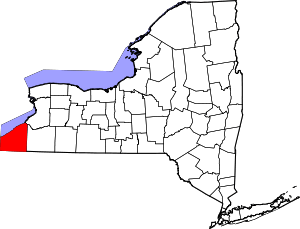 | |
| Towns | ||
| Villages | ||
| CDPs | ||
| Other hamlets | ||
| Indian reservation | ||