Bemus Point, New York
Bemus Point is a village in Chautauqua County, New York, United States. The village is within the town of Ellery and is located along the eastern shore of Chautauqua Lake. The population was 364 at the 2010 census.[2] Bemus Point is home of the "Floating Stage", with many performers during the summer.
Bemus Point, New York | |
|---|---|
Village | |
 From right to left: Village Casino, Stow Ferry landing, The Italian Fisherman and Floating Stage | |
| Motto(s): Get to the Point… Bemus Point | |
 Bemus Point Location within the state of New York | |
| Coordinates: 42°9′46″N 79°23′28″W | |
| Country | United States |
| State | New York |
| County | Chautauqua |
| Town | Ellery |
| Government | |
| • Mayor | Bryan P. Dahlberg (R) |
| Area | |
| • Total | 0.44 sq mi (1.13 km2) |
| • Land | 0.44 sq mi (1.13 km2) |
| • Water | 0.0 sq mi (0.0 km2) |
| Elevation | 1,322 ft (403 m) |
| Population (2017 United States Census) | |
| • Total | 354 |
| • Estimate (2016)[1] | 355 |
| • Density | 810/sq mi (310/km2) |
| Time zone | UTC-5 (Eastern (EST)) |
| • Summer (DST) | UTC-4 (EDT) |
| ZIP code | 14712 |
| Area code(s) | 716 |
| FIPS code | 36-05848 |
| GNIS feature ID | 0943649 |
| Website | bemuspointny |
Geography
Bemus Point is located along the southwestern edge of the town of Ellery, on the eastern shore of Chautauqua Lake at 42°9′46″N 79°23′28″W (42.162886, -79.391230).[3] The village is immediately north of the location where Interstate 86 crosses Chautauqua Lake. Access to the village is from exits 9 and 10.
According to the United States Census Bureau, the village has a total area of 0.44 square miles (1.13 km2), all of it land.[2]
Community
Bemus Point is home to many restaurants including the See Zurh House, The Fish, Ellicottville Brewing on Chautauqua and the Village Casino. Bemus Point also has a 9-hole golf course, tennis courts, basketball courts, a small beach, park and free boat launch. The village's school district, Bemus Point Central School District, recently won its second New York State football championship. It is also proud to have three-time defending state champions in women's cross country (2010, 2011, 2012).
History
The area currently known as Bemus Point was first settled by William Bemus in 1806. Bemus had purchased land on both sides of Chautauqua Lake from the Holland Land Company in 1805 at a cost of $1.50. He moved his family to the east side of the lake (in the area now known as Bemus Point) on March 9, 1806. The Bemus family lived in a log cabin approximately 500 to 660 feet (150 to 200 m) northeast of the current ferry landing site. Bemus descendants still reside on original family property along Lakeside Drive north of Bemus Street.[4]
The village of Bemus Point was incorporated in 1911.
A ferry connecting Bemus Point and Stow was founded in 1811 by Thomas Bemus. The original ferry was a raft built by Thomas, and had to be poled across the lake.[4] Today, a cable-drawn ferry exists in its place and is operated by the Sea Lion Project.[5] Until the nearby bridge (now part of I-86) opened October 30, 1982, the Bemus-Stow Ferry was the only way to cross Chautauqua Lake. When closed for the winter months, motorists had to travel northwest to Mayville, or southeast to Jamestown to reach Stow. Either way was a 19-mile (31 km) round trip. Local residents often purchased a seasonal pass to use the ferry, commuting to Lakewood, Sherman, or other areas west of the lake.
Throughout the 1800s, Bemus Point gained popularity as a tourist destination, which promoted its growth and development. By the early 1900s, a dance hall known as the Casino, which still exists under the same name, became a well-known venue for entertainment, particularly big band music.[4]
Bemus Point hosted the "Bemus Bay Pops" concert, which involved many local musicians, and was also host to the "Chautauqua Lake Voices", similar to American Idol.
The village volunteer fire department was chartered in 1920, and began its operations with a Model T fire truck. Today the Bemus Point Volunteer Fire Department continues to serve the residents of the village and the surrounding community.
Today Bemus Point is still a popular summer tourist destination, with a large influx of summer population.
Demographics
| Historical population | |||
|---|---|---|---|
| Census | Pop. | %± | |
| 1920 | 227 | — | |
| 1930 | 280 | 23.3% | |
| 1940 | 290 | 3.6% | |
| 1950 | 424 | 46.2% | |
| 1960 | 443 | 4.5% | |
| 1970 | 487 | 9.9% | |
| 1980 | 444 | −8.8% | |
| 1990 | 383 | −13.7% | |
| 2000 | 340 | −11.2% | |
| 2010 | 364 | 7.1% | |
| Est. 2016 | 355 | [1] | −2.5% |
| U.S. Decennial Census[6] | |||
At the 2000 census there were 340 people, 170 households, and 95 families in the village. The population density was 850.0 people per square mile (309.1/km²). There were 218 housing units at an average density of 545.0 per square mile (198.2/km²). The racial makeup of the village was 97.65% White, 0.88% Native American, 0.59% Asian, 0.29% from other races, and 0.59% from two or more races. Hispanic or Latino of any race were 0.88%.[7]
Of the 170 households 18.8% had children under the age of 18 living with them, 44.1% were married couples living together, 9.4% had a female householder with no husband present, and 44.1% were non-families. 38.8% of households were one person and 24.7% were one person aged 65 or older. The average household size was 2.00 and the average family size was 2.65.
The age distribution was 17.6% under the age of 18, 4.7% from 18 to 24, 23.5% from 25 to 44, 26.5% from 45 to 64, and 27.6% 65 or older. The median age was 47 years. For every 100 females, there were 85.8 males. For every 100 females age 18 and over, there were 79.5 males.
The median household income was $33,333 and the median family income was $46,250. Males had a median income of $37,708 versus $25,625 for females. The per capita income for the village was $19,943. About 3.9% of families and 7.6% of the population were below the poverty line, including 10.8% of those under age 18 and 9.5% of those age 65 or over.
At the 2010 census, there were 364 people (an increase of 24 people or 7.06%) and 170 households in the village. The population density was 910.0 people per square mile (330.9/km²). The racial make up of the village was: 96.43% (351 people) white; 2.20% (8 people) Asian; 0.28% (1 person) other; and 1.10% (4 people) of two or more races. The Hispanic/Latino population of any race was 0.28% (1 person).
The age distribution was 19.23% (70 people) under the age of 18, 2.20% (8 people) ages 18 and 19, 3.02% (11 people) ages 20–24, 4.40% (16 people) ages 25–34, 19.78% (72 people) ages 35–49, 25.55% (93 people) ages 50–64, and 25.82% (94 people) over the age of 65. The male population made up 46.43% (169 people) of the total population and the female population made up 53.57% of the total population.[8]
Education
Notable people
- Kevyn Adams, retired NHL player
- Bill Baldwin, science fiction writer
- Jorn Barger, notable blogger
- Bainbridge Colby, United States Secretary of State, maintained a home north of the village on what is now Sunset Bay Road, where he died in 1950
References
- "Population and Housing Unit Estimates". Retrieved June 9, 2017.
- "Geographic Identifiers: 2010 Demographic Profile Data (G001): Bemus Point village, New York". U.S. Census Bureau, American Factfinder. Archived from the original on February 12, 2020. Retrieved November 7, 2014.
- "US Gazetteer files: 2010, 2000, and 1990". United States Census Bureau. 2011-02-12. Retrieved 2011-04-23.
- History of Bemus Point Archived December 21, 2007, at the Wayback Machine
- Sea Lion Project Ltd. Archived June 14, 2013, at the Wayback Machine
- "Census of Population and Housing". Census.gov. Retrieved June 4, 2015.
- "U.S. Census website". United States Census Bureau. Retrieved 2008-01-31.
- "2010 U.S. Census". Archived from the original on 8 January 2012. Retrieved 14 September 2012.
- "Welcome to the Bemus Point Central School District". Retrieved 2009-03-15.
External links
Municipalities and communities of Chautauqua County, New York, United States | ||
|---|---|---|
| Cities | 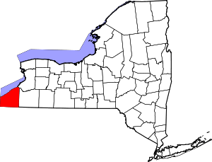 | |
| Towns | ||
| Villages | ||
| CDPs | ||
| Other hamlets | ||
| Indian reservation | ||