Cape May, New Jersey
Cape May is a city at the southern tip of Cape May Peninsula in Cape May County, New Jersey, where the Delaware Bay meets the Atlantic Ocean. One of the country's oldest vacation resort destinations,[20] it is part of the Ocean City Metropolitan Statistical Area. As of the 2010 United States Census, the city had a year-round population of 3,607,[9][10][11] reflecting a decline of 427 (-10.6%) from the 4,034 counted in the 2000 Census, which had in turn declined by 634 (-13.6%) from the 4,668 counted in the 1990 Census.[21] In the summer, Cape May's population is expanded by as many as 40,000 to 50,000 visitors.[22][23] The entire city of Cape May is designated the Cape May Historic District, a National Historic Landmark due to its concentration of Victorian buildings.
Cape May, New Jersey | |
|---|---|
| City of Cape May | |
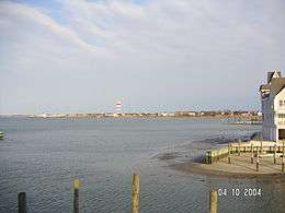
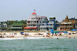 Beach Avenue, from the sea | |
| Motto(s): The Nation's Oldest Seashore Resort | |
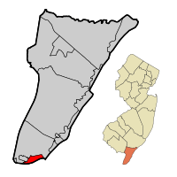 Cape May City highlighted in Cape May County. Inset map: Cape May County highlighted in the State of New Jersey. | |
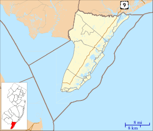
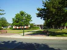
 Census Bureau map of Cape May, New Jersey | |
 Cape May City Location in Cape May County 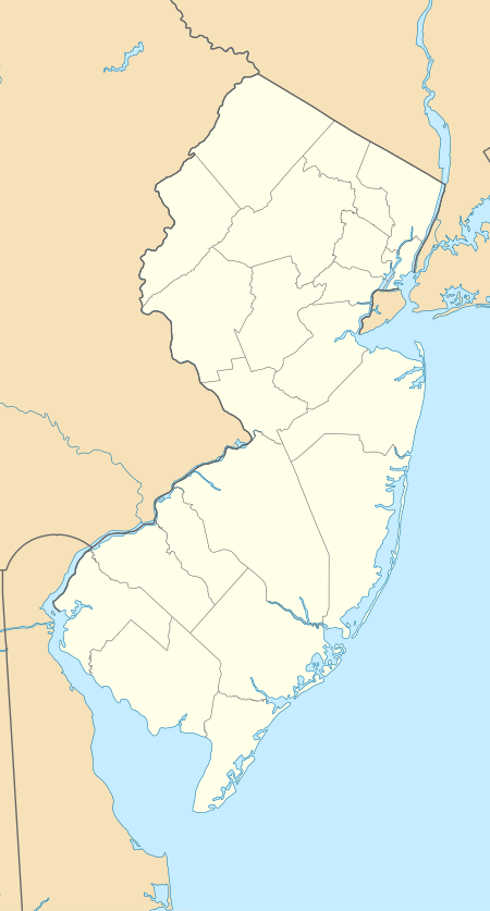 Cape May City Location in New Jersey  Cape May City Location in the United States | |
| Coordinates: 38°56′21″N 74°54′13″W[1][2] | |
| Country | |
| State | |
| County | Cape May |
| Incorporated | March 8, 1848, as Cape Island Borough |
| Reincorporated | March 10, 1851, as Cape Island City |
| Reincorporated | March 9, 1869, as Cape May City |
| Named for | Cornelius Jacobsen Mey |
| Government | |
| • Type | Faulkner Act (Council-Manager) |
| • Body | City Council |
| • Mayor | Clarence F. Lear III (term ends December 31, 2020)[4][5] |
| • Manager | Jerry Inderwies Jr.[6] |
| • Municipal clerk | Erin Burke[7] |
| Area | |
| • Total | 2.743 sq mi (7.103 km2) |
| • Land | 2.404 sq mi (6.226 km2) |
| • Water | 0.339 sq mi (0.877 km2) 12.35% |
| Area rank | 359th of 566 in state 8th of 16 in county[1] |
| Elevation | 10 ft (3 m) |
| Population | |
| • Total | 3,607 |
| • Estimate (2019)[12] | 3,422 |
| • Rank | 428th of 566 in state 8th of 16 in county[13] |
| • Density | 1,500.6/sq mi (579.4/km2) |
| • Density rank | 336th of 566 in state 6th of 16 in county[13] |
| Time zone | UTC−05:00 (Eastern (EST)) |
| • Summer (DST) | UTC−04:00 (Eastern (EDT)) |
| ZIP Code | |
| Area code(s) | 609[16] |
| FIPS code | 3400910270[1][17][18] |
| GNIS feature ID | 0885178[1][19] |
| Website | www |
Cape May was recognized as one of America's top 10 beaches by the Travel Channel and its beach was ranked fifth in New Jersey in the 2008 Top 10 Beaches Contest sponsored by the New Jersey Marine Sciences Consortium. It is also known as one of the best beaches on the Middle Atlantic coast.[24]
History
The area was originally settled by the Kechemeche people, who were part of the Lenape tribe.[25] The Kechemeche first encountered European colonialists around 1600. The city was named for the Dutch captain Cornelius Jacobsen Mey, who explored and charted the area between 1611–1614 and established a claim for the province of New Netherland.[26][27] It was later settled by New Englanders from the New Haven Colony.
What is now Cape May was originally formed as the borough of Cape Island by an act of the New Jersey Legislature on March 8, 1848, from portions of Lower Township. It was reincorporated as Cape Island City on March 10, 1851, and finally became Cape May City as of March 9, 1869.[28]
Cape May began hosting vacationers from Philadelphia in the mid 18th century and is recognized as the country's oldest seaside resort.[29] [23] Following the construction of Congress Hall in 1816, Cape May became increasingly popular in the 19th century and was considered one of the finest resorts in America by the 20th century.[30]
The city has suffered two devastating fires. In the early hours of 31 August 1869 a fire broke out in the "Japanese store" on Washington Street. The fire destroyed the post office and at least thirty-five other buildings. Press reports at the time did not mention any deaths.[31] In 1878, a five-day-long fire destroyed 30 blocks of the town center and, as part of the reconstruction efforts, replacement homes were almost uniformly of Victorian style.[32] As a result of this and of more recent preservation efforts, Cape May is noted for its large number of well-maintained Victorian houses — the second largest collection of such homes in the nation after San Francisco.
Tourism to the city was boosted in the 1860s by the opening of the Tuckahoe and Cape May Railroad in 1863.
In 1976, the entire city of Cape May was officially designated a National Historic Landmark as the Cape May Historic District, making Cape May the only city in the United States wholly designated as such.[33] That designation is intended to ensure the architectural preservation of these buildings.
U.S. Navy support during World War II
Because of the World War II submarine threat off the East Coast of the United States, especially off the shore of Cape May and at the mouth of the Delaware Bay, numerous United States Navy facilities were located here in order to protect American coastal shipping. Cape May Naval facilities, listed below, provided significant help in reducing the number of ships and crew members lost at sea.[34]
- Naval Air Station, Cape May
- Naval Base, Cape May
- Inshore Patrol, Cape May
- Naval Annex, Inshore Patrol, Cape May
- Joint Operations Office, Naval Base, Cape May
- Welfare and Recreation Office, Cape May
- Dispensary, Naval Air Station, Cape May
- Naval Frontier Base, Cape May
- Degaussing Range (Cold Spring Inlet), Naval Base, Cape May
- Joint Operations Office, Commander Delaware Group, ESF, Cape May
- Anti-Submarine Attack Teacher Training Unit, U.S. Naval Base, Cape May
- Naval Annex, Admiral Hotel, Cape May
Geography
According to the United States Census Bureau, the city had a total area of 2.743 square miles (7.103 km2), including 2.404 square miles (6.226 km2) of land and 0.339 square miles (0.877 km2) of water (12.35%).[1][2] Cape May is generally low-lying; its highest point, at the intersection of Washington and Jackson Streets, is 14 feet (4.3 m) above sea level.[35]
Unincorporated communities, localities and place names located partially or completely within the city include Poverty Beach.[36]
Cape May borders the Cape May County municipalities of Lower Township and West Cape May Borough, as well as the Atlantic Ocean and Delaware Bay.[37][38][39] The Cape May–Lewes Ferry provides transportation across the Delaware Bay between North Cape May, New Jersey and Lewes, Delaware.
Cape May Harbor, which borders Lower Township and nearby Wildwood Crest allows fishing vessels to enter from the Atlantic Ocean, was created as of 1911, after years of dredging completed the harbor which covers 500 acres (200 ha).[40] Cape May Harbor Fest celebrates life in and around the harbor, with the 2011 event commemorating the 100th anniversary of the harbor's creation.[41]
Cape May is the southernmost point in New Jersey.[42] It is at approximately the same latitude as Washington, D.C. and Arlington, Virginia [43]
Demographics
| Historical population | |||
|---|---|---|---|
| Census | Pop. | %± | |
| 1870 | 1,248 | — | |
| 1880 | 1,699 | 36.1% | |
| 1890 | 2,136 | 25.7% | |
| 1900 | 2,257 | 5.7% | |
| 1910 | 2,471 | 9.5% | |
| 1920 | 2,999 | 21.4% | |
| 1930 | 2,637 | −12.1% | |
| 1940 | 2,583 | −2.0% | |
| 1950 | 3,607 | 39.6% | |
| 1960 | 4,477 | 24.1% | |
| 1970 | 4,392 | −1.9% | |
| 1980 | 4,853 | 10.5% | |
| 1990 | 4,668 | −3.8% | |
| 2000 | 4,034 | −13.6% | |
| 2010 | 3,607 | −10.6% | |
| Est. 2019 | 3,422 | [12][44] | −5.1% |
| Population sources: 1870-2000[45] 1870-1920[46] 1870[47][48] 1880-1890[49] 1890-1910[50] 1910-1930[51] 1930-1990[52] 2000[53][54] 2010[9][10][11] | |||
2010 Census
The 2010 United States Census counted 3,607 people, 1,457 households, and 782.409 families in the city. The population density was 1,500.6 per square mile (579.4/km2). There were 4,155 housing units at an average density of 1,728.5 per square mile (667.4/km2). The racial makeup of the city was 89.05% (3,212) White, 4.85% (175) Black or African American, 0.30% (11) Native American, 0.67% (24) Asian, 0.11% (4) Pacific Islander, 2.30% (83) from other races, and 2.72% (98) from two or more races. Hispanic or Latino of any race were 8.62% (311) of the population.[9]
The 1,457 households accounted 16.3% with children under the age of 18 living with them; 44.6% were married couples living together; 7.5% had a female householder with no husband present, and 46.3% were non-families. Of all households, 42.0% were made up of individuals, and 27.9% had someone living alone who was 65 years of age or older. The average household size was 1.95 and the average family size was 2.64.[9]
In the city, the population age was spread out with 12.8% under the age of 18, 20.6% from 18 to 24, 18.6% from 25 to 44, 20.3% from 45 to 64, and 27.6% who were 65 years of age or older. The median age was 42.2 years. For every 100 females, the population had 104.7 males. For every 100 females ages 18 and older there were 107.4 males.[9]
The Census Bureau's 2006-2010 American Community Survey showed that (in 2010 inflation-adjusted dollars) median household income was $35,660 (with a margin of error of +/- $4,248) and the median family income was $50,846 (+/- $16,315). Males had a median income of $43,015 (+/- $20,953) versus $31,630 (+/- $22,691) for females. The per capita income for the city was $30,046 (+/- $4,010). About 2.2% of families and 4.8% of the population were below the poverty line, including 5.1% of those under age 18 and 7.1% of those age 65 or over.[55]
2000 Census
As of the 2000 United States Census[17] there were 4,034 people, 1,821 households, and 1,034 families residing in the city. The population density was 1,623.7 people per square mile (628.0/km2). There were 4,064 housing units at an average density of 1,635.7 per square mile (632.7/km2). The racial makeup of the city was 91.32% White, 5.26% African American, 0.20% Native American, 0.40% Asian, 0.05% Pacific Islander, 1.26% from other races, and 1.51% from two or more races. Hispanic or Latino of any race were 3.79% of the population.[53][54]
There were 1,821 households, out of which 18.0% had children under the age of 18 living with them, 47.6% were married couples living together, 7.0% had a female householder with no husband present, and 43.2% were non-families. 39.4% of all households were made up of individuals, and 24.2% had someone living alone who was 65 years of age or older. The average household size was 2.02 and the average family size was 2.69.[53][54]
In the city the population was spread out, with 16.3% under the age of 18, 11.5% from 18 to 24, 19.8% from 25 to 44, 23.9% from 45 to 64, and 28.5% who were 65 years of age or older. The median age was 47 years. For every 100 females, there were 97.1 males. For every 100 females age 18 and over, there were 94.5 males.[53][54]
The median income for a household in the city was $33,462, and the median income for a family was $46,250. Males had a median income of $29,194 versus $25,842 for females. The per capita income for the city was $29,902. About 7.7% of families and 9.1% of the population were below the poverty line, including 7.0% of those under age 18 and 10.9% of those age 65 or over.[53][54]
Economy
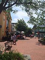
Tourism is the dominant industry. Cape May's economy runs on shops, restaurants, lodgings and tourist attractions on Washington Street Mall, along the boardwalk and elsewhere throughout town. Many historic hotels and B&Bs dot the landscape. Commercial and sport fishing are also important to Cape May's economy. The Cove Beach host hundreds of swimmers, sunbathers, surfers, and hikers each day.[56] Located at the very south west end of town, with a totally unobstructed view each day of the sunset Marine mammal watching, bird watching, and other forms of eco-tourism have become equally important. A small wine growing area is adjacent to Cape May and tours of several wineries are available.
For a period of several decades before 2010, French Canadian tourists visited Cape May during the summer. Cape May County established a tourism office in Montreal, Quebec, but around 1995 it closed due to budget cuts. By 2010 the tourism office of Cape May County established a French language coupon booklet.[57]
Arts and culture

Cape May has become known both for its Victorian gingerbread homes and its cultural offerings. The town hosts the Cape May Jazz Festival,[58] the Cape May Music Festival[59] and the Cape May, New Jersey Film Festival.[60] Cape May Stage, an Equity theater founded in 1988, performs at the Robert Shackleton Playhouse on the corner of Bank and Lafayette Streets.[61] East Lynne Theater Company, an Equity professional company specializing in American classics and world premieres, has its mainstage season from June–December and March, with school residencies throughout the year.[62] Cape May is home to the Mid-Atlantic Center for the Arts & Humanities (MAC), established in 1970 by volunteers who succeeded in saving the 1879 Emlen Physick Estate from demolition. MAC offers a wide variety of tours, activities and events throughout the year for residents and visitors and operates three Cape May area historic sites—the 1879 Emlen Physick Estate, the Cape May Lighthouse and the World War II Lookout Tower.[63] The Center for Community Arts (CCA) offers African American history tours of Cape May, arts programs for young people[64] and is transforming the historic Franklin Street School, constructed in 1928 to house African-American students in a segregated school, into a Community Cultural Center.[65]
Cape May is the home of the so-called "Cape May diamonds". They show up at Sunset Beach and other beaches in the area. These are in fact clear quartz pebbles that wash down from the Delaware River. They begin as prismatic quartz (including the color sub-varieties such as smoky quartz and amethyst) in the quartz veins alongside the Delaware River that get eroded out of the host rock and wash down 200 miles to the shore. Collecting Cape May diamonds is a popular pastime and many tourist shops sell them polished or even as faceted stones.[66]
The Cape May area is also world-famous for the observation of migrating birds, especially in the fall. With over 400 bird species having been recorded in this area by hundreds of local birders, Cape May is arguably the top bird-watching area in the entire Northeastern United States. The Cape May Warbler, a small songbird, takes it name from this location. The Cape May Bird Observatory is based nearby at Cape May Point.[67]
Cape May is also a destination for marine mammal watching. Several species of whales and dolphins can be seen in the waters of the Delaware Bay and Atlantic Ocean, many within 10 miles (16 km) of land, due to the confluence of fresh and saltwater that make for a nutrient rich area for marine life. Whale and dolphin watching cruises are a year-round attraction in Cape May, part of an ecotourism / agritourism industry that generated $450 million in revenue in the county, the most of any in the state.[68]
Fisherman's Memorial
The Cape May Fisherman's Memorial, at Baltimore and Missouri Avenues, was erected in 1988. It consists of a circular plaza reminiscent of a giant compass, a granite statue of a mother and two small children looking out to Harbor Cove, and a granite monument listing the names of 75 local fishermen who died at sea. The names begin with Andrew Jeffers, who died in 1893, and include the six people who died in March 2009 with the sinking of the scalloping boat Lady Mary.[69] The granite statue was designed by Heather Baird with Jerry Lynch. The memorial is maintained by the City of Cape May and administered by the Friends of the Cape May Fisherman's Memorial. Visitors often leave a stone or seashell on the statue's base in tribute to the fishermen.[70]
Government

Local government
Effective July 1, 2004, the City of Cape May switched to a Council-Manager form of government under the Faulkner Act,[71] after having used Plan A of the Faulkner Act Small Municipality form since 1995.[72][73] The governing body consists of a Mayor and a Borough Council comprising four council members, with all positions elected at large in non-partisan elections. A Mayor is elected directly by the voters to a four-year term of office. The Borough Council is elected to serve four-year terms on a staggered basis, with three seats coming up for election and then the mayor and the fourth seat two years later. Following the 2004 elections, the first under the new form of government, lots were drawn to determine which of the newly elected members would serve a four-year term, with the other three serving two-year terms. A city manager is responsible for the city's executive functions, managing Cape May's activities and operation.[3][74] Voters approved a November 2010 referendum to shift the city's elections from May to November, with city officials estimating that the change would save $30,000 in costs associated with each May election.[75]
As of 2020, the Mayor of Cape May City is Clarence F. Lear III, whose term of office ends December 31, 2020. Other members of the Cape May City Council are Deputy Mayor Patricia Gray Hendricks (2020), Shaine P. Meier (2022), Zack Mullock (2022) and Stacy D. Sheehan (2022).[4][76][77][78][79][80]
in March 2015, Councilman Jerry Inderwies Jr. resigned to protest what he called a "witch hunt" against the police chief.[81] In the November 2015 general election, Roger Furlin was elected to fill the balance of the council seat vacated by Inderwies.[82]
On February 4, 2020, former councilmember Jerry Inderwies Jr. was appointed by Cape May City Council to the position of City Manager, having had served as the Deputy City Manager since June 2018.[83][84][85]
Federal, state and county representation

Cape May City is located in the 2nd Congressional District[86] and is part of New Jersey's 1st state legislative district.[10][87][88]
For the 116th United States Congress, New Jersey's Second Congressional District is represented by Jeff Van Drew (R, Dennis Township).[89] New Jersey is represented in the United States Senate by Democrats Cory Booker (Newark, term ends 2021)[90] and Bob Menendez (Paramus, term ends 2025).[91][92]
For the 2020–2021 session (Senate, General Assembly), the 1st Legislative District of the New Jersey Legislature is represented in the State Senate by Mike Testa (R, Vineland) and in the General Assembly by Antwan McClellan (R, Ocean City) and Erik K. Simonsen (R, Lower Township).[93][94]
Cape May County is governed by a Board of Chosen Freeholders consisting of five members, elected at-large in partisan elections to three-year terms of office on a staggered basis, with one or two seats coming up for election each year; At an annual reorganization held each January, the freeholders select one member to serve as Director and another to serve as Vice-Director.[95] As of 2018, Cape May County's Freeholders are Freeholder Director Gerald M. Thornton (Republican Party, Cape May Court House in Middle Township; term as freeholder expires December 31, 2019, term as freeholder director ends 2018),[96] Freeholder Vice-Director Leonard C. Desiderio (R, Sea Isle City; term as freeholder and as freeholder vice-director ends 2018),[97] E. Marie Hayes (R, Ocean City; 2019),[98] Will Morey (R, Wildwood Crest; 2020)[99] and Jeffrey L. Pierson (R. Upper Township; 2020).[100][95][101][102] The county's constitutional officers are County Clerk Rita Marie Fulginiti (R, 2020, Ocean City),[103][104] Sheriff Robert Nolan (R, 2020, Lower Township)[105][106] and Surrogate Dean Marcolongo (R, 2022, Upper Township).[107][108][109][101]
Politics
As of March 23, 2011, there were a total of 1,932 registered voters in Cape May City, of which 452 (23.4%) were registered as Democrats, 838 (43.4%) were registered as Republicans and 640 (33.1%) were registered as Unaffiliated. There were 2 voters registered to other parties.[110]
In the 2012 presidential election, Republican Mitt Romney received 52.2% of the vote (745 cast), ahead of Democrat Barack Obama with 46.9% (669 votes), and other candidates with 0.9% (13 votes), among the 1,442 ballots cast by the city's 1,925 registered voters (15 ballots were spoiled), for a turnout of 74.9%.[111][112] In the 2008 presidential election, Republican John McCain received 50.9% of the vote (817 cast), ahead of Democrat Barack Obama, who received 46.4% (745 votes), with 1,605 ballots cast among the city's 1,940 registered voters, for a turnout of 82.7%.[113] In the 2004 presidential election, Republican George W. Bush received 53.8% of the vote (942 ballots cast), outpolling Democrat John Kerry, who received around 44.0% (771 votes), with 1,752 ballots cast among the city's 2,276 registered voters, for a turnout percentage of 77.0.[114]
In the 2013 gubernatorial election, Republican Chris Christie received 72.9% of the vote (737 cast), ahead of Democrat Barbara Buono with 25.8% (261 votes), and other candidates with 1.3% (13 votes), among the 1,036 ballots cast by the city's 1,902 registered voters (25 ballots were spoiled), for a turnout of 54.5%.[115][116] In the 2009 gubernatorial election, Republican Chris Christie received 52.1% of the vote (608 ballots cast), ahead of both Democrat Jon Corzine with 39.1% (457 votes) and Independent Chris Daggett with 6.8% (80 votes), with 1,168 ballots cast among the city's 2,069 registered voters, yielding a 56.5% turnout.[117]
Education
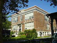
For pre-kindergarten through sixth grade, public school students attend Cape May City Elementary School as part of the Cape May City School District. Also attending are students from Cape May Point, a non-operating district, as part of a sending/receiving relationship, with most students in the district coming from the United States Coast Guard Training Center Cape May.[118] As of the 2018–19 school year, the district, comprised of one school, had an enrollment of 153 students and 20.7 classroom teachers (on an FTE basis), for a student–teacher ratio of 7.4:1.[119] Starting in 2010, discussions were under way regarding a possible consolidation of the districts of Cape May City, Cape May Point and the West Cape May School District.[120]
For seventh through twelfth grades, public school students attend the schools of the Lower Cape May Regional School District, which serves students from Cape May City, Cape May Point, Lower Township and West Cape May.[121] Schools in the district (with 2018–19 enrollment data from the National Center for Education Statistics[122]) are Richard M. Teitelman Middle School[123] with 472 students in grades 7-8 and Lower Cape May Regional High School[124] with 828 students in grades 9-12.[125] In the 2011–12 school year, the city of Cape May paid $6 million in property taxes to cover the district's 120 high school students, an average of $50,000 per student attending the Lower Cape May district. Cape May officials have argued that the district's funding formula based on assessed property values unfairly penalizes Cape May, which has higher property values and a smaller number of high school students as a percentage of the population than the other constituent districts, especially Lower Township.[126] The district's board of education has nine members, who are elected directly by voters to serve three-year terms of office on a staggered basis, with three seats up for election each year[127][128] Seats on the board are allocated based on population, with Cape May City assigned one seat.[129]
Students are also eligible to attend Cape May County Technical High School in Cape May Court House, which serves students from the entire county in its comprehensive and vocational programs, which are offered without charge to students who are county residents.[130][131]
The private Catholic schools serving Cape May are Cape Trinity Regional School (PreK – 8) and Wildwood Catholic High School serve all students from Cape May County under the auspices of the Roman Catholic Diocese of Camden.[132]
Colleges in the Cape May area include Rutgers University, Institute of Marine and Coastal Sciences and Atlantic Cape Community College.
The Cape May Branch of the Cape May County Public Library is located in Cape May City.[133]
Transportation
_between_Sidney_Avenue_and_Cape_May_County_Route_622_(Texas_Avenue)_in_Cape_May%2C_Cape_May_County%2C_New_Jersey.jpg)
Roads and highways
As of May 2010, the city had a total of 31.63 miles (50.90 km) of roadways, of which 24.99 miles (40.22 km) were maintained by the municipality and 6.64 miles (10.69 km) by Cape May County.[134]
Route 109 leads into Cape May from the north and provides access to the southern terminus of the Garden State Parkway along with US 9 in neighboring Lower Township.[135] US 9 leads to the Cape May–Lewes Ferry, which heads across the Delaware Bay to Lewes, Delaware.[136]
Public transportation
NJ Transit provides service to Philadelphia on the 313 and 315 routes and to Atlantic City on the 552 route, with seasonal service to Philadelphia on the 316 route and to the Port Authority Bus Terminal in Midtown Manhattan on the 319 route.[137][138]
The Great American Trolley Company operates trolley service in Cape May daily during the summer months, running along a loop route through the city.[139]
The city is served by rail from the Cape May City Rail Terminal, offering excursion train service on the Cape May Seashore Lines from the terminal located at the intersection of Lafayette Street and Elmira Street.[140][141]
The city last had regional passenger train service by the Pennsylvania-Reading Seashore Lines in the mid-1960s. Final service into Camden, New Jersey (across the Delaware River from Philadelphia) ended in January 1966, while service to Lindenwold station ended in October 1981.[142]
Ferry transport
The Delaware River and Bay Authority operates the Cape May-Lewes Ferry year-round, a 70-85 minute across the Delaware River to Lewes, Delaware, carrying passengers and cars.[143] The ferry constitutes a portion of U.S. Route 9.
The Delaware River and Bay Authority operates a shuttle bus in the summer months which connects the Cape May Welcome Center with the Cape May–Lewes Ferry terminal.[144]
Media

Cape May is served by several media outlets including WCFA-LP 101.5 FM, a commercial-free jazz and community station, the weekly Cape May Star and Wave, as well as free weekly newspapers, The Cape May Gazette and Exit Zero, and local websites CapeMay.com and Cape May Times.
The name Exit Zero refers to the town's location at the far southern end of the Garden State Parkway near the intersection with Route 109. Informally, the entire town is sometimes called Exit Zero.[145]
Coast Guard Training Center Cape May
The United States Coast Guard Training Center Cape May, New Jersey is the nation's only Coast Guard Recruit Training Center. In 1924, the U.S. Coast Guard occupied the base and established air facilities for planes used in support of United States Customs Service efforts. During the Prohibition era, several cutters were assigned to Cape May to foil rumrunners operating off the New Jersey coast. After Prohibition, the Coast Guard all but abandoned Cape May leaving a small air/sea rescue contingent. For a short period of time (1929–1934), part of the base was used as a civilian airport. With the advent of World War II, a larger airstrip was constructed and the United States Navy returned to train aircraft carrier pilots. The over the water approach simulated carrier landings at sea. The Coast Guard also increased its Cape May forces for coastal patrol, anti-submarine warfare, air/sea rescue and buoy service. In 1946, the Navy relinquished the base to the Coast Guard.[146]
In 1948, all entry level training on the East Coast was moved to the U.S. Coast Guard Recruit Receiving Station in Cape May. The Coast Guard consolidated all recruit training functions in Cape May in 1982. Over 350 military and civilian personnel and their dependents are attached to Training Center Cape May.[147]
Climate
According to the Köppen climate classification system, Cape May, New Jersey has a humid subtropical climate (Cfa) with hot, moderately humid summers, cool winters and year-around precipitation. Its climate resembles that of its neighbor, the Delmarva Peninsula. Cfa climates are characterized by all months having an average mean temperature > 32.0 °F (> 0.0 °C), at least four months with an average mean temperature ≥ 50.0 °F (≥ 10.0 °C), at least one month with an average mean temperature ≥ 71.6 °F (≥ 22.0 °C) and no significant precipitation difference between seasons. During the summer months in Cape May, a cooling afternoon sea breeze is present on most days, but episodes of extreme heat and humidity can occur with heat index values ≥ 95 °F (≥ 35 °C). During the winter months, episodes of extreme cold and wind can occur with wind chill values < 0 °F (< -18 °C). The plant hardiness zone at Cape May Beach is 7b with an average annual extreme minimum air temperature of 7.7 °F (-13.5 °C).[148] The average seasonal (November–April) snowfall total is around 12 inches (300 mm), and the average snowiest month is February which corresponds with the annual peak in nor'easter activity.
| Climate data for Cape May Beach, NJ (1981-2010 Averages) | |||||||||||||
|---|---|---|---|---|---|---|---|---|---|---|---|---|---|
| Month | Jan | Feb | Mar | Apr | May | Jun | Jul | Aug | Sep | Oct | Nov | Dec | Year |
| Average high °F (°C) | 42.3 (5.7) |
44.3 (6.8) |
51.4 (10.8) |
60.8 (16.0) |
70.4 (21.3) |
79.4 (26.3) |
84.5 (29.2) |
83.4 (28.6) |
77.8 (25.4) |
67.1 (19.5) |
56.8 (13.8) |
46.8 (8.2) |
63.7 (17.6) |
| Daily mean °F (°C) | 35.1 (1.7) |
36.8 (2.7) |
43.3 (6.3) |
52.3 (11.3) |
61.5 (16.4) |
71 (22) |
76.1 (24.5) |
75.1 (23.9) |
69.2 (20.7) |
58.5 (14.7) |
49.0 (9.4) |
39.4 (4.1) |
55.6 (13.1) |
| Average low °F (°C) | 27.9 (−2.3) |
29.2 (−1.6) |
35.2 (1.8) |
43.8 (6.6) |
52.7 (11.5) |
62.5 (16.9) |
67.7 (19.8) |
66.8 (19.3) |
60.7 (15.9) |
49.9 (9.9) |
41.1 (5.1) |
31.9 (−0.1) |
47.4 (8.6) |
| Average precipitation inches (mm) | 3.32 (84) |
2.82 (72) |
4.26 (108) |
3.53 (90) |
3.53 (90) |
3.37 (86) |
3.70 (94) |
3.62 (92) |
3.27 (83) |
3.70 (94) |
3.29 (84) |
3.47 (88) |
41.88 (1,064) |
| Source: NWS[149] | |||||||||||||
| Climate data for North Cape May, NJ Ocean Water Temperature (4 NW Cape May) | |||||||||||||
|---|---|---|---|---|---|---|---|---|---|---|---|---|---|
| Month | Jan | Feb | Mar | Apr | May | Jun | Jul | Aug | Sep | Oct | Nov | Dec | Year |
| Daily mean °F (°C) | 42 (6) |
40 (4) |
45 (7) |
52 (11) |
59 (15) |
68 (20) |
73 (23) |
76 (24) |
72 (22) |
61 (16) |
52 (11) |
42 (6) |
57 (14) |
| Source: NOAA[150] | |||||||||||||
Ecology
According to the A. W. Kuchler U.S. potential natural vegetation types, Cape May, New Jersey would have a dominant vegetation type of Northern Cordgrass (73) with a dominant vegetation form of Coastal Prairie (20).[151]
In popular culture
- Cape May is the subject of the song "On the Way to Cape May", originally sung by Cozy Morley.[152]
- The 1980s horror film The Prowler was filmed entirely on location in Cape May, as was the 1981 film Graduation Day.[153]
- The town lends its name to the Cape May Cafe, a restaurant in the Beach Club Resort at Walt Disney World.[154]
- In Mad Men, Betty Draper's family vacations at a home they own in Cape May.
- In The Blacklist, Cape May is the setting in the episode "Cape May".[155]
Notable people
People who were born in, residents of, or otherwise closely associated with Cape May include:
- Douglas Adams (1876–1931), cricketer, who played for the Gentlemen of Philadelphia in First class cricket.[156]
- Cliff Anderson (1929–1979), football player who played two seasons in the NFL with the Chicago Cardinals and New York Giants.[157]
- Nan Brooks (1935–2018), children's book illustrator.[158]
- Frederick B. Dent (1922–2019), politician who served as the United States Secretary of Commerce from 1973 to 1975.[159]
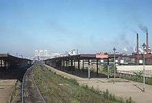
- Eugene Grace (1876–1960), president of Bethlehem Steel Corporation from 1916 to 1945.[160]
- Bubba Green (born 1957), football player who played defensive lineman for one season for the Baltimore Colts.[161]
- T. Millet Hand (1902–1956), represented New Jersey's 2nd congressional district in the United States House of Representatives as a Republican from 1945–1957. Hand was the mayor of Cape May from 1937–1944, and was the publisher of the Cape May Star and Wave from 1940 until his death.[162]
- Thomas H. Hughes (1769–1839), the founder and owner of the Congress Hall Hotel, and a Democratic-Republican member of the United States House of Representatives from New Jersey.[163]
- Chris Jay (born 1978), musician, actor and screenwriter. Founding member of the band, Army of Freshmen.[164]
- Alan Kotok (1941–2006), computer scientist known for his work at Digital Equipment Corporation and at the World Wide Web Consortium.[165]
- John D. Lankenau (1817–1901), German-American businessman and philanthropist.[166]
- Anthony Maher (born 1979), professional soccer forward.[167]
- Myles Martel (born 1943), communication adviser.[168]
- Richie Phillips (1940–2013), sports union leader.[169]
- Bill Pilczuk (born 1971), competitive swimmer.[170]
- Louis Purnell (1920–2001), curator at the National Air and Space Museum and earlier in life, a decorated Tuskegee Airman.[171]
- Emil Salvini (born 1949), author, historian and host / creator of PBS's Tales of the Jersey Shore.[172]
- Charles W. Sandman Jr. (1921–1985), politician who represented New Jersey's 2nd congressional district and was the party's candidate for Governor of New Jersey in 1973.[173]
- Barbara Lee Smith (born 1938), mixed media artist, writer, educator and curator.[174]
- Witmer Stone (1866–1939), ornithologist who did much of his research in Cape May.[175]
- Paul Volcker (1927–2019), former chairman of the United States Federal Reserve who was born here while his father was the City Manager.[176]
- John B. Walthour (1904–1952), 4th bishop of the Episcopal Diocese of Atlanta.[177]
See also
- Cape May Seashore Lines
- Cape May Light
- Cape May diamonds
References
- 2010 Census Gazetteer Files: New Jersey County Subdivisions, United States Census Bureau. Accessed May 21, 2015.
- US Gazetteer files: 2010, 2000, and 1990, United States Census Bureau. Accessed September 4, 2014.
- 2012 New Jersey Legislative District Data Book, Rutgers University Edward J. Bloustein School of Planning and Public Policy, March 2013, p. 8.
- City Council, City of Cape May. Accessed March 22, 2020.
- 2020 New Jersey Mayors Directory, New Jersey Department of Community Affairs. Accessed February 1, 2020.
- Administration, City of Cape May. Accessed March 22, 2020.
- City Clerk and Registrar of Vital Statistics, City of Cape May. Accessed March 22, 2020.
- "City of Cape May". Geographic Names Information System. United States Geological Survey. Retrieved March 5, 2013.
- DP-1 - Profile of General Population and Housing Characteristics: 2010 for Cape May city, Cape May County, New Jersey, United States Census Bureau. Accessed April 20, 2012.
- Municipalities Sorted by 2011-2020 Legislative District, New Jersey Department of State. Accessed February 1, 2020.
- Table DP-1. Profile of General Demographic Characteristics: 2010 for Cape May city Archived 2012-04-30 at the Wayback Machine, New Jersey Department of Labor and Workforce Development. Accessed April 20, 2012.
- Annual Estimates of the Resident Population for Minor Civil Divisions in New Jersey: April 1, 2010 to July 1, 2019, United States Census Bureau. Accessed May 21, 2020.
- GCT-PH1 Population, Housing Units, Area, and Density: 2010 - State -- County Subdivision from the 2010 Census Summary File 1 for New Jersey , United States Census Bureau. Accessed October 9, 2012.
- Look Up a ZIP Code for Cape May, NJ, United States Postal Service. Accessed November 6, 2011.
- ZIP Codes, State of New Jersey. Accessed October 8, 2013.
- Area Code Lookup - NPA NXX for Cape May, NJ, Area-Codes.com. Accessed October 8, 2013.
- U.S. Census website , United States Census Bureau. Accessed September 4, 2014.
- Geographic Codes Lookup for New Jersey, Missouri Census Data Center. Accessed September 1, 2019.
- US Board on Geographic Names, United States Geological Survey. Accessed September 4, 2014.
- Johnson, Charles P. "Many Drive To Resorts On Atlantic: Coast Places Draw Drivers From Pittsburgh District", The Pittsburgh Press, June 22, 1930, p. 3 of the Automobile section. Accessed July 4, 2011. "The southern part of New Jersey largely in Cape May County contains other popular resorts. Cape May City, the southernmost part of New Jersey, is said to be the oldest vacation resort in the United States."
- Table 7. Population for the Counties and Municipalities in New Jersey: 1990, 2000 and 2010, New Jersey Department of Labor and Workforce Development, February 2011. Accessed October 9, 2012.
- Mulvihill, Geoff via Associated Press. "Dangerous fishing, quaint B&B's share N.J. resort", Delaware County Daily Times, March 30, 2009. Accessed October 27, 2019. "'I don't really think much about the fishing business,' said Jimmy Iapallucci, a cook at Uncle Bill's Pancake House near the beach. He suspects the tourists who swell the community's population from 4,000 to 40,000 each summer don't either."
- Staff. "Life Style; Old Resort Draws New Clientele: Honeymooners", The New York Times, July 23, 1989. Accessed July 4, 2011. "At one time, Cape May was known as the serene Victorian getaway of four Presidents and scores of wealthy New York and Philadelphia industrialists. But recently, Cape May, the nation's oldest seaside resort, has begun to attract a new breed of beachgoer.... Innkeepers here say Cape May's 19th-century ambiance and views of the Atlantic Ocean are the main reasons this sleepy city of 5,000 (50,000 in the summer) has become popular for weddings and honeymoons."
- Urgo, Jacqueline L. "Triumph for South Jersey", The Philadelphia Inquirer, May 23, 2008. Accessed October 29, 2015. "Neighboring Wildwood Crest came in second, followed by Ocean City, North Wildwood, Cape May, Asbury Park in Monmouth County, Avalon, Point Pleasant Beach in northern Ocean County, Beach Haven in southern Ocean County and Stone Harbor."
- "Cape May Diamond Hunting Goes Back to the Kechemeche Tribe", Cape May County Herald, August 18, 2017. Accessed January 3, 2020. "The Kechemeche were part of the Lenni Lenape Council and were the original inhabitants of the southern part of Cape May County. The Lenape were the first settlers in the county and found the quartz stones washed up on the beaches in what is now Cape May Point."
- Hutchinson, Viola L. The Origin of New Jersey Place Names, New Jersey Public Library Commission, May 1945. Accessed August 28, 2015.
- Gannett, Henry. The Origin of Certain Place Names in the United States, p. 68. United States Government Printing Office, 1905. Accessed August 28, 2015.
- Snyder, John P. The Story of New Jersey's Civil Boundaries: 1606-1968, Bureau of Geology and Topography; Trenton, New Jersey; 1969. p. 113. Accessed April 20, 2012.
- Cape May Historic Preservation Commission. "Design Standards", Published Fall 2002, Standard Publishing, Inc; page 8.
- DiGiacomo, Robert. "Beach bicentennial: Cape May’s Congress Hall resort hits 200", USA Today, June 25, 2016. Accessed March 21, 2018. "Like many ladies of a certain age, Congress Hall has enjoyed her fair share of drama and notoriety over the decades. The original hotel, built of wood, helped usher in Cape May’s role as the leading resort of the early 19th century."
- "Great Destruction of Property at Cape May". New York Times. September 1, 1869. Retrieved May 20, 2020.
- Victorian Cape May, Cape May Times. Accessed July 4, 2011. "Cape May looked a lot different before the fire of 1878. The town is the oldest seashore resort in the nation. In the 1800s, Cape May had quite a collection of classically designed seaside hotels. The fire of 1878 wiped out 30 blocks of the early seashore town, including some of the resort's major hotels, including the original Congress Hall.... And, for the most part, the new buildings that went up were built in the modern style of the day...later known as the Victorian style... lots of gingerbread trim, gables and turrets."
- Kent, Bill. "Development; If They Build It, Will Even More Come? Cape May Ponders Parking Garage", The New York Times, November 9, 1997. Accessed July 4, 2011. "William Bolger, manager of the National Park Service Historic Landmarks Program for the Northeast, confirmed that he had been surveying Cape May to evaluate the city's historic buildings since January. 'Cape May is unique in America in that, since 1977, the entire city has been designated a National Historic Landmark District,' Mr. Bolger said. 'That means everything within the city limits is considered of historic landmark status.'"
- "U.S. Naval Activities, World War II". Archived from the original on August 8, 2007. Retrieved April 28, 2008.
- Floodplain Management Plan, City of Cape May, September 10, 2009. Accessed April 20, 2012.
- Locality Search, State of New Jersey. Accessed May 21, 2015.
- Areas touching Cape May, MapIt. Accessed March 22, 2020.
- Cape May County, Coalition for a Healthy NJ. Accessed March 22, 2020.
- New Jersey Municipal Boundaries, New Jersey Department of Transportation. Accessed November 15, 2019.
- Preston, Benjamin. "Cape May, New Jersey's Battle Against Nature", The Earth Institute, June 20, 2011. Accessed July 4, 2011. "Beach erosion is a perennial challenge for coastal communities, but in Cape May, man began accelerating the natural process in 1903. That year, dredges began scooping sand and muck out of the small harbor, expanding it to its current 500 acres. By 1911, a pair of massive stone jetties were completed to protect the mouth of Cape May Inlet."
- Staff. "Cape May Harbor Fest offers activities on land and sea" Archived 2011-10-01 at the Wayback Machine, Shore News Today, June 9, 2011. Accessed July 4, 2011. "Cape May's Harbor Fest, a celebration of seafood and song, the sea, its culture, economy and ecology, will take place 10 a.m.-5 p.m. Saturday, June 18 in and along the banks of Cape May Harbor on Delaware Avenue, with many of the land-based activities taking place at the Nature Center of Cape May.This year's festival commemorates the 100th anniversary of Cape May Harbor."
- Salamone, Gina. "Cape May is a world away from the raffish reputation of the Jersey Shore; The seaside resort is full of quaint shops, Victorian homes, great beaches and top-rated restaurants", New York Daily News, July 27, 2014. Accessed November 10, 2015. "Located on the southernmost point of New Jersey in the Cape May Peninsula, the city is also a big draw for nature lovers and birdwatchers due to its wetlands and wildlife refuges."
- Weaver, Meg. "Counterintuitive Geographic Facts and Other Minutiae", 'National Geographic Intelligent Travel, June 28, 2011. Accessed November 10, 2015. "Being the fact hound that I am, I had to check it out. Turns out, he's almost right. According to the U.S. Gazetteer, the latitude of Cape May, New Jersey, the Garden State's southernmost tip, is actually 38.96 degrees north while our fair National Geographic Headquarters in Washington, D.C., is 38.90 degrees north."
- Census Estimates for New Jersey April 1, 2010 to July 1, 2019, United States Census Bureau. Accessed May 21, 2020.
- Barnett, Bob. Population Data for Cape May County Municipalities, 1800 - 2000, WestJersey.org, January 6, 2011. Accessed July 10, 2012.
- Compendium of censuses 1726-1905: together with the tabulated returns of 1905, New Jersey Department of State, 1906. Accessed October 8, 2013.
- Raum, John O. The History of New Jersey: From Its Earliest Settlement to the Present Time, Volume 1, p. 260, J. E. Potter and company, 1877. Accessed October 8, 2013. "Cape May city contained in 1870 a population of 1,248."
- Staff. A compendium of the ninth census, 1870, p. 259. United States Census Bureau, 1872. Accessed October 8, 2013.
- Porter, Robert Percival. Preliminary Results as Contained in the Eleventh Census Bulletins: Volume III - 51 to 75, p. 97. United States Census Bureau, 1890. Accessed October 8, 2013.
- Thirteenth Census of the United States, 1910: Population by Counties and Minor Civil Divisions, 1910, 1900, 1890, United States Census Bureau, p. 336. Accessed July 10, 2012.
- Fifteenth Census of the United States : 1930 - Population Volume I, United States Census Bureau, p. 715. Accessed December 3, 2011.
- New Jersey Resident Population by Municipality: 1930 - 1990, Workforce New Jersey Public Information Network. Accessed June 28, 2015.
- Census 2000 Profiles of Demographic / Social / Economic / Housing Characteristics for Cape May city, New Jersey Archived 2014-08-24 at the Wayback Machine, United States Census Bureau. Accessed April 20, 2012.
- DP-1: Profile of General Demographic Characteristics: 2000 - Census 2000 Summary File 1 (SF 1) 100-Percent Data for Cape May city, New Jersey, United States Census Bureau. Accessed July 10, 2012.
- DP03: Selected Economic Characteristics from the 2006-2010 American Community Survey 5-Year Estimates for Cape May city, Cape May County, New Jersey, United States Census Bureau. Accessed April 20, 2012.
- "The Cove Beach in Cape May |". Jersey Shore Rentals. December 1, 2016. Retrieved January 8, 2017.
- ""Cape May, N.J., targets Canadian tourists", USA Today. February 9, 2010. Accessed August 10, 2013.
- Jackson, Vincent. "Jazz festival returns to Cape May next month, but without the original event's founders", The Press of Atlantic City, October 28, 2012. Accessed October 8, 2013.
- Reich, Ronni. "Cape May Music Festival puts together an eclectic schedule", The Star-Ledger, May 24, 2013. Accessed October 8, 2013. 'Classical ensembles from across the region, from the New Jersey Symphony Orchestra Chamber Players to the Bay-Atlantic Symphony, will take the stage for the 24th Cape May Festival. World music, jazz and country are also among the beachside musical offerings, which begin Sunday and continue through June 13."
- About Archived 2013-11-27 at the Wayback Machine, Cape May Film Festival . Accessed October 8, 2013. "The Cape May NJ State Film Festival is New Jersey's premiere weekend film festival dedicated exclusively to the support and presentation of creative, challenging, groundbreaking, film/video works by New Jersey filmmakers.... It has grown from a three-day event attracting an audience of 500 in 2001 to a four-day film festival drawing thousands annually."
- History and Mission Archived 2013-10-08 at Archive.today, Cape May Stage. Accessed October 8, 2013.
- About Archived August 30, 2013, at the Wayback Machine, East Lynne Theater Company. Accessed October 8, 2013. Accessed October 8, 2013.
- About MAC, Mid-Atlantic Center for the Arts & Humanities. Accessed October 8, 2013. "The Mid-Atlantic Center for the Arts & Humanities (MAC) is a multi-faceted non-profit organization that promotes the restoration, interpretation and cultural enrichment of greater Cape May for its residents and visitors."
- About, Center for Community Arts. Accessed August 29, 2015.
- Cherry-Farmer. Stephanie. "People Preserving Places: Cape May's Franklin Street School", Preserve NJ, December 12, 2011. Accessed October 8, 2013. "Designed in the Colonial Revival Style by the architectural firm of Edwards and Green of Philadelphia and Camden, the Franklin Street School opened in September 1928 as an elementary school for Cape May's African-American children.... Currently, the Center is working with the city to rehabilitate the school for use as a community cultural center and the focal point for African-American heritage tours of the area."
- Fox, Karen. "Cape May Diamonds", Cape May magazine, August 2009. Accessed July 4, 2011.
- Cape May Bird Observatory, New Jersey Audubon Society. Accessed October 27, 2019.
- Cutter, Joe. "Cape May will study impact of ecotourism and agritourismRead More: Cape May will study impact of ecotourism and agritourism", WKXW, November 9, 2016. Accessed November 22, 2016. "Cape May County tourism director Diane Wieland says they want to find out about the interest in bird- and nature-watching, hiking, biking and whale- and dolphin-watching. Wieland says 10 years ago, ecotourism was generating more than $450 million annually for the county — about 11 percent of the county's tourism dollars. The county generates more tourism dollars than any other county in the state."
- Degener, Richard. "Group has new goal for Cape Fishermen's Memorial", The Press of Atlantic City, June 3, 2009. Accessed July 4, 2011.
- Cape May County Fishermans Memorial, Historical Marker Database. Accessed October 27, 2019.
- Degener, Richard. "Cape May Government-Change Vote Challenged", The Press of Atlantic City, July 8, 2003. Accessed April 20, 2012. "A recount upheld the two-vote margin to change the form of government, and now some residents are asking a judge to set aside the decision and order a new election in November. Residents voted 422-420 on May 13 to return the city to the council-manager form of government."
- "The Faulkner Act: New Jersey's Optional Municipal Charter Law" Archived October 12, 2013, at the Wayback Machine, New Jersey State League of Municipalities, July 2007. Accessed October 8, 2013.
- Degener, Richard. "Cape May Voters Might Choose Government-Change Panel", The Press of Atlantic City, September 8, 2001. Accessed April 20, 2012. "The city in 1995 changed from a council-manager form of government to the small municipality plan A form of government under the Faulkner Act."
- Form of Government - Council / Manager, City of Cape May. Accessed October 8, 2013.
- Fichter, Jack. "Moving Cape May Election to November to Save $30K", Cape May County Herald, November 3, 2010. Accessed August 30, 2014. "Voters here approved moving the municipal election from May to November in a 610-320 votes, Tues. Nov. 2."
- 2020 Municipal Data Sheet, City of Cape May. Accessed April 30, 2020.
- The Official Cape May County 2019 Directory, Cape May County, New Jersey. Accessed March 18, 2020.
- 2020 County and Municipal Elected Officials Cape May County, NJ -- January 2020, Cape May County, New Jersey, January 7, 2020. Accessed March 18, 2020.
- 2018 General Election Successful Candidates, Cape May County, New Jersey, updated November 26, 2018. Accessed January 1, 2019.
- Cape May County Summary of Vote for 2016 Cape May County General Election, Cape May County, New Jersey, updated November 18, 2016. Accessed January 30, 2017.
- Conti, Vince. "Update: Council Member Resigns Following Rescinding of Police Chief's Contract", Cape May County Herald, March 3, 2015. Accessed June 27, 2016. "Councilman Jerry Inderwies, a retired Cape May Fire Chief and one of the three new members of the council elected this past November, spoke out vehemently in Sheehan's defense.... Inderwies then resigned his council seat and stormed from the room to the applause of the assembled police."
- Conti, Vince. "Furlin Takes Seat on Cape May Council, Mall Improvement District Budget Seen", Cape May County Herald, November 17, 2015. Accessed June 27, 2016. "Newly-elected Council member Roger Furlin was in his seat as Cape May City Council held its first meeting following the Nov. 3 election. Furlin won the seat vacated when Jerry Inderwies Jr. resigned in protest in March."
- Conti, Vince. "Cape May Appoints Inderwies Jr. as City Manager", Cape May County Herald, February 11, 2020. Accessed March 22, 2020. "Jerry Inderwies Jr. was appointed as Cape May's city manager Feb. 4. Inderwies is a former elected member of Cape May City Council, son of a former mayor, and former chief of the city’s fire department. Members of the council praised Inderwies’ work as deputy city manager, to then split their vote over complaints that the council’s process for Inderwies’ selection was, in the opinion of Councilman Zack Mullock, 'flawed.'"
- "Cape May Star and Wave Newspaper". www.facebook.com. Retrieved March 22, 2020.
- "INDERWEIS JR. NAMED DEPUTY MANAGER FOR CITY OF CAPE MAY". 98.7 The Coast WCZT. June 6, 2018. Retrieved March 22, 2020.
- Plan Components Report, New Jersey Redistricting Commission, December 23, 2011. Accessed February 1, 2020.
- 2019 New Jersey Citizen's Guide to Government, New Jersey League of Women Voters. Accessed October 30, 2019.
- Districts by Number for 2011-2020, New Jersey Legislature. Accessed January 6, 2013.
- Directory of Representatives: New Jersey, United States House of Representatives. Accessed January 3, 2019.
- About Cory Booker, United States Senate. Accessed January 26, 2015. "He now owns a home and lives in Newark's Central Ward community."
- Biography of Bob Menendez, United States Senate, January 26, 2015. "He currently lives in Paramus and has two children, Alicia and Robert."
- Senators of the 116th Congress from New Jersey. United States Senate. Accessed April 17, 2019. "Booker, Cory A. - (D - NJ) Class II; Menendez, Robert - (D - NJ) Class I"
- Legislative Roster 2020–2021 Session, New Jersey Legislature. Accessed April 16, 2020.
- District 1 Legislators, New Jersey Legislature. Accessed April 16, 2020.
- Cape May County Freeholders Home Page, Cape May County, New Jersey. Accessed June 6, 2018.
- Gerald M. Thornton, Cape May County, New Jersey. Accessed June 6, 2018.
- Leonard C. Desiderio, Cape May County, New Jersey. Accessed June 6, 2018.
- E. Marie Hayes, Cape May County, New Jersey. Accessed June 6, 2018.
- Will Morey, Cape May County, New Jersey. Accessed June 6, 2018.
- Jeffrey L. Pierson, Cape May County, New Jersey. Accessed June 6, 2018.
- The Official Cape May County 2018 Directory, Cape May County, New Jersey. Accessed June 6, 2018.
- 2018 County Data Sheet, Cape May County, New Jersey. Accessed June 6, 2018.
- County Clerk, Cape May County, New Jersey. Accessed June 6, 2018.
- Members List: Clerks, Constitutional Officers Association of New Jersey. Accessed June 6, 2018.
- Home Page, Cape May County Sheriff. Accessed June 6, 2018.
- Members List: Sheriffs, Constitutional Officers Association of New Jersey. Accessed June 6, 2018.
- Surrogate, Cape May County, New Jersey. Accessed June 6, 2018.
- Members List: Surrogates, Constitutional Officers Association of New Jersey. Accessed June 6, 2018.
- Constitutional Officers, Cape May County, New Jersey. Accessed June 6, 2018.
- Voter Registration Summary - Cape May, New Jersey Department of State Division of Elections, March 23, 2011. Accessed October 16, 2012.
- "Presidential General Election Results - November 6, 2012 - Cape May County" (PDF). New Jersey Department of Elections. March 15, 2013. Retrieved December 24, 2014.
- "Number of Registered Voters and Ballots Cast - November 6, 2012 - General Election Results - Cape May County" (PDF). New Jersey Department of Elections. March 15, 2013. Retrieved December 24, 2014.
- 2008 Presidential General Election Results: Cape May County, New Jersey Department of State Division of Elections, December 23, 2008. Accessed October 16, 2012.
- 2004 Presidential Election: Cape May County, New Jersey Department of State Division of Elections, December 13, 2004. Accessed October 16, 2012.
- "Governor - Cape May County" (PDF). New Jersey Department of Elections. January 29, 2014. Retrieved December 24, 2014.
- "Number of Registered Voters and Ballots Cast - November 5, 2013 - General Election Results - Cape May County" (PDF). New Jersey Department of Elections. January 29, 2014. Retrieved December 24, 2014.
- 2009 Governor: Cape May County Archived 2012-10-17 at the Wayback Machine, New Jersey Department of State Division of Elections, December 31, 2009. Accessed October 16, 2012.
- Cape May City School District 2013 Report Card Narrative, New Jersey Department of Education. Accessed December 29, 2016. "The District is a one-school district. 60% of the students come from the United States Coast Guard Training Center based in Cape May; 25% from Cape May City residents; and 15% from the Low-income Housing Authority, and three students from the sending district of Cape May Point."
- District information for Cape May City School District, National Center for Education Statistics. Accessed April 1, 2020.
- Crowley, Terrence J. Cape May County Report on Consolidation and Regionalization, New Jersey Department of Education, March 15, 2010, available through the Asbury Park Press. Accessed August 30, 2014. "The school districts of Cape May City, West Cape May, and Cape May Point (non-operating) are currently conducting a feasibility study to merge the districts. A consultant is currently collecting and analyzing data and will be finalizing his report in late spring 2010."
- School Choice Brochure, Lower Cape May Regional School District. Accessed March 21, 2018. "Lower Cape May Regional High School is a four-year comprehensive public High School that serves students from Cape May, West Cape May, Lower Township, Cape May Point and now Choice School students."
- School Data for the Lower Cape May Regional High School District, National Center for Education Statistics. Accessed April 1, 2020.
- General Information, Richard M. Teitelman Middle School. Accessed February 11, 2020.
- General Information, Lower Cape May Regional High School. Accessed February 11, 2020.
- New Jersey School Directory for the Lower Cape May Regional School District, New Jersey Department of Education. Accessed December 26, 2016.
- Fichter, Jack. "Cape May Paying $50K Per Student to Regional School District", Cape May County Herald, January 4, 2012. Accessed March 21, 2018. "Cape May — Taxpayers here pay $50,000 per year for each student sent to the Lower Cape May Regional High School District, a total of $6 million per year.... Deputy Mayor Jack Wichterman said Cape May was paying $6 million to send 120 kids to the regional school district.... 'We have no say in the formula that's utilized to determine how much money we pay to that school district,' he said. 'There are several formulas that can be used and the one that the Lower Township members of that school board chose to use is the one that penalizes the City of Cape May because our real estate values are so much higher than they are in Lower Township.'"
- Comprehensive Annual Financial Report of the Lower Cape May Regional School District, New Jersey Department of Education, for year ending June 30, 2018. Accessed February 3, 2020. "The Lower Cape May Regional School District (District) is a Type II school district located in Cape May County, New Jersey and covers an area of approximately 34 square miles. As a Type II school district, it functions independently through a Board of Education. The Board is comprised of nine members elected to three-year terms. These terms are staggered so that three member’s terms expire each year. The purpose of the School District is to provide educational services for all of Lower Cape May Regional’s students in grades 7 through 12."
- Board of Education, Lower Cape May Regional School District. Accessed February 11, 2020.
- Crowley, Terence J. A Response to the Cape May Study to Reconfigure the Lower Cape May Regional School District, Lower Cape May Regional School District, January 6, 2014. Accessed February 11, 2020. "The Lower Cape May Regional District (Regional is classified as a Limited Purpose District.... It is a Type II district and apportions the Board of Education seats based upon the most recent United States Census. It has nine seats on the Board and that are apportioned as follows: Cape May City 1; West Cape May 1; Lower Township 7."
- Frequently Asked Questions, Cape May County Technical High School. Accessed October 27, 2019. "All residents of Cape May County are eligible to attend Cape May County Technical High School.... The Cape May County Technical High School is a public school so there is no cost to residents of Cape May County."
- Technical High School Admissions, Cape May County Technical High School. Accessed October 27, 2019. "All students who are residents of Cape May County may apply to the Technical High School."
- Cape May County Schools, Roman Catholic Diocese of Camden. Accessed July 4, 2011.
- Cape May City Librray Location, Cape May County Library. Accessed October 27, 2019.
- Cape May County Mileage by Municipality and Jurisdiction, New Jersey Department of Transportation, May 2010. Accessed July 18, 2014.
- New Jersey Route 109 Straight Line Diagram, New Jersey Department of Transportation, April 2015. Accessed May 26, 2016.
- New Jersey State Transportation Map, New Jersey Department of Transportation, 2012. Accessed May 26, 2016.
- Cape May County Bus / Rail Connections, NJ Transit, backed up by the Internet Archive as of January 28, 2010. Accessed August 30, 2014.
- South Jersey Transit Guide Archived 2018-09-29 at the Wayback Machine, Cross County Connection, as of April 1, 2010. Accessed August 30, 2014.
- "Cape May Trolley Service". Great American Trolley Company. Retrieved August 7, 2017.
- Degener, Richard. "Seashore Line resumes train service to Cape May as tourist attraction", The Press of Atlantic City, August 18, 2010. Accessed May 26, 2016.
- Rio Grande–Cape May Line Archived 2015-07-23 at the Wayback Machine, Cape May Seashore Lines. Accessed May 26, 2016.
- About, Cape May Seashore Lines. Accessed July 8, 2019. "PRSL 'through' service to Camden continued until January 14, 1966, and to Philadelphia until September 30, 1969, requiring the remaining passengers to change trains at Lindenwold.... Passenger service between Lindenwold and Ocean City ended on August 13, 1981, and to Cape May City on October 2, 1981."
- Cape May-Lewes ferry, schedules and fares https://www.cmlf.com/schedules-fares
- Getting Here & Getting Around, Cape May–Lewes Ferry. Accessed June 20, 2017. "Cape May Shuttle: The shuttle leaves from the Cape May Ferry Terminal, meets incoming boats from 10:30Am through 4:30PM and loops continuously to the Cape May Welcome Center (609 Lafayette St.), which is a short walk from most Cape May attractions. This shuttle runs from late May through the end of September."
- Hoffman, Barbara. "Killing Kitsch - Going Beyond the Quaint in Cape May; Cape Crusader", New York Post, August 28, 2007. Accessed October 8, 2013. "I knew it was down there - I just didn't care. After 25 years in North Jersey, a k a 'the very West Side,' I'd never ventured down the shore to Cape May. I'm not alone. Randomly polled neighbors - who routinely head to the Hamptons and Cape Cod - showed zero interest in the Garden State Parkway's Exit Zero, hailed for its gingerbread Victoriana by the sea."
- Kluger, Cindy J. "From rum to subs: The Coast Guard in Cape May", Cape May Magazine, November 1, 2000. Accessed October 7, 2013. "In 1924, the Coast Guard took over the World War I Cape May City's naval air station fighting the rumrunners and bootleggers with eight seventy-five foot patrol boats.... Over time they were united and placed under the umbrella of the USCG, which, in turn, was placed under Navy Department control in 1941, moved to Treasury Department control in 1946, and finally transferred to the newly-formed Department of Transportation in 1967, where it remains today."
- History of Training Center Cape May, United States Coast Guard. Accessed July 4, 2011.
- "USDA Interactive Plant Hardiness Map". United States Department of Agriculture. Retrieved August 5, 2019.
- "NOAA Online Weather Data, NOAA". Retrieved November 18, 2019.
- Water Temperature Table of All Coastal Regions, National Oceanic and Atmospheric Administration. Accessed March 18, 2020.
- U.S. Potential Natural Vegetation, Original Kuchler Types, v2.0 (Spatially Adjusted to Correct Geometric Distortions), Data Basin. Accessed March 18, 2020.
- Gilfillian, Trudi. "Morley Tribute Halfway There", The Press of Atlantic City, February 8, 2003. Accessed April 20, 2012. "About half of Cozy Morley's statue is paid for, and organizers are looking for help with the other half. The money, about $60,000, is earmarked for a life-size bronze statue of Morley along with a Memorial Day weekend tribute to the popular entertainer known for singing the famed tune On the Way to Cape May."
- Toner, Noreen. "Garden State Blossoms As Filmmakers' Setting", The Press of Atlantic City, September 17, 1989. Accessed April 20, 2012. "Graduation Day (1980, Cape May), The Prowler (1980, Cape May)"
- Shenot, Christine for the Orlando Sentinel. "The Jersey Shore Comes to Florida; Disney's New Boardwalk Resort Evokes 1900s Seaside Nostalgia", Sun-Sentinel, July 8, 1996. Accessed October 8, 2013. "Architectural touches are reminiscent of Cape May, NJ, with a Coney Island feel to the boardwalk."
- Walker, Jodi. "The Blacklist recap: Cape May", Entertainment Weekly, April 22, 2016. Accessed July 8, 2019.
- Douglas Adams, Cricket Archives. Accessed November 22, 2016.
- Cliff Anderson, NFL.com. Accessed April 28, 2015.
- Nan Brooks, MB Artists. Accessed November 22, 2016. "Nan grew up in Cape May, New Jersey, and studied advertising design at the University of the Arts (formerly PCA) in Philadelphia."
- "Frederick Baily Dent Twenty-First Secretary of Commerce.", NOAA Photo Library at the National Oceanic and Atmospheric Administration. Accessed November 22, 2016. "Frederick B. Dent was born in Cape May, New Jersey, on August 17, 1922."
- Eugene G. Grace, Lehigh University. Accessed October 27, 2019. "Born in Cape May, New Jersey on August 27, 1876, Grace was the son of a sea captain."
- Bubba Green, Pro-Football-Reference.com. Accessed November 22, 2016.
- Thomas Millet Hand, Biographical Directory of the United States Congress. Accessed August 16, 2007.
- Thomas Hurst Hughes, Biographical Directory of the United States Congress. Accessed July 4, 2011.
- Pree bio Archived 2013-02-03 at the Wayback Machine, Army of Freshmen. Accessed October 7, 2013. "Started by lead singer, Chris Jay, who moved as a teenager by himself to California from his hometown of Cape May, New Jersey, and met fellow AOF members, Aaron Goldberg, Owen Bucey, Dan Clark and Kai Dodson at a local coffeehouse where he was performing, the band first made a name for themselves in the Ventura County area."
- Welcome to the Web site of Alan Kotok, Kotok.org. Accessed November 22, 2016. "I live in Cambridge, MA, USA and Cape May, NJ, USA"
- Staff. "John D. Lankenau Dead.", The New York Times, August 31, 1901. Accessed November 22, 2016. "John D. Lankenau, well-known philanthropist and member of the Drexel family, who was stricken with paralysis last Wednesday, died this afternoon at his residence in this city. He was eighty-four years of age. Early in the Summer he sustained his first stroke of paralysis in his Summer home at Cape May, N.J., but he recovered sufficiently to return to this city at the end of July. "
- "KiXX agree to terms with three vets, Cape May native Anthony Maher", OurSportsCentral, October 22, 2008. Accessed November 22, 2016. "The KiXX will be Maher's sixth team in eight years, having spent the last two with the Wave. The Cape May, NJ native scored 13 goals in 26 games last season for Milwaukee, who finished in a tie for first place during the regular season with a superb 22-8 record."
- DeAngelis, Martin. "Reagan's debate adviser to share stories in Cape May", The Press of Atlantic City, October 16, 2014. Accessed November 22, 2016. "Still, Martel - a part-time Cape May resident and 'leadership communications adviser' in his working life at Martel & Associates - spent a lot of face time with the man on his way to becoming the 40th president of the United States."
- Martin, Douglas. "Richie Phillips, Union Leader Who Helped and Hurt Umpires, Dies at 72", The New York Times, June 4, 2013. Accessed October 5, 2013. "Richie Phillips, a boisterous, street-shrewd lawyer who quintupled the salaries of major league baseball umpires as their union representative, then caused many of them to lose their jobs by having them resign en masse, died Friday at his home in Cape May, N.J. He was 72."
- Litsky, Frank. "Goodwill Games; Popov Defeats U.S. Rival, and It Isn't Even Close", The New York Times, August 3, 1998. Accessed October 9, 2012. "Pilczuk, from Cape May, N.J., was six inches behind Yegorov, a disappointment for someone who upset Popov at this distance in last January's world championships."
- Barnes, Bat. "Curator and Tuskegee Airman Louis Purnell Dies", The Washington Post, August 16, 2001. Accessed November 22, 2016. "Mr. Purnell was born in Snow Hill, Md., and grew up in Wilmington, Del., and Cape May, N.J."
- Staff. "The Lure of the Boards", Asbury Park Press, July 9, 2006. Accessed November 22, 2016. "'Every boardwalk has its own personality,' said Emil Salvini, of Cape May, author of Boardwalk Memories."
- via Associated Press. "G.O.P. Picks Sandman to Run For Congress in New Jersey", The New York Times, July 7, 1966. Accessed November 22, 2016. "Mr. Sandman, 44 years old, of Cape May City, was selected by a screening committee of G.O.P. chairmen of Atlantic, Salem, Cape May and Cumberland Counties, which comprise the newly formed district."
- "Oral history interview with Barbara Lee Smith, 2009 March 16-17", Archives of American Art. Accessed November 22, 2016. "MS. RIEDEL: Well, I think that's a perfect segue back to the East Coast, where you grew up, and this full circle that we're talking about. You spent a lot of time growing up in Cape May, and certainly nature, the immensity of nature there, is extremely moving. MS. SMITH: Oh, yeah. It's wonderful. It was a great place to grow up."
- Staff. "Dr. Witmer Stone, Ornithologist, 72; Member of Academy of Natural Sciences of Philadelphia for 51 Years Dies", The New York Times, May 25, 1939. Accessed July 4, 2011.
- Paul A. Volcker, Federal Reserve Bank of New York. Accessed April 20, 2012. "Mr. Volcker was born on September 1927 in Cape May, New Jersey."
- "The Rt. Rev. John Buchman Walthour Bishop of Atlanta 1951", Episcopal Diocese of Atlanta, backed up by the Internet Archive as of September 28, 2007. Accessed November 22, 2016. "John Buchman Walthour was forty eight when he was elected the fourth Bishop of Atlanta. He was born August 24, 1904 in Cape May, New Jersey, to Harry Clayton and Helen Millward Walthour."
Further reading
- Salvini, Emil R. (2005). Boardwalk memories: tales of the Jersey shore, Insiders' Guide Series. Globe Pequot. p. 180. ISBN 0-7627-3674-7, ISBN 978-0-7627-3674-4.
External links
| Wikimedia Commons has media related to Cape May, New Jersey. |
| Wikivoyage has a travel guide for Cape May. |
| Preceded by Diamond Beach |
Beaches of New Jersey | Succeeded by Southernmost |
Municipalities and communities of Cape May County, New Jersey, United States | ||
|---|---|---|
| Cities | 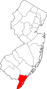 Map of New Jersey highlighting Cape May County | |
| Boroughs | ||
| Townships | ||
| CDPs | ||
| Other unincorporated communities | ||
| Authority control |
|
|---|