Lower Township, New Jersey
Lower Township is a township in Cape May County, New Jersey, United States. It is part of the Ocean City Metropolitan Statistical Area. As of the 2010 United States Census, the township's population was 22,866,[10][11][12] reflecting a decrease of 79 (-0.3%) from the 22,945 counted in the 2000 Census, which had in turn increased by 2,125 (+10.2%) from the 20,820 counted in the 1990 Census.[20]
Lower Township, New Jersey | |
|---|---|
| Township of Lower | |
 | |
| Nickname(s): "Home of the Best Sunsets"[1] | |
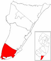 Lower Township highlighted in Cape May County. Inset map: Cape May County highlighted in the State of New Jersey. | |
 Census Bureau map of Lower Township, New Jersey | |
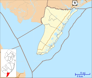 Lower Township Location in Cape May County 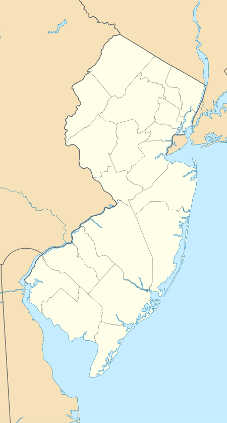 Lower Township Location in New Jersey  Lower Township Location in the United States | |
| Coordinates: 38.983768°N 74.911308°W[2][3] | |
| Country | |
| State | |
| County | Cape May |
| Established | April 2, 1723 (as precinct) |
| Incorporated | February 21, 1798 (as township) |
| Government | |
| • Type | Faulkner Act (Council-Manager) |
| • Body | Township Council |
| • Mayor | Frank Sippel (R, term ends December 31, 2020)[5][6] |
| • Manager | Jim Ridgway[7] |
| • Municipal clerk | Julie Picard[8] |
| Area | |
| • Total | 31.015 sq mi (80.327 km2) |
| • Land | 27.740 sq mi (71.846 km2) |
| • Water | 3.275 sq mi (8.482 km2) 10.56% |
| Area rank | 85th of 566 in state 4th of 16 in county[2] |
| Elevation | 20 ft (6 m) |
| Population | |
| • Total | 22,866 |
| • Estimate (2019)[13] | 21,339 |
| • Rank | 110th of 566 in state 1st of 16 in county[14] |
| • Density | 824.3/sq mi (318.3/km2) |
| • Density rank | 404th of 566 in state 10th of 16 in county[14] |
| Time zone | UTC−05:00 (Eastern (EST)) |
| • Summer (DST) | UTC−04:00 (Eastern (EDT)) |
| ZIP Code | |
| Area code(s) | 609 exchanges: 884, 886, 889, 898[16] |
| FIPS code | 3400941610[2][17][18] |
| GNIS feature ID | 0882044[2][19] |
| Website | www |
New Jersey Monthly magazine ranked Lower Township as its 34th best place to live in its 2008 rankings of the "Best Places To Live" in New Jersey.[21]
History
Before the region was settled by Europeans, the Kechemeche tribe of the Lenape Native Americans inhabited South Jersey, and traveled to the barrier islands during the summer to hunt and fish.[22][23][24] On August 28, 1609, English explorer Henry Hudson entered the Delaware Bay and stayed one day on land, north of what is now Cape May Point.[25] In 1630, representatives of the Dutch West India Company purchased a 16 sq mi (41 km2) tract of land along the Delaware from indigenous people, and additional land in the county was purchased 11 years later.[25] Due to the large number of whales in the region of Cape May, Dutch explorers founded Town Bank around 1640 as a whaling village, in what is now Lower Township as a whaling village around 1640. It was the first European settlement in Cape May County. The village once functioned as the court house for the county, along with Coxehall, built by Dr. Daniel Coxe to be a center for a manorial style of government.[26][27][28]
Lower Township was formed as a precinct on April 2, 1723, and was incorporated by an act of the New Jersey Legislature on February 21, 1798, as one of New Jersey's initial group of 104 townships established by the Township Act of 1798.[22] The township's name came from its location when Cape May was split into three townships in 1723 at the same time that Middle Township and Upper Township were created.[29][30]
Portions of the township were taken to form Cape Island Borough (March 8, 1848, now known as Cape May city), Cape May Point borough (created April 19, 1878, restored to Lower Township on April 8, 1896, recreated April 6, 1908), Holly Beach (April 14, 1885, now part of Wildwood city), South Cape May (August 27, 1894; restored to Lower Township after the borough was dissolved on April 30, 1945), Wildwood Crest (April 6, 1910) and North Cape May (March 19, 1928; restored to Lower Township after it was dissolved on April 30, 1945).[22]
Geography


According to the United States Census Bureau, the township had a total area of 31.015 square miles (80.327 km2), including 27.740 square miles (71.846 km2) of land and 3.275 square miles (8.482 km2) of water (10.56%).[2][3]
Diamond Beach (2010 Census population of 136[31]), Erma (2,134[32]), North Cape May (3,226[33]) and Villas (9,483[34]) are unincorporated communities and census-designated places (CDPs) located within Lower Township.[35] Other unincorporated communities, localities and place names located partially or completely within the township include Bennett, Cold Spring, Cold Spring Inlet, Ephraims Island, Fishing Creek, Higbees Landing, Miami Beach, Schellingers Landing, Sewells Point, South Cape May, Sunset Beach, Town Bank, Weers Landing, and Wildwood Gables.[36][37]
Lower Township borders the Cape May County municipalities of Cape May City, Cape May Point Borough, Middle Township, West Cape May Borough, Wildwood City, Wildwood Crest Borough, as well as Delaware Bay and the Atlantic Ocean.[38][39][40]
Demographics
| Historical population | |||
|---|---|---|---|
| Census | Pop. | %± | |
| 1810 | 862 | — | |
| 1820 | 1,001 | 16.1% | |
| 1830 | 999 | −0.2% | |
| 1840 | 1,133 | 13.4% | |
| 1850 | 1,604 | * | 41.6% |
| 1860 | 1,865 | 16.3% | |
| 1870 | 1,783 | −4.4% | |
| 1880 | 1,779 | * | −0.2% |
| 1890 | 1,156 | * | −35.0% |
| 1900 | 1,141 | * | −1.3% |
| 1910 | 1,188 | * | 4.1% |
| 1920 | 1,096 | −7.7% | |
| 1930 | 1,444 | * | 31.8% |
| 1940 | 1,693 | 17.2% | |
| 1950 | 2,737 | 61.7% | |
| 1960 | 6,332 | 131.3% | |
| 1970 | 10,154 | 60.4% | |
| 1980 | 17,105 | 68.5% | |
| 1990 | 20,820 | 21.7% | |
| 2000 | 22,945 | 10.2% | |
| 2010 | 22,866 | −0.3% | |
| Est. 2019 | 21,339 | [13][41][42] | −6.7% |
| Population sources: 1810-2000[43] 1810-1920[44] 1840[45] 1850-1870[46] 1850[47] 1870[48] 1880-1890[49] 1890-1910[50] 1910-1930[51] 1930-1990[52] 2000[53][54] 2010[10][11][12] * = Lost territory in previous decade[22] | |||
Census 2010
The 2010 United States Census counted 22,866 people, 9,579 households, and 6,350.877 families in the township. The population density was 824.3 per square mile (318.3/km2). There were 14,507 housing units at an average density of 523.0 per square mile (201.9/km2). The racial makeup of the township was 94.24% (21,549) White, 1.99% (456) Black or African American, 0.16% (37) Native American, 0.62% (142) Asian, 0.04% (10) Pacific Islander, 1.20% (275) from other races, and 1.74% (397) from two or more races. Hispanic or Latino of any race were 4.24% (969) of the population.[10]
The 9,579 households accounted 22.6% with children under the age of 18 living with them; 49.3% were married couples living together; 12.1% had a female householder with no husband present, and 33.7% were non-families. Of all households, 28.7% were made up of individuals, and 15.1% had someone living alone who was 65 years of age or older. The average household size was 2.38 and the average family size was 2.89.[10]
In the township, the population age was spread out with 19.8% under the age of 18, 7.6% from 18 to 24, 20.4% from 25 to 44, 31.0% from 45 to 64, and 21.1% who were 65 years of age or older. The median age was 46.5 years. For every 100 females, the population had 90.1 males. For every 100 females ages 18 and older there were 86.9 males.[10]
The Census Bureau's 2006-2010 American Community Survey showed that (in 2010 inflation-adjusted dollars) median household income was $51,101 (with a margin of error of +/- $2,460) and the median family income was $62,587 (+/- $7,438). Males had a median income of $50,572 (+/- $3,361) versus $35,978 (+/- $2,297) for females. The per capita income for the borough was $28,175 (+/- $1,295). About 6.6% of families and 10.6% of the population were below the poverty line, including 20.4% of those under age 18 and 6.5% of those age 65 or over.[55]
Census 2000
As of the 2000 United States Census[17] there were 22,945 people, 9,328 households, and 6,380 families residing in the township. The population density was 813.0 people per square mile (313.9/km²). There were 13,924 housing units at an average density of 493.4 per square mile (190.5/km²). The racial makeup of the township was 96.26% White, 1.39% African American, 0.23% Native American, 0.53% Asian, 0.02% Pacific Islander, 0.65% from other races, and 0.92% from two or more races. Hispanic or Latino of any race were 1.88% of the population.[53][54]
There were 9,328 households out of which 28.2% had children under the age of 18 living with them, 52.9% were married couples living together, 11.7% had a female householder with no husband present, and 31.6% were non-families. 27.2% of all households were made up of individuals and 15.0% had someone living alone who was 65 years of age or older. The average household size was 2.43 and the average family size was 2.95.[53][54]
In the township the population was spread out with 23.7% under the age of 18, 6.1% from 18 to 24, 25.1% from 25 to 44, 24.4% from 45 to 64, and 20.7% who were 65 years of age or older. The median age was 42 years. For every 100 females, there were 90.3 males. For every 100 females age 18 and over, there were 85.2 males.[53][54]
The median income for a household in the township was $38,977, and the median income for a family was $45,058. Males had a median income of $35,201 versus $24,715 for females. The per capita income for the township was $19,786. About 5.3% of families and 7.7% of the population were below the poverty line, including 10.3% of those under age 18 and 5.3% of those age 65 or over.[53][54]
Government

Local government
Lower Township operates within the Faulkner Act, formally known as the Optional Municipal Charter Law, under the Council-Manager form of government which was adopted in 1984. The council has five members (Mayor, Council Member-at-Large, and three Ward seats), each elected on a partisan basis to four-year terms on a staggered basis, with either two seats (mayor and council at-large) or the three ward seats are up for election every other year on an alternating basis as part of the November general election.[4][5] The Mayor presides at all Council meetings and has a voice and vote in the proceedings. Powers are limited to those expressly conferred by the Charter. The Manager serves the Council for an indefinite term of office and may be removed by a majority vote of the Council. The Manager is the chief executive and administrator of the Township.
As of 2020, members of the Lower Township Council are Mayor Frank Sippel (R, term ends December 31, 2020; At Large), Deputy Mayor David Perry (R, 2020; At Large), Thomas Conrad (R, 2022; Ward I), Kevin Coombs (R, 2022; Ward II - appointed to serve an unexpired term) and Roland A. Roy Jr. (R, 2022; Ward III).[5][56][57][58][59][60]
In February 2020, the Township Council selected Keven Coombs to fill the Ward II seat expiring in December 2022 that became vacant when David Perry was chosen to serve as deputy mayor.[61] Earlier that month, Perry had been shifted to deputy mayor after Frank Sippel was selected as mayor to replace Erik K. Simonsen, who resigned to take office in the New Jersey General Assembly.[62]
In January 2017, Roland Roy was selected from three candidates nominated by the Republican municipal committee to fill the Third Ward seat vacated by Erik Simonsen when he took office as mayor; Roy served on an interim basis until the November 2017 general election, when he was elected to serve the balance of the term through December 2018.[63][64]
Erik Simonsen won a special election in November 2013 to fill the seat of Glenn Douglass, who had resigned two months earlier and whose seat had been filled on an interim basis by Jackie Henderson.[65]
Federal, state and county representation
Lower Township is located in the 2nd Congressional District[66] and is part of New Jersey's 1st state legislative district.[11][67][68]
For the 116th United States Congress, New Jersey's Second Congressional District is represented by Jeff Van Drew (R, Dennis Township).[69] New Jersey is represented in the United States Senate by Democrats Cory Booker (Newark, term ends 2021)[70] and Bob Menendez (Paramus, term ends 2025).[71][72]
For the 2020–2021 session (Senate, General Assembly), the 1st Legislative District of the New Jersey Legislature is represented in the State Senate by Mike Testa (R, Vineland) and in the General Assembly by Antwan McClellan (R, Ocean City) and Erik K. Simonsen (R, Lower Township).[73][74]
Cape May County is governed by a Board of Chosen Freeholders consisting of five members, elected at-large in partisan elections to three-year terms of office on a staggered basis, with one or two seats coming up for election each year; At an annual reorganization held each January, the freeholders select one member to serve as Director and another to serve as Vice-Director.[75] As of 2018, Cape May County's Freeholders are Freeholder Director Gerald M. Thornton (Republican Party, Cape May Court House in Middle Township; term as freeholder expires December 31, 2019, term as freeholder director ends 2018),[76] Freeholder Vice-Director Leonard C. Desiderio (R, Sea Isle City; term as freeholder and as freeholder vice-director ends 2018),[77] E. Marie Hayes (R, Ocean City; 2019),[78] Will Morey (R, Wildwood Crest; 2020)[79] and Jeffrey L. Pierson (R. Upper Township; 2020).[80][75][81][82] The county's constitutional officers are County Clerk Rita Marie Fulginiti (R, 2020, Ocean City),[83][84] Sheriff Robert Nolan (R, 2020, Lower Township)[85][86] and Surrogate Dean Marcolongo (R, 2022, Upper Township).[87][88][89][81]
Politics
As of March 23, 2011, there were a total of 14,612 registered voters in Lower Township, of which 3,000 (20.5%) were registered as Democrats, 5,902 (40.4%) were registered as Republicans and 5,702 (39.0%) were registered as Unaffiliated. There were 8 voters registered to other parties.[90]
In the 2012 presidential election, Republican Mitt Romney received 52.6% of the vote (5,493 cast), ahead of Democrat Barack Obama with 46.2% (4,823 votes), and other candidates with 1.1% (120 votes), among the 10,534 ballots cast by the township's 15,217 registered voters (98 ballots were spoiled), for a turnout of 69.2%.[91][92] In the 2008 presidential election, Republican John McCain received 52.2% of the vote (5,831 cast), ahead of Democrat Barack Obama, who received 45.1% (5,040 votes), with 11,177 ballots cast among the township's 14,435 registered voters, for a turnout of 77.4%.[93] In the 2004 presidential election, Republican George W. Bush received 54.3% of the vote (5,951 ballots cast), outpolling Democrat John Kerry, who received around 44.1% (4,830 votes), with 10,961 ballots cast among the township's 14,709 registered voters, for a turnout percentage of 74.5.[94]
In the 2013 gubernatorial election, Republican Chris Christie received 70.8% of the vote (4,909 cast), ahead of Democrat Barbara Buono with 27.6% (1,913 votes), and other candidates with 1.7% (115 votes), among the 7,142 ballots cast by the township's 14,910 registered voters (205 ballots were spoiled), for a turnout of 47.9%.[95][96] In the 2009 gubernatorial election, Republican Chris Christie received 51.6% of the vote (3,712 ballots cast), ahead of both Democrat Jon Corzine with 40.1% (2,882 votes) and Independent Chris Daggett with 6.0% (433 votes), with 7,190 ballots cast among the township's 14,989 registered voters, yielding a 48.0% turnout.[97]
Education
The Lower Township School District serves public school students in pre-kindergarten through sixth grade.[98] As of the 2017–18 school year, the district, comprising four schools, had an enrollment of 1,718 students and 143.0 classroom teachers (on an FTE basis), for a student–teacher ratio of 12.0:1.[99] Schools in the district (with 2017-18 enrollment data from the National Center for Education Statistics[100]) are David C. Douglass Veterans Memorial School[101] with 410 students in grades PreK-K, Carl T. Mitnick School[102] with 401 students in grades 1–2, Maud T. Abrams School[103] with 436 students in grades 3-4 and Charles W. Sandman Consolidated School[104] with 449 students in grades 5–6.[105][106] The Lower Township School District participates in the Interdistrict Public School Choice Program, which allows non-resident students to attend the district's schools without cost to their parents, with tuition paid by the state. Seats in the program for non-resident students are specified by the district and are allocated by lottery.[107][108]
For seventh through twelfth grades, public school students attend the schools of the Lower Cape May Regional School District, which also serves students from Cape May City and West Cape May, along with students from Cape May Point who attend the district as part of a sending/receiving relationship.[109][110] Schools in the district (with 2017-18 enrollment data from the National Center for Education Statistics[111]) are Richard M. Teitelman Middle School[112] with 458 students in grades 7-8 and Lower Cape May Regional High School[113] with 871 students in grades 9-12.[114] In the 2011–12 school year, the city of Cape May paid $6 million in property taxes to cover the district's 120 high school students, an average of $50,000 per student attending the Lower Cape May district. Cape May officials have argued that the district's funding formula based on assessed property values unfairly penalizes Cape May, which has higher property values and a smaller number of high school students as a percentage of the population than the other constituent districts, especially Lower Township.[115] The district's board of education is comprised of nine members, who are elected directly by voters to serve three-year terms of office on a staggered basis, with three seats up for election each year[116][117] Seats on the board are allocated based on population, with Lower Township assigned seven seats.[118]
Students are also eligible to attend Cape May County Technical High School in Cape May Court House, which serves students from the entire county in its comprehensive and vocational programs, which are offered without charge to students who are county residents.[119][120]
There are two private Catholic schools in close proximity to Lower Township, Cape Trinity Catholic (pre-K to 8) in Wildwood and Wildwood Catholic High School (9-12) in North Wildwood, both of which operate under the supervision of the Roman Catholic Diocese of Camden.[121]
Transportation
_at_New_Jersey_State_Route_109_in_Lower_Township%2C_Cape_May_County%2C_New_Jersey.jpg)
As of May 2010, the township had a total of 179.10 miles (288.23 km) of roadways, of which 131.92 miles (212.30 km) were maintained by the municipality, 33.83 miles (54.44 km) by Cape May County and 6.87 miles (11.06 km) by the New Jersey Department of Transportation and 6.48 miles (10.43 km) by the New Jersey Turnpike Authority.[122]
The most prominent highway serving Lower Township is the Garden State Parkway, which has its southern terminus at the intersection with Route 109, within the township.[123] U.S. Route 9, Route 162 and Ocean Drive are other significant roadways within Lower Township.
NJ Transit offers bus service on the 313 and 315 routes between Cape May / Wildwood / Philadelphia, on the 552 between Cape May and Atlantic City, with seasonal service on the 319 route serving shore points between Cape May and the Port Authority Bus Terminal in New York City's Midtown Manhattan.[124][125]
The Cape May–Lewes Ferry terminal is located in North Cape May.[126] Operated by the Delaware River and Bay Authority, the ferry makes the 17-mile (27 km) trip between Lower Township and Lewes, Delaware in 85 minutes, carrying passengers and vehicles.[127] The Delaware River and Bay Authority operates a shuttle bus service that connects the ferry terminal with the Cape May Transportation Center in Cape May in the summer months and to the Cape May County Park & Zoo in July and August.[128]
Cape May Airport is in Lower Township.[129][130]
Points of interest
- Battery 223
- Cape May Lighthouse
- Cape May Winery & Vineyard
- Owen Coachman House
- Cold Spring Grange Hall
- Cold Spring Presbyterian Church
- Fire Control Tower No. 23
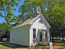
- Fishing Creek Schoolhouse
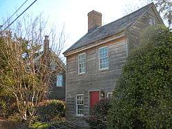
- George Hildreth House
- Hawk Haven Vineyard & Winery
- Jonathan Pyne House
- Naval Air Station Wildwood Aviation Museum
- Rio Grande Station
- Turdo Vineyards & Winery
Notable people
People who were born in, residents of, or otherwise closely associated with Lower Township include:
- Bob Andrzejczak (born 1986), politician who has represented the 1st Legislative District in the New Jersey General Assembly since March 2013.[131]
- Maurice Catarcio (1929–2005), professional wrestler for the World Wrestling Federation and record holder in The Guinness Book of World Records.[132]
- T. Millet Hand (1902-1956), politician who represented New Jersey's 2nd congressional district in the United States House of Representatives from 1945 to 1956.[133]
- Chris Jay, (born 1978), musician, screenwriter, actor, member of the band, Army of Freshmen.[134]
- Charles W. Sandman Jr. (1921-1985), represented New Jersey's 2nd congressional district from 1967 to 1975.[135]
- Erik K. Simonsen, politician who represents the 1st Legislative District in the New Jersey General Assembly and had served as mayor of Lower Township from 2016 until 2020.[136]
- Matt Szczur (born 1989), Major League Baseball outfielder.[137]
References
- Kuperinsky, Amy. "'The Jewel of the Meadowlands'?: N.J.'s best, worst and weirdest town slogans", NJ Advance Media for NJ.com, January 22, 2015. Accessed July 12, 2016. "Lower Township, also in Cape May County, claims to be 'Home of the Best Sunsets.'"
- 2010 Census Gazetteer Files: New Jersey County Subdivisions, United States Census Bureau. Accessed May 21, 2015.
- US Gazetteer files: 2010, 2000, and 1990, United States Census Bureau. Accessed September 4, 2014.
- 2012 New Jersey Legislative District Data Book, Rutgers University Edward J. Bloustein School of Planning and Public Policy, March 2013, p. 8.
- Mayor and Council, Lower Township. Accessed February 26, 2020. "Lower Township adopted the Council-Manager form of government in 1984. The council is composed of five council members (Mayor, Council Member-at-Large, and 3 Wards), each elected on partisan basis, serving the Township for a four-year term. Because the terms overlap, elections to council are held every two years."
- 2020 New Jersey Mayors Directory, New Jersey Department of Community Affairs. Accessed February 1, 2020.
- Township Manager, Township of Lower. Accessed October 27, 2019.
- Clerk, Township of Lower. Accessed October 27, 2019.
- U.S. Geological Survey Geographic Names Information System: Township of Lower, Geographic Names Information System. Accessed March 7, 2013.
- DP-1 - Profile of General Population and Housing Characteristics: 2010 for Lower township, Cape May County, New Jersey Archived 2020-02-12 at Archive.today, United States Census Bureau. Accessed July 16, 2012.
- Municipalities Sorted by 2011-2020 Legislative District, New Jersey Department of State. Accessed February 1, 2020.
- Profile of General Demographic Characteristics: 2010 for Lower township Archived 2012-04-30 at the Wayback Machine, New Jersey Department of Labor and Workforce Development. Accessed July 16, 2012.
- QuickFacts for Lower township, Cape May County, New Jersey; Cape May County, New Jersey; New Jersey from Population estimates, July 1, 2019, (V2019), United States Census Bureau. Accessed May 21, 2020.
- GCT-PH1 Population, Housing Units, Area, and Density: 2010 - State -- County Subdivision from the 2010 Census Summary File 1 for New Jersey Archived 2020-02-12 at Archive.today, United States Census Bureau. Accessed October 17, 2012.
- Look Up a ZIP Code for Villas, NJ, United States Postal Service. Accessed July 16, 2012.
- Area Code Lookup - NPA NXX for Villas, NJ, Area-Codes.com. Accessed September 29, 2014.
- U.S. Census website , United States Census Bureau. Accessed September 4, 2014.
- Geographic codes for New Jersey, Missouri Census Data Center. Accessed September 1, 2019.
- US Board on Geographic Names, United States Geological Survey. Accessed September 4, 2014.
- Table 7. Population for the Counties and Municipalities in New Jersey: 1990, 2000 and 2010, New Jersey Department of Labor and Workforce Development, February 2011. Accessed July 16, 2012.
- "Best Places To Live - The Complete Top Towns List 1-100" Archived 2008-02-28 at the Wayback Machine, New Jersey Monthly, February 21, 2008. Accessed February 24, 2008.
- Snyder, John P. The Story of New Jersey's Civil Boundaries: 1606-1968, Bureau of Geology and Topography; Trenton, New Jersey; 1969. p. 118. Accessed October 16, 2012.
- Holden, Robert F. "History of the Ten Villages of Upper Township: The Island Village of Strathmere, Part 1", The Press of Atlantic City, August 9, 2017. Accessed October 27, 2019.
- A Brief History of Ocean City New Jersey, Ocean City, New Jersey. Accessed December 23, 2017.
- "Cape May County", from Historic Roadsides of New Jersey by The Society of Colonial Wars in the State of New Jersey, 1928. Accessed October 27, 2019.
- Cape May County Comprehensive Plan, Cape May County, New Jersey Planning Board. Accessed October 27, 2019.
- "Bizarre History of Cape May --Town Bank was once touted as a whaling town", The Press of Atlantic City, August 1, 2012. Accessed October 27, 2019.
- Lower Township, Cape May County, New Jersey. Accessed October 27, 2019.
- Stevens, Lewis Townsend. The History of Cape May County, New Jersey: From the Aboriginal Times to the Present Day, p. 92. L.T. Stevens, 1897. Accessed September 3, 2015. "The county of Cape May was divided into three townships, Upper, Middle and Lower, April 2, 1723, of which the official record says:"
- Schaad Jr., Jacob "Bizarre History of Cape May: Lower Township's borders have been constantly changing", ShoreNewsToday, May 15, 2014. Accessed September 3, 2015. "Lower Township has long had an image problem, its name not helping. Middle Township and Upper Township have no problem because it's okay to be at the top or even in the middle, but how much lower can you get than lower?"
- DP-1 - Profile of General Population and Housing Characteristics: 2010 Demographic Profile Data for Diamond Beach CDP, New Jersey Archived 2020-02-12 at Archive.today, United States Census Bureau. Accessed July 16, 2012.
- DP-1 - Profile of General Population and Housing Characteristics: 2010 Demographic Profile Data for Erma CDP, New Jersey Archived 2020-02-12 at Archive.today, United States Census Bureau. Accessed July 16, 2012.
- DP-1 - Profile of General Population and Housing Characteristics: 2010 Demographic Profile Data for North Cape May CDP, New Jersey Archived 2020-02-12 at Archive.today, United States Census Bureau. Accessed July 16, 2012.
- DP-1 - Profile of General Population and Housing Characteristics: 2010 Demographic Profile Data for Villas CDP, New Jersey Archived 2020-02-12 at Archive.today, United States Census Bureau. Accessed July 16, 2012.
- New Jersey: 2010 - Population and Housing Unit Counts - 2010 Census of Population and Housing (CPH-2-32), United States Census Bureau, August 2012. Accessed October 17, 2012.
- Welcome to the Township of Lower's Website, Township of Lower. Accessed July 12, 2008.
- Locality Search, State of New Jersey. Accessed December 18, 2014.
- Areas touching Lower Township, MapIt. Accessed February 26, 2020.
- Cape May County, Coalition for a Healthy NJ. Accessed February 26, 2020.
- New Jersey Municipal Boundaries, New Jersey Department of Transportation. Accessed November 15, 2019.
- Annual Estimates of the Resident Population for Minor Civil Divisions in New Jersey: April 1, 2010 to July 1, 2019, United States Census Bureau. Accessed May 21, 2020.
- Census Estimates for New Jersey April 1, 2010 to July 1, 2019, United States Census Bureau. Accessed May 21, 2020.
- Barnett, Bob. Population Data for Cape May County Municipalities, 1810 - 2000, WestJersey.org, January 6, 2011. Accessed July 16, 2012.
- Compendium of censuses 1726-1905: together with the tabulated returns of 1905, New Jersey Department of State, 1906. Accessed September 29, 2013.
- Bowen, Francis. American Almanac and Repository of Useful Knowledge for the Year 1843, p. 232, David H. Williams, 1842. Accessed September 29, 2013.
- Raum, John O. The History of New Jersey: From Its Earliest Settlement to the Present Time, Volume 1, p. 260, J. E. Potter and company, 1877. Accessed September 29, 2013. "Lower the most southern township in the state was incorporated in 1798."
- Debow, James Dunwoody Brownson. The Seventh Census of the United States: 1850, p. 137. R. Armstrong, 1853. Accessed September 29, 2013.
- Staff. A compendium of the ninth census, 1870, p. 259. United States Census Bureau, 1872. Accessed July 15, 2012.
- Porter, Robert Percival. Preliminary Results as Contained in the Eleventh Census Bulletins: Volume III - 51 to 75, p. 97. United States Census Bureau, 1890. Accessed July 16, 2012.
- Thirteenth Census of the United States, 1910: Population by Counties and Minor Civil Divisions, 1910, 1900, 1890, United States Census Bureau, p. 336. Accessed July 16, 2012.
- Fifteenth Census of the United States : 1930 - Population Volume I, United States Census Bureau, p. 715. Accessed December 5, 2011.
- Table 6. New Jersey Resident Population by Municipality: 1930 - 1990, New Jersey Department of Labor and Workforce Development. Accessed June 28, 2015.
- Census 2000 Profiles of Demographic / Social / Economic / Housing Characteristics for Lower township, Cape May County, New Jersey Archived 2004-01-15 at the Wayback Machine, United States Census Bureau. Accessed July 16, 2012.
- DP-1: Profile of General Demographic Characteristics: 2000 - Census 2000 Summary File 1 (SF 1) 100-Percent Data for Lower township, Cape May County, New Jersey Archived 2020-02-12 at Archive.today, United States Census Bureau. Accessed July 16, 2012.
- DP03: Selected Economic Characteristics from the 2006-2010 American Community Survey 5-Year Estimates for Lower township, Cape May County, New Jersey Archived 2020-02-12 at Archive.today, United States Census Bureau. Accessed July 16, 2012.
- 2019 Municipal User Friendly Budget, Lower Township. Accessed October 27, 2019.
- The Official Cape May County 2018 Directory, Cape May County, New Jersey. Accessed August 7, 2018.
- 2020 County & Municipal Elected Officials Cape May County, NJ -- January 2020, Cape May County, New Jersey, January 7, 2020. Accessed February 26, 2020.
- 2018 General Election Statement of Vote, Cape May County, New Jersey, updated November 26, 2018. Accessed January 1, 2019.
- Cape May County Summary of Vote for 2016 Cape May County General Election, Cape May County, New Jersey, updated November 18, 2016. Accessed January 30, 2017.
- Price, Carl. "Coombs Sworn to Lower Township Council", Cape May County Herald, February 25, 2020. Accessed February 26, 2020. "Kevin Coombs, second from right, was sworn to Lower Township Council at the Feb. 19 meeting. The Lower Township Regular Republican Organization submitted three candidates to fill the seat of Second Ward Councilman David Perry until the election in November. Perry became deputy mayor after Mayor Frank Sippel became mayor when former Mayor Erik Simonsen was elected to state Assembly."
- Price, Carl. "Perry Takes Oath as Lower’s Deputy Mayor", Cape May County Herald, February 8, 2020. Accessed February 26, 2020. "Since Mayor Erik Simonsen vacated his position, after winning a seat on the State Assembly, there has been a shift on Lower Township Council. Deputy Mayor Frank Sippel became mayor, and Councilman David Perry became deputy mayor."
- South, Christopher. "Lower Township Council votes in Roland Roy Jr. as Ward 3 councilman", The Gazette of Cape May, January 25, 2017. Accessed January 11, 2018. "Lower Township Council appointed Roland Roy, Jr. to fill the vacant Ward 3 council seat at its Jan. 18 meeting. Roy will replace Mayor Erik Simonsen, who was elected mayor in November and took office at the reorganization meeting earlier this month. Roy was appointed by a unanimous vote of Township Council."
- 2017 General Election Official Results, Cape May County, New Jersey, updated November 9, 2017. Accessed January 1, 2018.
- Campbell, Braden. "Middle Township Democrat Michael Clark wins seat, unofficially", The Press of Atlantic City, November 5, 2013. Accessed December 18, 2014. "In Lower Township, Republican Erik Simonsen won the open Ward 3 Council seat with 1,290 votes.... Simonsen will serve out the remainder of Douglass' one-year unexpired term. Douglass resigned from his seat in September after he found out he must in order to collect his state pension after retiring from the New Jersey Department of Corrections. His seat has been held by North Cape May resident Jackie Henderson since his resignation.... He joins Mayor Michael Beck, Norris Clark, Thomas Conrad and James Neville. All are Republicans save Beck, who is an independent."
- Plan Components Report, New Jersey Redistricting Commission, December 23, 2011. Accessed February 1, 2020.
- 2019 New Jersey Citizen's Guide to Government, New Jersey League of Women Voters. Accessed October 30, 2019.
- Districts by Number for 2011-2020, New Jersey Legislature. Accessed January 6, 2013.
- Directory of Representatives: New Jersey, United States House of Representatives. Accessed January 3, 2019.
- About Cory Booker, United States Senate. Accessed January 26, 2015. "He now owns a home and lives in Newark's Central Ward community."
- Biography of Bob Menendez, United States Senate, January 26, 2015. "He currently lives in Paramus and has two children, Alicia and Robert."
- Senators of the 116th Congress from New Jersey. United States Senate. Accessed April 17, 2019. "Booker, Cory A. - (D - NJ) Class II; Menendez, Robert - (D - NJ) Class I"
- Legislative Roster 2020–2021 Session, New Jersey Legislature. Accessed April 16, 2020.
- District 1 Legislators, New Jersey Legislature. Accessed April 16, 2020.
- Cape May County Freeholders Home Page, Cape May County, New Jersey. Accessed June 6, 2018.
- Gerald M. Thornton, Cape May County, New Jersey. Accessed June 6, 2018.
- Leonard C. Desiderio, Cape May County, New Jersey. Accessed June 6, 2018.
- E. Marie Hayes, Cape May County, New Jersey. Accessed June 6, 2018.
- Will Morey, Cape May County, New Jersey. Accessed June 6, 2018.
- Jeffrey L. Pierson, Cape May County, New Jersey. Accessed June 6, 2018.
- The Official Cape May County 2018 Directory, Cape May County, New Jersey. Accessed June 6, 2018.
- 2018 County Data Sheet, Cape May County, New Jersey. Accessed June 6, 2018.
- County Clerk, Cape May County, New Jersey. Accessed June 6, 2018.
- Members List: Clerks, Constitutional Officers Association of New Jersey. Accessed June 6, 2018.
- Home Page, Cape May County Sheriff. Accessed June 6, 2018.
- Members List: Sheriffs, Constitutional Officers Association of New Jersey. Accessed June 6, 2018.
- Surrogate, Cape May County, New Jersey. Accessed June 6, 2018.
- Members List: Surrogates, Constitutional Officers Association of New Jersey. Accessed June 6, 2018.
- Constitutional Officers, Cape May County, New Jersey. Accessed June 6, 2018.
- Voter Registration Summary - Cape May, New Jersey Department of State Division of Elections, March 23, 2011. Accessed October 17, 2012.
- "Presidential General Election Results - November 6, 2012 - Cape May County" (PDF). New Jersey Department of Elections. March 15, 2013. Retrieved December 24, 2014.
- "Number of Registered Voters and Ballots Cast - November 6, 2012 - General Election Results - Cape May County" (PDF). New Jersey Department of Elections. March 15, 2013. Retrieved December 24, 2014.
- 2008 Presidential General Election Results: Cape May County, New Jersey Department of State Division of Elections, December 23, 2008. Accessed October 17, 2012.
- 2004 Presidential Election: Cape May County, New Jersey Department of State Division of Elections, December 13, 2004. Accessed October 17, 2012.
- "Governor - Cape May County" (PDF). New Jersey Department of Elections. January 29, 2014. Retrieved December 24, 2014.
- "Number of Registered Voters and Ballots Cast - November 5, 2013 - General Election Results - Cape May County" (PDF). New Jersey Department of Elections. January 29, 2014. Retrieved December 24, 2014.
- 2009 Governor: Cape May County Archived 2012-10-17 at the Wayback Machine, New Jersey Department of State Division of Elections, December 31, 2009. Accessed October 17, 2012.
- Lower Township Board of Education District Policy 0110 - Identification, Lower Township School District. Accessed February 11, 2020. "Purpose: The Board of Education exists for the purpose of providing a thorough and efficient system of free public education in grades Pre-Kindergarten through six in the Lower Township School District. Composition: The Lower Township School District is comprised of all the area within the municipal boundaries of Lower Township."
- District information for Lower Township Elementary School District, National Center for Education Statistics. Accessed November 1, 2019.
- School Data for the Lower Township School District, National Center for Education Statistics. Accessed November 1, 2019.
- David C. Douglass Veterans Memorial School, Lower Township School District. Accessed February 11, 2020.
- Carl T. Mitnick School, Lower Township School District. Accessed February 11, 2020.
- Maud T. Abrams School, Lower Township School District. Accessed February 11, 2020.
- Charles W. Sandman Consolidated School, Lower Township School District. Accessed February 11, 2020.
- Student-Parent Handbook 2019-2020, Lower Township School District. Accessed February 11, 2020.
- New Jersey School Directory for the Lower Township School District, New Jersey Department of Education. Accessed December 29, 2016.
- Interdistrict Public School Choice Program List of Operating Choice Districts: 2018-2019 School Year, New Jersey Department of Education, September 18, 2017. Accessed January 11, 2018.
- Lower Township Elementary District Choice Program Profile, New Jersey Department of Education. Accessed January 11, 2018.
- Interdistrict Public School Choice, Lower Cape May Regional School District. Accessed February 11, 2020. "Lower Cape May Regional High School is a four year comprehensive public High School that serves students from Cape May, West Cape May, Lower Township, Cape May Point and now Choice School students."
- Linehan, Mary. "Cape May makes new push to dissolve Lower Cape May Regional school district", The Gazette of Cape May, June 20, 2013. Accessed January 11, 2018. "The regional school district was formed in 1956 and now serves as a limited purpose regional school district educating students from Cape May, Cape May Point, West Cape May and Lower Township. Cape May Point students attend on a 'sending-receiving' basis."
- School Data for the Lower Cape May Regional High School District, National Center for Education Statistics. Accessed November 1, 2019.
- General Information, Richard M. Teitelman Middle School. Accessed February 11, 2020.
- General Information, Lower Cape May Regional High School. Accessed February 11, 2020.
- New Jersey School Directory for the Lower Cape May Regional School District, New Jersey Department of Education. Accessed December 26, 2016.
- Fichter, Jack. "Cape May Paying $50K Per Student to Regional School District", Cape May County Herald, January 4, 2012. Accessed March 21, 2018. "Cape May — Taxpayers here pay $50,000 per year for each student sent to the Lower Cape May Regional High School District, a total of $6 million per year.... Deputy Mayor Jack Wichterman said Cape May was paying $6 million to send 120 kids to the regional school district.... 'We have no say in the formula that's utilized to determine how much money we pay to that school district,' he said. 'There are several formulas that can be used and the one that the Lower Township members of that school board chose to use is the one that penalizes the City of Cape May because our real estate values are so much higher than they are in Lower Township.'"
- Comprehensive Annual Financial Report of the Lower Cape May Regional School District, New Jersey Department of Education, for year ending June 30, 2018. Accessed February 3, 2020. "The Lower Cape May Regional School District (District) is a Type II school district located in Cape May County, New Jersey and covers an area of approximately 34 square miles. As a Type II school district, it functions independently through a Board of Education. The Board is comprised of nine members elected to three-year terms. These terms are staggered so that three member’s terms expire each year. The purpose of the School District is to provide educational services for all of Lower Cape May Regional’s students in grades 7 through 12."
- Board of Education, Lower Cape May Regional School District. Accessed February 11, 2020.
- Crowley, Terence J. A Response to the Cape May Study to Reconfigure the Lower Cape May Regional School District, Lower Cape May Regional School District, January 6, 2014. Accessed February 11, 2020. "The Lower Cape May Regional District (Regional is classified as a Limited Purpose District.... It is a Type II district and apportions the Board of Education seats based upon the most recent United States Census. It has nine seats on the Board and that are apportioned as follows: Cape May City 1; West Cape May 1; Lower Township 7."
- Frequently Asked Questions, Cape May County Technical High School. Accessed October 27, 2019. "All residents of Cape May County are eligible to attend Cape May County Technical High School.... The Cape May County Technical High School is a public school so there is no cost to residents of Cape May County."
- Technical High School Admissions, Cape May County Technical High School. Accessed October 27, 2019. "All students who are residents of Cape May County may apply to the Technical High School."
- Cape May County School Directory, Roman Catholic Diocese of Camden. Accessed December 5, 2011.
- Cape May County Mileage by Municipality and Jurisdiction, New Jersey Department of Transportation, May 2010. Accessed July 18, 2014.
- Garden State Parkway, New Jersey Department of Transportation Straight-line diagram. Accessed September 18, 2007.
- Cape May County Bus / Rail Connections, NJ Transit, backed up by the Internet Archive as of January 28, 2010. Accessed September 29, 2014.
- South Jersey Transit Guide Archived 2018-09-29 at the Wayback Machine, Cross County Connection, as of April 1, 2010. Accessed September 29, 2014.
- Directions, Cape May–Lewes Ferry. Accessed September 29, 2014.
- Welcome Aboard, Cape May–Lewes Ferry. Accessed September 29, 2014.
- Ground Transportation Services, Cape May–Lewes Ferry. Accessed May 26, 2016.
- 2010 CENSUS - CENSUS BLOCK MAP (INDEX): Lower township, NJ, United States Census Bureau. Accessed August 15, 2018. Pages: 1, 2, 3, and 4.
- Airport Operations, Cape May Airport. Accessed August 15, 2018. "Cape May Airport (WWD) 507 Terminal Drive, Bldg. 102 Rio Grande, NJ 08242"
- Avedissian, Eric. "A soldier’s story: Bob Andrzejczak lost a leg, not his resolve; The hardest part about the aftermath of attack in Iraq was not the pain ... it was calling home", Ocean City Sentinel, May 20, 2015. Accessed January 11, 2018. "Andrzejczak grew up in Lower Township in North Cape May, a bedroom community straddling the Delaware Bay."
- "Catarcio, Maurice A.", Northeast Obits, May 13, 2005, backed up by the Internet Archive as of August 29, 2014. Accessed November 22, 2016. "He was Republican Leader in Lower Township for ten years."
- Staff. "T. Millet Hand, 54, Legislator, Dead; U.S. Representative From Second Jersey District -- Once Cape May Mayor", The New York Times, December 27, 1956. Accessed August 10, 2016. "Thomas Millet Hand Representative in Congress from the Second New Jersey District, died this evening at his home in nearby Cold Spring apparently of a heart attack."
- Weinberg, David "Cape musician Chris Jay forms unlikely friendship with Russian boxer Magomed Abdusalamov", The Press of Atlantic City, March 8, 2013. Accessed April 21, 2017. "The 34-year-old Lower Township native grew up in a musical household. Both of his parents, Ed and Lisa Jurewicz, are retired music teachers and own Mr. J's Music Shop in North Cape May, which is connected to their home."
- Kerr, Peter. "Ex-Rep. Charles Sandman. Nixon Supporter, Dies", The New York Times, August 27, 1985. Accessed September 29, 2013. "He was 64 and lived in Erma Park, N.J"
- Assemblyman Erik K. Simonsen (R), New Jersey Legislature. Accessed February 26, 2020. "Public / Party Service: Township of Lower Council 2011-19, Mayor 2017-19"
- Caldwell, Dave. "Two Sports, One Big Choice", The New York Times, December 16, 2010. Accessed September 11, 2016. "Szczur, a senior from Erma, N.J., gained attention late in the 2009 season after the National Marrow Donor Program determined that his bone marrow was a match for a 13-month-old girl with juvenile leukemia."
External links
| Wikimedia Commons has media related to Lower Township, New Jersey. |
- Lower Township website
- Lower Township School District
- Lower Township School District's 2015–16 School Report Card from the New Jersey Department of Education
- School Data for the Lower Township School District, National Center for Education Statistics
- Lower Cape May Regional School District
- The Cape May Gazette - Weekly newspaper covering Lower Township
- Tabernacle United Methodist Church (est. 1803)
Municipalities and communities of Cape May County, New Jersey, United States | ||
|---|---|---|
| Cities | 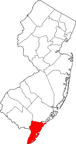 Map of New Jersey highlighting Cape May County | |
| Boroughs | ||
| Townships | ||
| CDPs | ||
| Other unincorporated communities | ||