California County Routes in zone J
There are 45 routes assigned to the "J" zone of the California Route Marker Program, which designates county routes in California. The "J" zone includes county highways in Alameda, Calaveras, Contra Costa, Fresno, Kern, Inyo, Mariposa, Merced, Sacramento, San Benito, San Joaquin, Stanislaus, and Tulare counties.
J1
| |
|---|---|
| Location | Fresno – San Benito Counties |
| Length | 70.48 mi[1] (113.43 km) |
| Existed | 1958–present[1] |
County Route J1 is a county road in San Benito and Fresno counties. The route begins in Paicines, San Benito County, at State Route 25. Between Paicines and Panoche Valley, J1 is known as Panoche Road. Its north–south portion between Panoche Valley and Fresno County is called Little Panoche Road. In Fresno County, the route then intersects with Interstate 5 and terminates in Mendota at State Route 33 near State Route 180 in the Central Valley. East of Interstate 5, the alignment of J1 follows Fresno County's West Shields Avenue (which is Exit 379 off of Interstate 5). Shields Avenue ends at North Fairfax Avenue. J1 continues south 2 miles (3.2 km) on Fairfax Avenue to West Belmont Avenue, at which location J1 proceeds east on Belmont Avenue until its end at State Routes 33 and 180.
Panoche Road lies within the corridor of an unbuilt Route 180 segment. No current plan exists to extend Route 180 westward from Mendota past Interstate 5 and into San Benito County.[2]
Parts of J1 just west of I-5 are gravel rather than paved.[3]
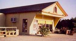 Paicines General Store.
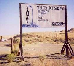 Mercey Hot Springs Resort sign.
J2
| |
|---|---|
| Location | Alameda – San Joaquin Counties |
| Length | 39.22 mi[1] (63.12 km) |
| Existed | 1960–present[1] |
County Route J2 or I-580 Alt. is a series of streets and roads in the California counties of Alameda and San Joaquin.
J2 begins at the Portola Avenue overcrossing of Interstate 580 in Livermore. The route follows Portola to Livermore Avenue, where J2 turns southward to pass through Livermore's downtown. The highway continues past the southeast edge of Livermore to become Tesla Road and rise into the Diablo Range, which separates the outer San Francisco Bay Area from the San Joaquin Valley.
At the Alameda-San Joaquin county line, J2 becomes Corral Hollow Road and enters the narrow valley of the same name. Upon approaching the San Joaquin Valley, the road turns northward, meeting Interstate 580 again and arriving at the southern subdivisions of Tracy. After passing through this city, the road intersects Interstate 205, shifts briefly onto Lammers Road, and soon turns northward onto Tracy Boulevard. Here J2 crosses the sea-level Union and Roberts Islands in the San Joaquin-Sacramento River Delta before terminating at State Route 4.
J3
| |
|---|---|
| Location | San Joaquin – Stanislaus Counties |
| Length | 35.37 mi[1] (56.92 km) |
| Existed | 1960–present[1] |
County Route J3 is a county road in central California that runs 35 miles (56 km) north-south through Stanislaus and San Joaquin Counties.
The route begins 2 miles (3.2 km) east of Vernalis as Kasson Road, running northward from the road's intersection with State Route 132. After almost 3 miles (4.8 km) the route meets Airport Way and follows it northward 21 miles (34 km) past Manteca, Lathrop, and French Camp into Stockton. J3 then follows West Lane 10 miles (16 km) out from Stockton and becomes Hutchins Street for the route's last 1 mile (1.6 km). The route reaches its northern end at State Route 12 near Lodi.
The highway is also known as Stanislaus County Route J3 and San Joaquin County Route J3, though all but 1 mile (1.6 km) of the route is within San Joaquin County.
J4
| |
|---|---|
| Location | Alameda – Contra Costa – San Joaquin Counties |
| Length | 27.99 mi[1] (45.05 km) |
| Existed | 1960–present[1] |
County Route J4 is a county road in central California that runs 28 miles (45 km) nominally north–south across portions of San Joaquin County, Alameda County and Contra Costa County that are growing in population and suburbanization. The highway connects the suburbs of the far outer East Bay and the Sacramento River Delta with the northern San Joaquin Valley.
The route begins 9 miles (14 km) southeast of Tracy at County Route J3, passes through Tracy and Byron, and terminates at State Route 4 between Discovery Bay and Brentwood.
The portion between Tracy and Brentwood lies along the unconstructed corridor of State Route 239. SAFETEA-LU, federal legislation enacted in 2005, authorized $14 million in federal appropriations toward construction of the route.
J5
| |
|---|---|
| Location | San Joaquin County |
| Length | 30.45 mi[1] (49.00 km) |
| Existed | 1960–present[1] |
County Route J5 is a county road in San Joaquin County, California that runs for about 30 miles (49 km). It begins at State Route 99's interchange with Jack Tone Road in Ripon. Following Jack Tone Road, CR J5 passes through SR 120 east of Manteca and State Routes 4 and 26 east of Stockton. Eventually, it curves northwest where it is then co-routed with SR 88 at a right turn in Lockeford for a short distance before leaving SR 88 at a left turn at Elliot Road. It eventually leads to Peltier Road (CR J12), where CR J5 ends.
J6
| |
|---|---|
| Location | San Joaquin – Stanislaus Counties |
| Length | 22.27 mi[1] (35.84 km) |
| Existed | 1960–present[1] |
County Road J6 is a county road in San Joaquin and Stanislaus Counties. Its northern terminus is at Route 26 at Bellota, 4 miles east of Linden. South of Highway 26, it carries the name Escalon-Bellota Road, and runs due south, crossing Route 4 at Farmington. The route continues due south to a junction with Route 120 at Escalon, where it continues due south as McHenry Avenue before ending at a junction with Route 108 near Del Rio.
J7
| |
|---|---|
| Location | Merced – San Joaquin – Stanislaus Counties |
| Length | 58.91 mi[1] (94.81 km) |
| Existed | 1960–present[1] |
County Route J7 mostly parallels State Route 99 to the east and generally follows the BNSF Railway between Merced and Stockton. It also connects several smaller communities including Atwater, Winton, Cressey, Ballico, Denair, Hughson, Empire, Riverbank, and Escalon.
Route Description
The southern terminus for County Route J7 is at SR 59 in Merced, locally known as The Snelling Highway. The route is locally signed as Santa Fe Drive. From this point, it travels north for 12 mi through Merced County, passing by the former site of Castle Air Force Base in Atwater. Upon crossing the Merced River, the route continues in Stanislaus County for another 20 mi until it reaches the community of Empire. In Empire, the route briefly co-signs with SR 132 (locally signed as Yosemite Boulevard) for just over 1 mi before turning onto Claus Road, where it skirts the eastern edge of Modesto. The route follows Claus Road for approximately 6.5 mi, passing the former site of the Riverbank Army Ammunition Plant as well as the Rainbow Fields sports park.
County Route J7 then follows SR 108 (locally signed Atchison Street) westward in Riverbank for approximately 0.9 mi before turning onto First Street and continuing on a north-south trajectory. Once it crosses the Stanislaus River and enters San Joaquin County, the route is locally signed as Santa Fe Road. At this point, it continues its parallel path with the BNSF rail line. About 4.3 mi after entering San Joaquin County, the route then enters Escalon and becomes Main Street for 0.7 mi before reaching SR 120. CR J7 very briefly co-signs with SR 120 before intersecting with CR J6. The two county routes share the same roadway (locally signed as Escalon-Bellota Road) for 2.5 mi before CR J7 follows a curve onto Mariposa Road on a northwest-southeast trajectory.
At this point, CR J7 continues on Mariposa Road, a mostly rural road. While on Mariposa Road, CR J7 passes just north of the BNSF Stockton Intermodal Yard. The county route eventually meets its northern terminus with SR 99 in Eastern Stockton
J8
| |
|---|---|
| Location | Sacramento – San Joaquin Counties |
| Length | 43.81 mi[1] (70.51 km) |
| Existed | 1960–present[1] |
County Route J8 is a county road in California that mostly parallels Interstate 5 to the east and generally follows the Union Pacific Railroad between Stockton and Sacramento.
Route Description
County Route J8 starts at the intersection of Hammer Lane and State Route 99 in Stockton. The route proceeds west on Hammer Lane to the intersection of Thornton Road, then turns northwest, following Thornton Road and North Thornton Road from Stockton to the Sacramento County line north of Thornton. North of Thornton, the route proceeds slightly away from I-5 until it parallels the Union Pacific Railroad and crosses the Cosumnes River into Sacramento County. From here the route is known as Franklin Boulevard and proceeds north to the town of Franklin. Northbound traffic must then turn east onto Bilby Road to cross the railroad, then turn north on Willard Parkway to rejoin Franklin Boulevard south of its junction with Elk Grove Boulevard (CR E12). Southbound traffic follows the original alignment of Franklin Boulevard to cross the railroad tracks. The route continues north through Elk Grove and parts of the city of Sacramento before its junction with SR 99 at Broadway in Sacramento.
J9
| |
|---|---|
| Location | San Joaquin – Stanislaus Counties |
| Length | 44.05 mi[1] (70.89 km) |
| Existed | 1960–present[1] |
County Route J9 is the main route between the cities of Oakdale, Waterford, and Turlock. It is especially busy during the morning and evening rush hours. This route is primarily rural, only traveling through a few cities, all with fewer than 20,000 people.
Route description
This road begins at Interstate 5 near Stockton. It then continues east through French Camp and south Stockton to SR 99. From here, the route is primarily rural. It then travels through Valley Home southbound. Next it crosses the Stanislaus River into Oakdale, passes the old Hershey's plant, and continues over the Hetch Hetchy Aqueduct. It then turns sharply left and becomes the Oakdale-Waterford Highway, through Waterford. Exiting Waterford, it crosses the Tuolumne River into Hickman and stays rural through to its terminus at J17.
J10
| |
|---|---|
| Location | Sacramento – San Joaquin Counties |
| Length | 17.63 mi[1] (28.37 km) |
| Existed | 1960–present[1] |
County Route J10 is a county road in California that connects the northern section of Stockton in San Joaquin County with the city of Galt in Sacramento County. A majority of the route is locally signed as Lower Sacramento Road. The route also connects through the city of Lodi, as well as the historic community of Woodbridge.
Route Description
The route begins at Hammer Lane (also known as County Route J8) at its southern terminus. It then travels approximately 7 mi until it reaches the southern border of Lodi. From there, it continues another 2 mi to Turner Road. Briefly, Lower Sacramento Road is co-routed with Turner Road for 0.2 mi before again following a north-south route. The route continues on Lower Sacramento Road for another 10 mi before crossing into Sacramento County. At this point, the route becomes locally signed as South Lincoln Way. The route from this point travels another 4 mi, mostly through the city of Galt, before reaching its northern terminus at SR 99.
J11
| |
|---|---|
| Location | Sacramento – San Joaquin Counties |
| Length | 6.18 mi[1] (9.95 km) |
| Existed | 1960–present[1] |
County Route J11 connects the towns of Walnut Grove and Thornton. It is known as Walnut Grove-Thornton Road.
Route Description
CR J11 begins at the junction of CR E13 at the eastern end of the Walnut Grove Bridge in the town of Walnut Grove. The route proceeds south briefly along the levee of the Sacramento River and Georgiana Slough before leaving the levee and turning east. The route crosses into San Joaquin County at the Mokelumne River and proceeds eastward to cross Interstate 5 before it terminates at the junction of County Route J8 in the town of Thornton.
J12
| |
|---|---|
| Location | San Joaquin County |
| Length | 19.65 mi[1] (31.62 km) |
| Existed | 1960–present[1] |
J13
| |
|---|---|
| Location | San Joaquin County |
J14
| |
|---|---|
| Location | Calaveras – Stanislaus Counties |
| Length | 47.91 mi[1] (77.10 km) |
| Existed | 1973–present[1] |
County Route J14 (CR J14) is a county highway in California, USA that runs through Stanislaus and Calaveras counties.
The route is known as Lander Avenue, Olive Street, Golden State Boulevard, Geer Road, Albers Road, Yosemite Avenue, Twenty Six Mile Road, Sonora Road, Milton Road and Jenny Lind Road.
J15
| |
|---|---|
| Location | Tulare County |
| Length | 29.99 mi[1] (48.26 km) |
| Existed | 1974–present[1] |
County Route J15 is an unsigned route, starting at Avenue 96 and ending at Avenue 232, staying within Tulare County. It follows Road 152 for its entire length (17 miles or 27 kilometers) and intersects California State Highway 190 at mile 6.
J16
| |
|---|---|
| Location | Mariposa – Merced – Stanislaus Counties |
| Length | 75.74 mi[1] (121.89 km) |
| Existed | 1960–present[1] |
County Route J16 (CR J16) is a county highway running through Stanislaus, Merced, and Mariposa counties in California.
The route is known as Grayson Road, Keyes Road, Merced Falls Road, Hornitos Road, and Bear Valley Road.
J17
| |
|---|---|
| Location | Merced – Stanislaus Counties |
| Length | 39.20 mi[1] (63.09 km) |
| Existed | 1960–present[1] |
County Route J17 (CR J17) is a county highway that runs through Stanislaus and Merced counties in California.
The route is known as Sperry Avenue from Interstate 5 to Patterson, Las Palmas Avenue from Patterson to the San Joaquin River, West Main Street from the San Joaquin River to Turlock, East Avenue from Turlock to Oakdale Road, Oakdale Road from East Avenue to Turlock Road and Turlock Road from Oakdale Road to State Route 59.
J18
| |
|---|---|
| Location | Merced – Stanislaus Counties |
| Length | 26.54 mi[1] (42.71 km) |
| Existed | 1960–present[1] |
County Route J18 runs through Stanislaus and Merced counties in California. It follows Stuhr Road from Interstate 5 past Newman to Hills Ferry Road. It briefly follows Hills Ferry Road to the confluence of the Merced and San Joaquin rivers. It follows River Road along the Merced River. At State Route 165, J18 diverges from River Road. It is known as Westside Boulevard from State Route 165 to State Route 99.
Bellevue Avenue continues east of State Route 99 through Atwater.
J19
| |
|---|---|
| Location | Fresno – Tulare Counties |
| Length | 25.65 mi[1] (41.28 km) |
| Existed | 1964–present[1] |
J20
| |
|---|---|
| Location | Mariposa – Tuolumne Counties |
| Length | 14.72 mi[1] (23.69 km) |
| Existed | 1965–1997[1] |
County Route J20 is a county highway in Tuolumne County, California and Mariposa County, California, United States. It ran from its western terminus at State Route 49 east and north to State Route 120. It was the continuation of State Route 132 east of Coulterville. It was renumbered as County Route J132 in 1997 for continuity with the current State Route 132.
J21
| |
|---|---|
| Location | Tulare County |
| Length | 18.21 mi[1] (29.31 km) |
| Existed | 1968–present[1] |
County Route J21 (Dry Creek Drive) connects State Route 245 (Millwood Drive) near Badger with State Route 216 outside of Woodlake in Tulare County. Defined in 1968, it runs 18.21 miles (29.31 km) from an elevation of approximately 3,000 feet (914 m) near Badger[4] to approximately 400 feet (122 m) near Woodlake.[5]
J22
| |
|---|---|
| Location | Tulare County |
| Length | 31.87 mi[1] (51.29 km) |
| Existed | 1968–present[1] |
J23
| |
|---|---|
| Location | Tulare County |
| Length | 17.39 mi[1] (27.99 km) |
| Existed | 1974–present[1] |
J24
| |
|---|---|
| Location | Tulare County |
| Length | 13.00 mi[1] (20.92 km) |
| Existed | 1970–present[1] |
J25
| |
|---|---|
| Location | Tulare County |
| Length | 8.45 mi[1] (13.60 km) |
| Existed | 1971–present[1] |
J26
| |
|---|---|
| Location | Tulare County |
| Length | 15.85 mi[1] (25.51 km) |
| Existed | 1970–present[1] |
J27
| |
|---|---|
| Location | Tulare County |
| Length | 31.63 mi[1] (50.90 km) |
| Existed | 1975–present[1] |
J28
| |
|---|---|
| Location | Tulare County |
| Length | 18.46 mi[1] (29.71 km) |
| Existed | 1970–present[1] |
J29
| |
|---|---|
| Location | Tulare County |
| Length | 12.45 mi[1] (20.04 km) |
| Existed | 1971–present[1] |
J30
| |
|---|---|
| Location | Tulare County |
| Length | 14.36 mi[1] (23.11 km) |
| Existed | 1971–present[1] |
J31
| |
|---|---|
| Location | Tulare County |
| Length | 6.03 mi[1] (9.70 km) |
| Existed | 1975–present[1] |
J32
| |
|---|---|
| Location | Tulare County |
| Length | 7.98 mi[1] (12.84 km) |
| Existed | 1972–present[1] |
J33
| |
|---|---|
| Location | Tulare County |
| Length | 7.56 mi[1] (12.17 km) |
| Existed | 1975–present[1] |
J34
| |
|---|---|
| Location | Tulare County |
| Length | 12.9 mi[1] (20.8 km) |
| Existed | 1971–present[1] |
J35
| |
|---|---|
| Location | Tulare County |
| Length | 7.66 mi[1] (12.33 km) |
| Existed | 1975–present[1] |
J36
| |
|---|---|
| Location | Tulare County |
| Length | 2.94 mi[1] (4.73 km) |
| Existed | 1975–present[1] |
J37
| |
|---|---|
| Location | Tulare County |
| Length | 25.17 mi[1] (40.51 km) |
| Existed | 1975–present[1] |
J38
| |
|---|---|
| Location | Tulare County |
J42
| |
|---|---|
| Location | Tulare County |
J46
| |
|---|---|
| Location | Tulare County |
J59
| |
|---|---|
| Location | Merced – Stanislaus – Tuolumne Counties |
County Route J59 is a road in the California foothills of the Sierra Nevada. It is the continuation of State Route 59 north of Snelling.
J132
| |
|---|---|
| Location | Mariposa – Tuolumne Counties |
| Existed | 1997–present[1] |
County Route J132 is a county highway in Tuolumne County, California and Mariposa County, California, United States. It runs from its western terminus at State Route 49 east and north to State Route 120. It is the continuation of State Route 132 east of Coulterville.
CR J132 was numbered J20 until 1997.
See also

References
- "County Routes 'J'".
- "California Highways (www.cahighways.org): Routes 177 through 184". www.cahighways.org. Archived from the original on April 17, 2018. Retrieved April 27, 2018.
- "Google Maps". Google Maps. Retrieved April 27, 2018.
- "Badger California, Topo Maps Sequoia Camping Sierra". www.totalescape.com. Archived from the original on March 11, 2016. Retrieved April 27, 2018.
- "City of Woodlake – A city with true western hospitality". www.cityofwoodlake.com. Archived from the original on November 13, 2017. Retrieved April 27, 2018.
