Cadeo
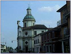
Cadeo (Piacentino: La Cadé or Cadé) is a town and comune (municipality) in the Province of Piacenza in the Italian region Emilia-Romagna, located about 130 kilometres (81 mi) northwest of Bologna and about 14 kilometres (9 mi) southeast of Piacenza. It has about 5,600 inhabitants. The name is derived from Italian, meaning "House of God." This refers to a time when Cadeo was a stop-over for Christian pilgrims. The photo of the church accompanying this article is actually on the Via Emilia in Roveleto.
Cadeo | |
|---|---|
| Comune di Cadeo | |
 | |
Location of Cadeo 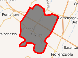
| |
 Cadeo Location of Cadeo in Italy 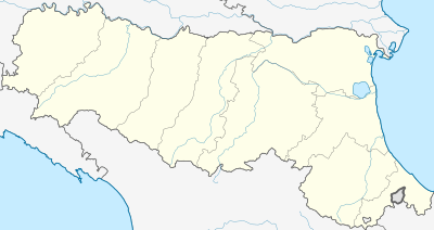 Cadeo Cadeo (Emilia-Romagna) | |
| Coordinates: 44°58′N 9°50′E | |
| Country | Italy |
| Region | Emilia-Romagna |
| Province | Piacenza (PC) |
| Frazioni | Roveleto, Saliceto, Fontana Fredda |
| Area | |
| • Total | 38.6 km2 (14.9 sq mi) |
| Elevation | 65 m (213 ft) |
| Population (Dec. 2004)[2] | |
| • Total | 5,601 |
| • Density | 150/km2 (380/sq mi) |
| Time zone | UTC+1 (CET) |
| • Summer (DST) | UTC+2 (CEST) |
| Postal code | 29010 |
| Dialing code | 0523 |
| Website | Official website |
Cadeo borders the following municipalities: Carpaneto Piacentino, Cortemaggiore, Fiorenzuola d'Arda, Pontenure. The Municipal Building for Cadeo is located in Roveleto, which is to the south-east on the Via Emilia. Roveleto is also the site of the closest railroad station to Cadeo.
Demographic evolution

References
- "Superficie di Comuni Province e Regioni italiane al 9 ottobre 2011". Istat. Retrieved 16 March 2019.
- All demographics and other statistics: Italian statistical institute Istat.
External links
| Wikimedia Commons has media related to Cadeo. |