Bukedea District
Bukedea District is a district in the Eastern Region of Uganda. The town of Bukedea is the site of the district headquarters.
Bukedea District | |
|---|---|
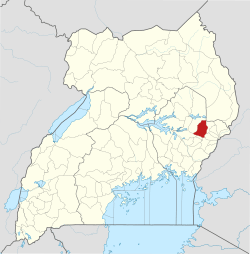 District location in Uganda | |
| Coordinates: 01°21′N 34°03′E | |
| Country | |
| Region | Eastern Region of Uganda |
| Sub-region | Teso sub-region |
| Capital | Bukedea |
| Area | |
| • Land | 1,051.7 km2 (406.1 sq mi) |
| Population (2012 Estimate) | |
| • Total | 186,400 |
| • Density | 177.2/km2 (459/sq mi) |
| Time zone | UTC+3 (EAT) |
| Website | bukedea.go.ug |
Location
Bukedea District is bordered by Kumi District to the west and north, Bulambuli District to the east, Sironko District and Mbale District to the south-east, and Pallisa District to the south. The district headquarters at Bukedea are approximately 79 kilometres (49 mi), by road, south-east of Soroti, the largest city in the Teso sub-region.[1]
Overview
Bukedea District was created by an Act of the Ugandan parliament on 13 July 2006 and became operational on 1 July 2007.[2] Before that, the district was part of Kumi District.[3]
Population
In 1991, the national population census estimated the district population at 75,300. The national census in 2002 estimated the population at 122,400. The annual population growth rate in the district was calculated at 4.4 percent. In 2012, the population was estimated at 186,400.[4]
References
- "Road Distance Between Soroti And Bukedea With Map". Globefeed.com. Retrieved 17 May 2014.
- Statoids. 30 June 2015 http://www.statoids.com/uug.html. Retrieved 5 March 2016. Missing or empty
|title=(help) - Commonwealth Network. Nexus Strategic Partnerships Limited http://www.commonwealthofnations.org/info/regions-uganda/eastern-region/bukedea/. Retrieved 5 March 2016. Missing or empty
|title=(help) - "Estimated Population of Bukedea District In 1991, 2002 & 2012". Citypopulation.de. Retrieved 17 May 2014.