Soroti
Soroti is the main municipal, commercial, and administrative centre of Soroti District in the Eastern Region of Uganda, lying near Lake Kyoga. It is known for the rock formation near the town.
Soroti | |
|---|---|
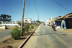 Soroti Main Street | |
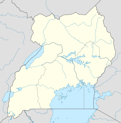 Soroti Location in Uganda | |
| Coordinates: 01°42′54″N 33°36′40″E | |
| Country | |
| Region | Eastern Region of Uganda |
| Sub-region | Teso sub-region |
| District | Soroti District |
| Elevation | 3,540 ft (1,080 m) |
| Population (2020 Estimates) | |
| • Total | 150,000[1] |
Location
Soroti is approximately 112 kilometres (70 mi), by road, northwest of the city of Mbale on the highway between Mbale and Lira.[2] The coordinates of Soroti town are 1°42'54.0"N, 33°36'40.0"E (Latitude:1.7150; Longitude:33.6111).[3]
Soroti Airport
Soroti Airport has the third longest paved runway in Uganda at 1,857 metres (6,093 ft).[4] The longest paved runway in Uganda, measuring 12,000 feet (3,700 m), is at Entebbe International Airport.[5]
Population
The 2002 national population census estimated the population of Soroti at 41,600. In 2010, the Uganda Bureau of Statistics (UBOS) estimated the population at 62,600. In 2011, UBOS estimated the mid-year population of Soroti at 66,000.[6] In August 2014, the national population census put Soroti's population at 49,452.[1]
Education
Soroti University is located in the suburb of Arapai.[7] Soroti is also home to campuses of Kumi University[8] and Kyambogo University[9]. Soroti Secondary School is the biggest day school in Teso.[10]
Points of interest
The following points of interest are located in Soroti or near the town limits:[11]
- headquarters of Soroti District Administration
- offices of Soroti Town Council
- branch of the National Social Security Fund
- Soroti Regional Referral Hospital, a 275-bed public hospital administered by the Uganda Ministry of Health
- Teso College Aloet
- Lwala Soroti Hospital, a 135-bed, non-governmental hospital, administered by the Uganda Catholic Medical Bureau.
- Soroti Solar Power Station
- Soroti Rock, a volcanic rock formation.
- Soroti central market
- Bethesda Hospital Soroti Limited[Private founded hospital at after St.Stephens School, Oderai Center(2.5km from town)
- Soroti Railway Station (non-functional)
- headquarters of the Roman Catholic Diocese of Soroti
- Mbale-Lira highway, which passes through the center of town in a north-west/south-east direction.
References
- UBOS (27 August 2014). "The Population of The Regions of the Republic of Uganda And All Cities And Towns of More Than 15,000 Inhabitants". Citypopulation.de Quoting Uganda Bureau of Statistics (UBOS). Retrieved 21 February 2015.
- "Distance between Mbale And Soroti With Map". Globefeed.com. Retrieved 12 May 2014.
- Google (2 July 2015). "Location of Soroti At Google Maps" (Map). Google Maps. Google. Retrieved 2 July 2015.
- "SRT - Soroti, UG - Airport - Great Circle Mapper". www.gcmap.com. Retrieved 2018-11-08.
- "List of Airports In Uganda". Aircraft Charter World. Retrieved 12 May 2014.
- "Estimated Population of Soroti In 2002, 2010 & 2011" (PDF). Uganda Bureau of Statistics. Retrieved 12 May 2014.
- "Soroti University to open in August". Daily Monitor. Retrieved 2020-01-26.
- "Kumi University". Retrieved 2020-01-25.
- "Kyambogo opens regional learning centers". www.newvision.co.ug. Retrieved 2020-01-26.
- Elunya, Joseph. "Soroti Secondary School Teachers on Strike". Uganda Radio Network. Retrieved 2020-01-26.
- "Profile of Soroti". Uganda Travel Guide. Retrieved 12 May 2014.
External links
| Wikivoyage has a travel guide for Soroti. |
Capital: Soroti | ||
| Towns and villages | 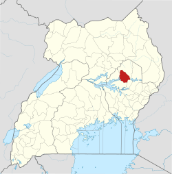 | |
| Economy |
| |
| Transport | ||
| Energy | ||
| Health |
| |
| Media |
| |
| Notable landmarks |
| |
| Education | ||
| Hospitality |
| |
| Notable people | ||