Broût-Vernet
Broût-Vernet is a commune in the Allier department in central France. It is around 15 km north-west of Vichy and 40 km north of Clermont-Ferrand.
Broût-Vernet | |
|---|---|
.jpg) Aubeterre priory | |
.svg.png) Coat of arms | |
Location of Broût-Vernet 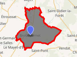
| |
 Broût-Vernet  Broût-Vernet | |
| Coordinates: 46°11′20″N 3°16′26″E | |
| Country | France |
| Region | Auvergne-Rhône-Alpes |
| Department | Allier |
| Arrondissement | Vichy |
| Canton | Bellerive-sur-Allier |
| Intercommunality | Bassin de Gannat |
| Government | |
| • Mayor (2014–2020) | Pierre Houbé[1] |
| Area 1 | 31.71 km2 (12.24 sq mi) |
| Population (2017-01-01)[2] | 1,169 |
| • Density | 37/km2 (95/sq mi) |
| Time zone | UTC+01:00 (CET) |
| • Summer (DST) | UTC+02:00 (CEST) |
| INSEE/Postal code | 03043 /03110 |
| Elevation | 253–331 m (830–1,086 ft) (avg. 310 m or 1,020 ft) |
| 1 French Land Register data, which excludes lakes, ponds, glaciers > 1 km2 (0.386 sq mi or 247 acres) and river estuaries. | |
Population
| Historical population | ||
|---|---|---|
| Year | Pop. | ±% |
| 1962 | 1,028 | — |
| 1968 | 1,061 | +3.2% |
| 1975 | 994 | −6.3% |
| 1982 | 1,048 | +5.4% |
| 1990 | 1,035 | −1.2% |
| 1999 | 1,068 | +3.2% |
| 2008 | 1,175 | +10.0% |
| 2013 | 1,207 | +2.7% |
| Source: INSEE (1968–2013[3]) | ||
See also
References
- "Liste nominative des communes de l'Allier (avec maire, arrondissement et canton)" [Nominative list of communes of Allier (with mayor, arrondissement and canton)] (PDF). Association of Mayors and Presidents of Communities of Allier. 1 April 2015. Archived from the original (PDF) on 18 May 2015. Retrieved 22 June 2015.
- "Populations légales 2017". INSEE. Retrieved 6 January 2020.
- "2013 legal populations - Broût-Vernet". INSEE (in French). Retrieved 1 February 2016.
| Wikimedia Commons has media related to Broût-Vernet. |
This article is issued from Wikipedia. The text is licensed under Creative Commons - Attribution - Sharealike. Additional terms may apply for the media files.