Blanchardstown
Blanchardstown (Irish: Baile Bhlainséir) is a large outer suburb of Dublin in County Fingal, Ireland, built out from a small village since the 1960s. It is located 10 km north-west of the city centre. It is within the historical barony of Castleknock in the traditional County Dublin, as well as the Dublin 15 postal area and the Dublin West electoral constituency.
Blanchardstown Baile Bhlainséir | |
|---|---|
Suburb (village core) | |
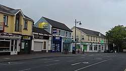 Cross roads on Mill Road and Main Street Blanchardstown | |
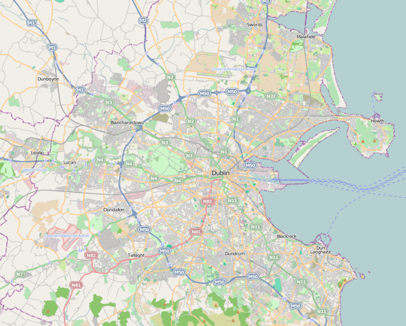 Blanchardstown Location in Dublin  Blanchardstown Blanchardstown (Ireland) | |
| Coordinates: 53.387°N 6.380°W | |
| Country | Ireland |
| Province | Leinster |
| County | Dublin |
| Government | |
| • Local Authority | Fingal County Council |
| • Dáil Éireann | Dublin West |
| Elevation | 56 m (184 ft) |
| Population (2006)[1] | |
| • Urban | 68,156 |
| Time zone | UTC±0 (WET) |
| • Summer (DST) | UTC+1 (IST) |
| Eircode routing key | D15 |
| Telephone area code | +353(0)1 |
| Irish Grid Reference | O055383 |
Blanchardstown is the largest urban area in Fingal. One of Ireland's largest shopping and leisure centres, the Blanchardstown Centre, is located in the area.
Etymology
The name Blanchardstown comes from the Blanchard family, who were granted their estate some time between 1250 and 1260. The name 'Blanchard' is thought to come from the old French word blanch, meaning white, and could refer to white or fair hair.[2] The townland has an area of over 454 acres.
Geography
.jpg)
Blanchardstown is just outside Dublin's M50 motorway ring road, slightly to the north of the tolled crossing of the River Liffey. The core of the suburb is the townland of the same name, containing the village itself and the Roselawn housing area.[3] It is bordered to the east by the suburb of Castleknock, to the west by Coolmine, which includes some areas, including Blanchardstown Shopping Centre, central to the district, and Clonsilla/Ongar, to the north by Tyrellstown and Hollystown, and to the south and south east by Porterstown and Diswellstown. The stretch of suburban housing from Castleknock Way north to the Old Navan Road and Talbot Court, including Laurel Lodge, has an ambiguous status - all of it is in the townland of Blanchardstown,[4] but it is sometimes considered to be a western extension of Castleknock.
The Tolka, the second river of Fingal, and Dublin, runs through the centre of the area, meandering to run just north of the village core, and then further north to pass the Connolly Memorial Hospital and then Abbotstown.
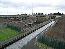
The Royal Canal and the Dublin-Sligo railway line pass along the southern edge of Blanchardstown proper from east to west.
History
| Historical population | ||
|---|---|---|
| Year | Pop. | ±% |
| 1821 | 302 | — |
| 1831 | 342 | +13.2% |
| 1841 | 182 | −46.8% |
| 1851 | 273 | +50.0% |
| 1861 | 253 | −7.3% |
| 1871 | 239 | −5.5% |
| 1881 | 239 | +0.0% |
| 1891 | 236 | −1.3% |
| 1901 | 235 | −0.4% |
| 1911 | 315 | +34.0% |
| 1926 | 317 | +0.6% |
| 1936 | 269 | −15.1% |
| 1946 | 419 | +55.8% |
| 1951 | 574 | +37.0% |
| 1956 | 990 | +72.5% |
| 1961 | 1,328 | +34.1% |
| 1966 | 1,782 | +34.2% |
| 1971 | 3,279 | +84.0% |
| 1981 | 21,921 | +568.5% |
| 1986 | 31,637 | +44.3% |
| 1991 | 34,853 | +10.2% |
| 1996 | 37,346 | +7.2% |
| 2002 | 50,193 | +34.4% |
| 2006 | 63,120 | +25.8% |
| 2011 | 68,156 | +8.0% |
| 2016 | 73,150 | +7.3% |
Blanchardstown was a predominantly rural area, with a small village, in western County Dublin, alongside the neighbouring district of Castleknock. Both areas shared a common history until well into the 19th century, when their development diverged.
In the late 1960s, the first housing estates began to be developed. During the 1970s/80s, the village and surrounding housing developments became subsumed into the suburban fabric of Dublin.
The Institute of Technology, Blanchardstown (ITB) was established in 1999 and since 2019 is one of the three campuses of the new Technological University Dublin along with Grangegorman and Tallaght campuses.
During the late 1990s a criminal gang from Blanchardstown, known as "The Westies”, controlled the heroin trade in west Dublin. One of its leaders was shot in a pub in Blanchardstown in 2003,[5] while others were killed in Spain in 2004.[6]
Transport
Rail
There are three Irish Rail train stations in the wider Blanchardstown area: Castleknock, Coolmine and Clonsilla. Trains on the Maynooth/Longford line connect the city centre, at Dublin Connolly, Tara Street and Dublin Pearse stations, to Maynooth, Longford and Sligo. At Clonsilla station, the Dublin–Navan railway line connects Docklands railway station to Hansfield and Dunboyne.[7]
Bus
Ballycoolin Industrial Estate is served by a private bus company called AMC Ballycoolin, also known as Express Bus.
Bus Éireann services pass through Blanchardstown on Routes 105,109 and 111.[8][9][10] Dublin Bus and Go-Ahead Ireland routes include 17A, 37, 38, 38A, 38B, 38C, 38D, 39, 39A, 39N, 40D, 70, 76A, 220, 236, 238, 239 and 270.[11][12][13][14][15][16][17][18][19][20][21][22][23][24][25]
Two Nitelink bus routes also operate on Friday and Saturday nights to Tyrrelstown Route 39N[26] and Dunboyne Route 70N.[27] Express bus routes include service from Aston Quay and from Coolmine Railway Station to Ballycoolin Industrial Estate.[28][29]
Amenities
.jpg)
Connolly Hospital, one of Dublin's main hospitals, and a public university teaching hospital, is located in the area, as is the Institute of Technology, Blanchardstown.
Local retail outlets include Blanchardstown Centre (a large retail shopping centre with over 180 stores), and WestEnd Shopping Park (a retail park located beside the Blanchardstown Centre). The Carlton Hotel, a 4 Star Hotel north-west of the village, is located by the Blanchardstown Centre complex. There is a SuperValu outlet on Main Street.
Blanchardstown has a large public library, and is also home to the Draíocht Arts Centre.
There is a large Garda station on Main Street.
Education
.jpg)
There are a number of primary schools (national schools) in Blanchardstown, including Scoil Bhríde (Cailiní) and Scoil Bhríde (Buacaillí) on Church Avenue,[30][31] Sacred Heart of Jesus Primary School (Huntstown),[32] Scoile Olilibheir (Coolmine), St Ciaran's Primary School (Hartstown), Mary Mother of Hope Primary School (Clonee), and St Phillip the Apostle Primary School (Mountview).
Second level schools (secondary schools) serving the area include Blakestown Community School, Riversdale Community College, Hartstown Community School, and Coolmine Community School.
The Institute of Technology, Blanchardstown (part of TU Dublin) is a third-level institution with a campus on the Blanchardstown Road.
Sport
The National Sports Campus is located in Blanchardstown, and includes the National Aquatic Centre (NAC), a major indoor aquatics facility with a 50m swimming pool, diving pool, leisure pool and aquapark, and fitness centre. The centre hosted the Special Olympics World Summer Games in 2003, and a number of international swimming events since then.
There are several GAA clubs in the Blanchardstown area, including St. Brigids, Castleknock and St. Peregrines, Clonsilla. There are also a number of association football (soccer) clubs in the area.
Religion
St Brigid's Roman Catholic Church is situated behind Main Street at Church Avenue. The foundation stone for the church was laid on 13 October 1835 and the first Mass was celebrated there on 29 October 1837. The construction of the Church and its unusual Flemish spire was finally completed in 1863.[33]
In the 19th century, the Roman Catholic parish of Blanchardstown encompassed much of the area now within the Dublin 15 postal district; some of the component areas were quite distinct from Blanchardstown but Catholic parishes had been merged during Penal Laws times. Following the relaxation of the Penal Laws, it became possible for Catholic adherents to consider the construction of additional churches and to repair the existing stock of religious buildings. Church authorities used the opportunity to implement the Tridentine reform which saw the parish as the basic unit of ecclesiastical organisation and the parish priest as the central figure within the parish.[34]
The new parish priest of Blanchardstown in 1839, Fr Michael Dungan, oversaw the construction of a number of new churches, which today serve independent parishes, and invited a number of religious communities to provide for the education of Catholic children. St Brigid's Church, Blanchardstown – not to be confused with a church of the Church of Ireland in nearby Castleknock – was constructed in 1837 upon the foundation of a church that had been built prior to 1731. It is the mother church of 12 other churches constituted out of the parish over the following 156 years.[35]
- Chapelizod - "Nativity of the Blessed Virgin Mary" (separated from Blanchardstown Parish 1883)
- Navan Road - "Our Lady Help of Christians" (separated from Chapelizod 1953)[36]
- Castleknock - "Our Lady Mother of the Church" (separated from Blanchardstown 1976)[37]
- Laurel Lodge / Carpenterstown - "St Thomas, the Apostle" (separated from Castleknock 1983)[38]
- Porterstown - "St Mochta's" (separated from Castleknock 1986. The present church was constructed in 1890 as a Chapel of ease for Blanchardstown.)[39]
- Corduff - "St Patrick's Church" (separated from Blanchardstown 1976)
- Hartstown - "St Ciarán' Church" (separated Blanchardstown 1979)[43]
- Mulhuddart / Lady's Well - "St Luke, the Evangelist" (separated from Blanchardstown 1993)
Representation
.jpg)
For the purposes of elections to Dáil Éireann, Blanchardstown is part of the Dublin West constituency, which returns four TDs.
For elections to Fingal County Council, the village is split between the two local electoral areas (LEAs) of Castleknock[44] (which returns 4 councillors), and Mulhuddart[45] (which returns 5 councillors).
Notable people
- John Troy, Roman Catholic Archbishop of Dublin
- Leo Varadkar, Fine Gael TD and Taoiseach
- Joan Burton, Former Labour TD and former Tánaiste and Government Minister
- Siva Kaneswaran, musician with The Wanted
- William Mooney, cricketer
Gallery
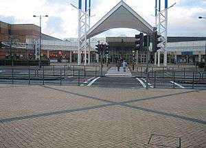 Blanchardstown shopping centre
.jpg) Draíocht Arts Centre
Draíocht Arts Centre Blanchardstown Garda Station
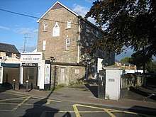
 Shop on Blanchardstown's main street
.jpg) National Childrens Hospital Satellite Centre Connolly Hospital
National Childrens Hospital Satellite Centre Connolly Hospital
References
- "Census 2006 – Volume 1 – Population Classified by Area" (PDF). Central Statistics Office Census 2006 Reports. Central Statistics Office Ireland. April 2007. Archived from the original (PDF) on 7 June 2011. Retrieved 12 May 2011.
- "Early History". Ask About Ireland. Retrieved 5 December 2012.
- "Blanchardstown townland". logainm.ie. Placenames Database of Ireland.
- Ordnance Survey Ireland (Government of Ireland), Ordnance Survey Ireland Mapviewer - Geohive - Townlands view, viewed 25 May 2020
- Khan, Frank (12 November 2003). "Murder hunt as man gunned down in new gangland killing". Irish Independent.
- Ken Foy (13 June 2011). "Garda swoop foils the revival of feared Westies crime gang". The Herald. Retrieved 28 February 2013.
- "M3 Parkway" (PDF). Irish Rail. Archived from the original (PDF) on 1 March 2014.
- "Bus Éireann route 105" (PDF). Archived from the original (PDF) on 3 April 2014. Retrieved 22 February 2014.
- "Bus Éireann route 109" (PDF). Archived from the original (PDF) on 17 May 2012. Retrieved 12 June 2012.
- "Bus Éireann route 105" (PDF). Archived from the original (PDF) on 27 March 2014. Retrieved 22 February 2014.
- "Dublin Bus route 17A". dublinbus.ie.
- "Dublin Bus route 37". Archived from the original on 26 February 2014. Retrieved 22 February 2014.
- "Dublin Bus route 38". Archived from the original on 22 February 2014. Retrieved 22 February 2014.
- "Dublin Bus route 38A". Archived from the original on 22 February 2014. Retrieved 22 February 2014.
- "Dublin Bus route 38B". dublinbus.ie.
- "Dublin Bus route 39". Archived from the original on 26 February 2014. Retrieved 22 February 2014.
- "Dublin Bus route 39A". Archived from the original on 23 February 2014. Retrieved 22 February 2014.
- "Dublin Bus route 40D". dublinbus.ie.
- "Dublin Bus route 70". Archived from the original on 26 February 2014. Retrieved 22 February 2014.
- "Dublin Bus route 76A". dublinbus.ie.
- "Dublin Bus route 220". dublinbus.ie.
- "Dublin Bus route 236". Archived from the original on 26 February 2014. Retrieved 22 February 2014.
- "Dublin Bus route 238". dublinbus.ie.
- "Dublin Bus route 239". Archived from the original on 26 February 2014. Retrieved 22 February 2014.
- "Dublin Bus route 270". dublinbus.ie.
- "39n - Dublin Bus". Dublinbus.ie. Retrieved 8 January 2020.
- "Timetable 70N". dublinbus.ie.
- "Route Details Timetable 7". Archived from the original on 27 February 2014. Retrieved 22 February 2014.
- "Route Details Timetable 1". Archived from the original on 27 February 2014. Retrieved 22 February 2014.
- "Scoil Bhríde (Cailíní) Blanchardstown – School for Girls in Blanchardstown Village". Scoilbhridec.ie. 30 September 2019. Retrieved 8 January 2020.
- "Scoil Bhride Boys National School | Blanchardstown Parish". Blanchardstownparish.ie. Retrieved 8 January 2020.
- "Sacred Heart of Jesus". sacredhearthuntstown.weebly.com.
- "Blanchardstown Village - St. Brigid's Roman Catholic Church". Ask About Ireland.
- Cronin, Elizabeth, Fr Michael Dungan's Blanchardstown, 1836-1968, Four Courts Press (2002), p. 10.
- Cronin, Elizabeth, Fr Michael Dungan's Blanchardstown, 1836-1968, Four Courts Press (2002), p 56.
- "Website of Parish of Our Lady Help of Christians". navanroadparish.com. Archived from the original on 30 January 2013.
- "Website of the Parish of Our Lady Mother of the Church, Castleknock". castleknockparish.ie.
- "Website of the Parish of St Thomas, the Apostle, Castleknock". laurellodgeparish.ie.
- "Website of the Parish of St Mochta, Porterstown". stmochtasparish.ie.
- "Website of the Parish of St Philip". stphilipsmountview.ie. Archived from the original on 29 October 2013.
- "Website of the Parish of Mary of the Servants". blakestownparish.com.
- "Website of the Parish of Huntstown-Littlepace". huntstown-littlepace.ie.
- "Website] of the Parish of St Ciarán, Hartstown". st-ciarans-parish.ie. Archived from the original on 24 January 2001.
- "Councillors – Castleknock". Fingal County Council. Retrieved 19 February 2011.
- "Councillors – Mulhuddart". Fingal County Council. Retrieved 19 February 2011.
| Wikimedia Commons has media related to Blanchardstown. |