Baruun-Urt
Baruun-Urt (Mongolian: Баруун-Урт; ᠪᠠᠷᠠᠭᠤᠨ ᠤᠷᠲᠤ, west-long) is a town in eastern Mongolia and the capital of Sükhbaatar Province. The town with its vicinities creates a sum (district) of Sükhbaatar Province. The Baruun-Urt sum area is 59 km², population 15,549, population density 265 per km² (2008). It forms an enclave within the surrounding Sükhbaatar sum.
Baruun-Urt District Баруун-Урт сум ᠪᠠᠷᠠᠭᠤᠨᠤᠷᠲᠤᠰᠤᠮᠤ | |
|---|---|
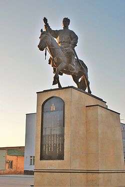 Sükhbaatar Square Statue in Baruun-Urt | |
| Country | Mongolia |
| Province | Sükhbaatar Province |
| Elevation | 981 m (3,219 ft) |
| Population (2017) | |
| • Total | 18,190 |
| Time zone | UTC+8 (UTC + 8) |
| Climate | BSk |
Tömörtiin Ovoo Zinc Mine lies about 13 km north of the town.
Population
| 1959 est. |
1969 census |
1979 census |
1989 census |
1994 est. |
2000 census |
2006 est. |
2008 est. |
|---|---|---|---|---|---|---|---|
| 6,000 | 8,000 | 11,600 | 16,100 | 17,289 | 15,133 | 12,000 | 12,944 |
Transportation
The Baruun-Urt Airport (UUN/ZMBU) has one unpaved runway. There is a regular flight connecting the city to the capital every Monday. The flight is operated by the MIAT through Sky Horse Aviation.
Climate
Baruun-Urt experiences a cold semi-arid climate (Köppen BSk) with long, very dry, frigid winters and short, very warm summers.
| Climate data for Baruun-Urt | |||||||||||||
|---|---|---|---|---|---|---|---|---|---|---|---|---|---|
| Month | Jan | Feb | Mar | Apr | May | Jun | Jul | Aug | Sep | Oct | Nov | Dec | Year |
| Record high °C (°F) | 0.2 (32.4) |
4.8 (40.6) |
17.3 (63.1) |
27.5 (81.5) |
34.6 (94.3) |
37.4 (99.3) |
39.0 (102.2) |
37.4 (99.3) |
30.5 (86.9) |
26.5 (79.7) |
12.9 (55.2) |
1.0 (33.8) |
39.0 (102.2) |
| Average high °C (°F) | −16.3 (2.7) |
−12.0 (10.4) |
−1.2 (29.8) |
10.7 (51.3) |
19.2 (66.6) |
24.5 (76.1) |
26.2 (79.2) |
24.4 (75.9) |
17.9 (64.2) |
9.2 (48.6) |
−4.1 (24.6) |
−13.4 (7.9) |
7.1 (44.8) |
| Daily mean °C (°F) | −21.5 (−6.7) |
−18.1 (−0.6) |
−8.2 (17.2) |
3.0 (37.4) |
11.4 (52.5) |
17.6 (63.7) |
20.0 (68.0) |
18.0 (64.4) |
10.8 (51.4) |
1.7 (35.1) |
−10.3 (13.5) |
−18.8 (−1.8) |
0.5 (32.8) |
| Average low °C (°F) | −26.2 (−15.2) |
−23.2 (−9.8) |
−14.5 (5.9) |
−4.0 (24.8) |
3.9 (39.0) |
11.2 (52.2) |
14.0 (57.2) |
12.0 (53.6) |
4.5 (40.1) |
−4.2 (24.4) |
−15.5 (4.1) |
−23.2 (−9.8) |
−5.4 (22.2) |
| Record low °C (°F) | −38.3 (−36.9) |
−40.1 (−40.2) |
−32.2 (−26.0) |
−19.7 (−3.5) |
−8.8 (16.2) |
−1.8 (28.8) |
4.0 (39.2) |
0.2 (32.4) |
−7.2 (19.0) |
−23.0 (−9.4) |
−31.5 (−24.7) |
−38.2 (−36.8) |
−40.1 (−40.2) |
| Average precipitation mm (inches) | 1.8 (0.07) |
1.5 (0.06) |
2.6 (0.10) |
6.7 (0.26) |
13.1 (0.52) |
35.3 (1.39) |
61.2 (2.41) |
50.6 (1.99) |
21.2 (0.83) |
5.9 (0.23) |
2.7 (0.11) |
1.8 (0.07) |
204.4 (8.04) |
| Average precipitation days (≥ 1.0 mm) | 0.7 | 0.5 | 0.6 | 1.5 | 2.3 | 6.8 | 8.1 | 7.5 | 3.5 | 1.5 | 0.7 | 0.6 | 34.3 |
| Mean monthly sunshine hours | 203.3 | 216.4 | 263.5 | 274.6 | 304.5 | 303.0 | 298.9 | 290.4 | 280.0 | 245.2 | 208.2 | 183.2 | 3,071.2 |
| Source: NOAA (1961-1990) [7] | |||||||||||||
References
| Wikivoyage has a travel guide for Baruun-Urt. |
- National Statistical Office Archived 2007-06-07 at the Wayback Machine
- National Economy of the Mongolian People's Republic (1921 - 1981), Ulaanbaatar 1981
- GeoHive: Global Statistics Archived 2013-07-30 at the Wayback Machine
- "Population Statistics: historical demography". Archived from the original on 2015-02-23. Retrieved 2007-10-24.
- http://www.reliefweb.int/library/documents/oxfamannex1-4.pdf%5B%5D
- Sukhbaatar Aimag Statistical Office 2008 Annual Report Archived 2011-07-22 at the Wayback Machine
- "Baruun-Urt Climate Normals 1961-1990". National Oceanic and Atmospheric Administration. Retrieved January 14, 2013.
| ||
Capital: Ulaanbaatar | ||
| ||
This article is issued from Wikipedia. The text is licensed under Creative Commons - Attribution - Sharealike. Additional terms may apply for the media files.