Öndörkhaan
Öndörkhaan (Mongolian: Өндөрхаан; ᠥᠨᠳᠦᠷᠬᠠᠨ; sometimes Undurkhaan), is a town in Mongolia located 290 km east of Ulaanbaatar. The Mongolian Parliament, State Great Khural, renamed the city Chinggis City on November 18, 2013 in honor of Genghis Khan, who was born and possibly buried in the same province north of the city.[1] Öndörkhaan has a population of roughly 15,000 persons and serves as the capital of the Khentii Aimag (province).
Öndörkhaan Өндөрхаан ᠥᠨᠳᠦᠷᠬᠠᠨ | |
|---|---|
| Kherlen District Хэрлэн сум ᠬᠡᠷᠦᠯᠦᠨᠰᠤᠮᠤ | |
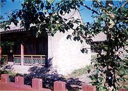 In the Öndörkhaan Museum complex | |
 Öndörkhaan | |
| Coordinates: 47°19′N 110°39′E | |
| Country | Mongolia |
| Province | Khentii Province |
| Area | |
| • Total | 3,788 km2 (1,463 sq mi) |
| Elevation | 1,027 m (3,369 ft) |
| Population (2017) | |
| • Total | 20,935 |
| • Density | 5.5/km2 (14/sq mi) |
| Time zone | UTC+8 (UTC + 8) |
History
On September 13, 1971, Lin Biao died when a Hawker Siddeley Trident he was aboard crashed in Öndörkhaan.
Geography and climate
Öndörkhaan shares its location with the Kherlen sum (municipality) and is the most populous part of the Khentii province.
Öndörkhaan experiences a semi-arid climate (Köppen BSk) with long, dry, frigid winters and short, very warm summers. It borders the Kherlen River and is located on a broad flat unprotected plain. In winter, when the river freezes over and the winds howl across the open steppe it can easily reach −40 °C or −40 °F without the subtraction of wind chill.
| Climate data for Öndörkhaan | |||||||||||||
|---|---|---|---|---|---|---|---|---|---|---|---|---|---|
| Month | Jan | Feb | Mar | Apr | May | Jun | Jul | Aug | Sep | Oct | Nov | Dec | Year |
| Record high °C (°F) | 0.2 (32.4) |
7.2 (45.0) |
19.4 (66.9) |
27.1 (80.8) |
35.3 (95.5) |
38.5 (101.3) |
37.7 (99.9) |
36.6 (97.9) |
30.4 (86.7) |
31.7 (89.1) |
14.6 (58.3) |
7.5 (45.5) |
38.5 (101.3) |
| Average high °C (°F) | −15.0 (5.0) |
−10.4 (13.3) |
0.2 (32.4) |
10.8 (51.4) |
19.2 (66.6) |
24.0 (75.2) |
25.4 (77.7) |
23.5 (74.3) |
17.7 (63.9) |
9.3 (48.7) |
−3.9 (25.0) |
−12.6 (9.3) |
7.4 (45.2) |
| Daily mean °C (°F) | −22.4 (−8.3) |
−19.2 (−2.6) |
−8.9 (16.0) |
2.3 (36.1) |
10.6 (51.1) |
16.4 (61.5) |
18.5 (65.3) |
16.5 (61.7) |
9.4 (48.9) |
0.6 (33.1) |
−11.6 (11.1) |
−19.8 (−3.6) |
−0.6 (30.9) |
| Average low °C (°F) | −27.9 (−18.2) |
−26.9 (−16.4) |
−16.6 (2.1) |
−5.8 (21.6) |
2.2 (36.0) |
9.2 (48.6) |
12.0 (53.6) |
10.1 (50.2) |
2.8 (37.0) |
−5.9 (21.4) |
−17.7 (0.1) |
−25.4 (−13.7) |
−7.5 (18.5) |
| Record low °C (°F) | −44.1 (−47.4) |
−43.2 (−45.8) |
−38.2 (−36.8) |
−20.8 (−5.4) |
−13.7 (7.3) |
−3.0 (26.6) |
1.2 (34.2) |
−1.9 (28.6) |
−10.8 (12.6) |
−24.1 (−11.4) |
−35.3 (−31.5) |
−42.9 (−45.2) |
−44.1 (−47.4) |
| Average precipitation mm (inches) | 1.2 (0.05) |
2.6 (0.10) |
2.5 (0.10) |
7.9 (0.31) |
15.0 (0.59) |
42.2 (1.66) |
65.4 (2.57) |
49.4 (1.94) |
23.4 (0.92) |
8.2 (0.32) |
3.3 (0.13) |
2.4 (0.09) |
223.5 (8.78) |
| Average precipitation days (≥ 1.0 mm) | 0.5 | 0.4 | 0.8 | 1.7 | 2.7 | 6.3 | 10.1 | 8.5 | 4.1 | 2.3 | 1.1 | 0.9 | 39.4 |
| Source: NOAA (1961-1990) [2] | |||||||||||||
Economy
Coal mining is important to the economy of the town and Chandgana Tal coalfield is located 53 km W from Öndörkhaan.
There exists a major United Nations Development Programme (UNDP) Networking and Cluster Development project stationed in Öndörkhaan specializing in the strengthen of urban, peri-urban and rural business associations and networks so as to reduce the very high unemployment rates.
Transportation
The Öndörkhaan Airport (UNR/ZMUH) has one unpaved runway and was serviced by regular flights from and to Ulan Bator, before the paved highway was completed.
The town serves as a transportation hub, linking Ulaanbaatar and Choibalsan.
See also
References
| Wikivoyage has a travel guide for Ondorkhaan. |
- http://www.infomongolia.com/ct/ci/7032
- "Underkhaan Climate Normals 1961-1990". National Oceanic and Atmospheric Administration. Retrieved January 14, 2013.
 | ||
Capital: Ulaanbaatar | ||
| ||