Ballaghaderreen
Ballaghaderreen (Irish: Bealach an Doirín, meaning "the way of the little oak grove"[2]) is a town in County Roscommon, Ireland, but traditionally part of County Mayo, located just off the N5 National primary road. The population was 1,808 in the 2016 census.
Ballaghaderreen Bealach an Doirín | |
|---|---|
Town | |
 | |
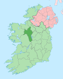
 Ballaghaderreen Location in Ireland | |
| Coordinates: 53°54′00″N 8°34′53″W | |
| Country | Ireland |
| Province | Connacht |
| County | County Roscommon |
| Elevation | 83 m (272 ft) |
| Population (2016)[1] | 1,808 |
| Time zone | UTC+0 (WET) |
| • Summer (DST) | UTC+1 (IST (WEST)) |
| Irish Grid Reference | M617948 |
History
By 1837 the town was recorded as having 1147 inhabitants in about 200 houses and as "rising in importance" as a post-town,[3] being on the (then) new mail coach road from Ballina to Longford. As of the mid 19th century, markets were held on Fridays, with seven fairs held throughout the year. A court-house, market house and an infantry barracks to accommodate 94 persons had all been established by that time.[3]
In 1860, Ballaghaderreen Cathedral was dedicated as the cathedral for the Roman Catholic Diocese of Achonry.
In March 2017, Ballaghaderreen became an Emergency Reception and Orientation Centre (EROC) for hundreds of refugees from the Syrian Civil War.[4] In April 2018, the community was honoured with a People of the Year Award for welcoming the refugees into the community.[5]
Governance
Ballaghadereen is part of the Barony of Costello and in the parish of Kilcoleman.[3]
Prior to 1898 the town and parish of Ballaghaderreen and Edmonstown was located in the eastern part of County Mayo until its transfer to County Roscommon under the Local Government Act 1898 by the Parliament of the United Kingdom. This has led to some anomalies, for example the local Gaelic Athletic Association team, Ballaghaderreen GAA plays in the Mayo championship and its players represent County Mayo.
Sports
There is a local Gaelic Athletic Association team, Ballaghaderreen GAA. It plays in the Mayo championship and its players represent County Mayo.
Transport
Ballaghaderreen was previously located on the N5 National primary road linking Dublin to Mayo, however increasing traffic levels and the opening of the nearby Charlestown bypass exacerbated the problem. In September 2014 after two years of construction a €60 million 13.5 km scheme re-rerouting the N5 2 km north of the town was completed. It was estimated this would remove approximately 4,000 vehicle movements through the town per day.[6][7][8]
The Ballaghaderreen branch line was formerly served by rail from Kilfree Junction. The old railway station opened on 2 November 1874, but closed permanently on 4 February 1963.[9] Ballaghaderreen is on the main Dublin-Ballina bus route and there are several buses daily serving this route. The nearest railway stations are in Castlerea 21 km and Boyle 26 km. It is 22 km from Ireland West Airport Knock.
People
- Anne Deane, nationalist, businesswoman and philanthropist
- John Blake Dillon, writer, politician, and founding member of the Young Ireland movement
- James Dillon, politician, leader of the opposition and leader of Fine Gael
- Garry Hynes, first female Tony Award winner for direction of a play.
- Matt Molloy, Irish flute player
- Thomas Flynn, Bishop of Achonry
- Patsy McGarry Irish Times Journalist
- John O'Gorman, piper
- Brian O'Doherty, writer, artist, art critic and academic
- Andy Moran, Gaelic Footballer
- Dermot Flanagan, Gaelic footballer
- Pearce Hanley, Australian Rules footballer
- William Partridge, trade unionist and revolutionary socialist
References
- "Sapmap Area - Settlements - Ballaghaderreen". Census 2016. Central Statistics Office. Retrieved 28 March 2018.
- "Bealach an Doirín/Ballaghaderreen". Placenames Database of Ireland. Government of Ireland - Department of Arts, Heritage and the Gaeltacht and Dublin City University. Retrieved 28 March 2018.
- "BALLAGHADIREEN, a market and post-town". LibraryIreland. From A Topographical Dictionary of Ireland, 1837. Archived from the original on 5 September 2017. Retrieved 16 April 2018.
- Towey, Niamh (14 April 2018). "One year on: Ballaghaderreen and refugees 'let down' by State". The Irish Times.
- "Coast Guard and Catherine Corless honoured at People Of The Year awards". RTÉ.ie. 15 April 2018. Archived from the original on 16 April 2018. Retrieved 16 April 2018.
- http://www.transport.ie/pressRelease.aspx?Id=481
- "N5 Ballaghaderreen Bypass". NRA Road Scheme Activity. Archived from the original on 7 May 2013. Retrieved 24 July 2013.
- "N5 Ballaghaderreen Bypass Opens". Transport Infrastructure Ireland. September 2017. Retrieved 16 April 2018.
- "Ballaghaderreen station" (PDF). Railscot - Irish Railways. Retrieved 26 July 2012.
External links
| Wikimedia Commons has media related to Ballaghaderreen. |
Places in County Roscommon | ||
|---|---|---|
| Towns |
|  |
| Villages and Townlands |
| |
| ||