Badefols-d'Ans
Badefols-d'Ans is a commune in the Dordogne department in southwestern France.
Badefols-d'Ans | |
|---|---|
.JPG) A general view of Badefols-d'Ans | |
 Coat of arms | |
Location of Badefols-d'Ans 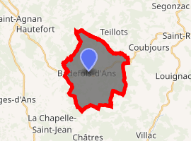
| |
 Badefols-d'Ans  Badefols-d'Ans | |
| Coordinates: 45°13′51″N 1°11′54″E | |
| Country | France |
| Region | Nouvelle-Aquitaine |
| Department | Dordogne |
| Arrondissement | Sarlat-la-Canéda |
| Canton | Haut-Périgord Noir |
| Intercommunality | Pays d’Hautefort |
| Government | |
| • Mayor (2008–2014) | Gérard Debet |
| Area 1 | 18.34 km2 (7.08 sq mi) |
| Population (2017-01-01)[1] | 404 |
| • Density | 22/km2 (57/sq mi) |
| Time zone | UTC+01:00 (CET) |
| • Summer (DST) | UTC+02:00 (CEST) |
| INSEE/Postal code | 24021 /24390 |
| Elevation | 165–348 m (541–1,142 ft) (avg. 293 m or 961 ft) |
| 1 French Land Register data, which excludes lakes, ponds, glaciers > 1 km2 (0.386 sq mi or 247 acres) and river estuaries. | |
Population
| Historical population | ||
|---|---|---|
| Year | Pop. | ±% |
| 1793 | 1,060 | — |
| 1800 | 1,073 | +1.2% |
| 1806 | 1,026 | −4.4% |
| 1821 | 1,112 | +8.4% |
| 1831 | 1,157 | +4.0% |
| 1836 | 1,196 | +3.4% |
| 1841 | 1,246 | +4.2% |
| 1846 | 1,171 | −6.0% |
| 1851 | 1,255 | +7.2% |
| 1856 | 1,265 | +0.8% |
| 1861 | 1,248 | −1.3% |
| 1866 | 1,307 | +4.7% |
| 1872 | 1,193 | −8.7% |
| 1876 | 1,209 | +1.3% |
| 1881 | 1,201 | −0.7% |
| 1886 | 1,261 | +5.0% |
| 1891 | 1,195 | −5.2% |
| 1896 | 1,312 | +9.8% |
| 1901 | 1,218 | −7.2% |
| 1906 | 1,172 | −3.8% |
| 1911 | 1,165 | −0.6% |
| 1921 | 913 | −21.6% |
| 1926 | 863 | −5.5% |
| 1931 | 766 | −11.2% |
| 1936 | 750 | −2.1% |
| 1946 | 719 | −4.1% |
| 1954 | 685 | −4.7% |
| 1962 | 567 | −17.2% |
| 1968 | 545 | −3.9% |
| 1975 | 518 | −5.0% |
| 1982 | 511 | −1.4% |
| 1990 | 451 | −11.7% |
| 1999 | 457 | +1.3% |
| 2006 | 463 | +1.3% |
| 2007 | 464 | +0.2% |
| 2008 | 477 | +2.8% |
| 2012 | 453 | −5.0% |
| 2015 | 425 | −6.2% |
See also
References
- "Populations légales 2017". INSEE. Retrieved 6 January 2020.
| Wikimedia Commons has media related to Badefols-d'Ans. |
| Authority control |
|
|---|
This article is issued from Wikipedia. The text is licensed under Creative Commons - Attribution - Sharealike. Additional terms may apply for the media files.