Avery, Missouri
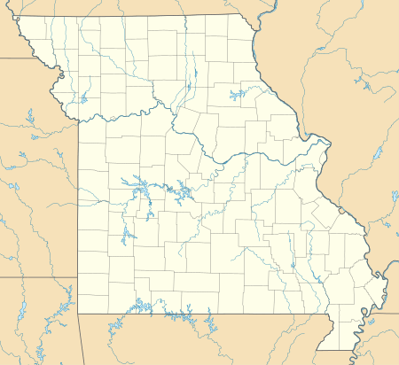
Avery is an unincorporated community in Benton and Hickory counties, Missouri, United States. Avery is located on Supplemental Route B, 8.7 miles (14.0 km) north-northeast of Wheatland.[2][3]
Avery, Missouri | |
|---|---|
 Avery  Avery | |
| Coordinates: 38°04′04″N 93°21′37″W | |
| Country | United States |
| State | Missouri |
| Counties | Benton and Hickory |
| Elevation | 797 ft (243 m) |
| Time zone | UTC-6 (Central (CST)) |
| • Summer (DST) | UTC-5 (CDT) |
| Area code(s) | 660 |
| GNIS feature ID | 713503[1] |
A post office called Avery was established in 1890, and remained in operation until 1897.[4] The community has the name of Henry Avery, a county commissioner.[5]
References
- "Avery". Geographic Names Information System. United States Geological Survey.
- Benton County General Highway Map (PDF) (Map). Missouri Department of Transportation. 2005. Archived from the original (PDF) on May 27, 2010. Retrieved May 26, 2012.
- Hickory County General Highway Map (PDF) (Map). Missouri Department of Transportation. 2011. Archived from the original (PDF) on December 21, 2016. Retrieved May 26, 2012.
- "Post Offices". Jim Forte Postal History. Archived from the original on 6 March 2016. Retrieved 1 September 2016.
- "Benton County Place Names, 1928-1945 (archived)". The State Historical Society of Missouri. Archived from the original on 24 June 2016. Retrieved 2 September 2016.CS1 maint: BOT: original-url status unknown (link)
Municipalities and communities of Benton County, Missouri, United States | ||
|---|---|---|
| Cities | 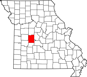 Map of Missouri highlighting Benton County | |
| Village | ||
| Townships | ||
| Unincorporated communities |
| |
| Former settlements | ||
| Footnotes | ‡This populated place also has portions in an adjacent county or counties | |
Municipalities and communities of Hickory County, Missouri, United States | ||
|---|---|---|
| Cities | 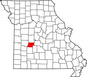 Map of Missouri highlighting Hickory County | |
| Village | ||
| Townships | ||
| Unincorporated communities | ||
| Footnotes | ‡This populated place also has portions in an adjacent county or counties | |
This article is issued from Wikipedia. The text is licensed under Creative Commons - Attribution - Sharealike. Additional terms may apply for the media files.