Preston, Missouri
Preston is a village in Hickory County, Missouri, United States. The population was 223 at the 2010 census.
Preston, Missouri | |
|---|---|
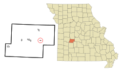 Location of Preston, Missouri | |
| Coordinates: 37°56′30″N 93°12′40″W | |
| Country | United States |
| State | Missouri |
| County | Hickory |
| Area | |
| • Total | 0.75 sq mi (1.94 km2) |
| • Land | 0.75 sq mi (1.94 km2) |
| • Water | 0 sq mi (0 km2) |
| Elevation | 1,043 ft (318 m) |
| Population | |
| • Total | 223 |
| • Estimate (2016)[3] | 219 |
| • Density | 300/sq mi (110/km2) |
| Time zone | UTC-6 (Central (CST)) |
| • Summer (DST) | UTC-5 (CDT) |
| ZIP code | 65732 |
| Area code(s) | 417 |
| FIPS code | 29-59870[4] |
| GNIS feature ID | 0729805[5] |
History
Preston was platted in 1857.[6] Some say the community was named after Samuel Preston, a pioneer citizen, while others believe the name is a transfer from Preston, Pennsylvania.[7] A post office called Preston has been in operation since 1881.[8]
Geography
Preston is located at 37°56′30″N 93°12′40″W (37.941571, -93.211015).[9]
According to the United States Census Bureau, the village has a total area of 0.75 square miles (1.94 km2), all land.[1]
Demographics
| Historical population | |||
|---|---|---|---|
| Census | Pop. | %± | |
| 1880 | 32 | — | |
| 1950 | 109 | — | |
| 1960 | 117 | 7.3% | |
| 1970 | 132 | 12.8% | |
| 1980 | 149 | 12.9% | |
| 1990 | 136 | −8.7% | |
| 2000 | 113 | −16.9% | |
| 2010 | 223 | 97.3% | |
| Est. 2016 | 219 | [3] | −1.8% |
| U.S. Decennial Census[10] | |||
2010 census
As of the census[2] of 2010, there were 223 people, 104 households, and 58 families living in the village. The population density was 297.3 inhabitants per square mile (114.8/km2). There were 121 housing units at an average density of 161.3 per square mile (62.3/km2). The racial makeup of the village was 97.8% White, 0.4% African American, and 1.8% Native American.
There were 104 households of which 20.2% had children under the age of 18 living with them, 48.1% were married couples living together, 2.9% had a female householder with no husband present, 4.8% had a male householder with no wife present, and 44.2% were non-families. 36.5% of all households were made up of individuals and 16.3% had someone living alone who was 65 years of age or older. The average household size was 2.14 and the average family size was 2.84.
The median age in the village was 48.1 years. 17.5% of residents were under the age of 18; 9.3% were between the ages of 18 and 24; 17% were from 25 to 44; 34.1% were from 45 to 64; and 22% were 65 years of age or older. The gender makeup of the village was 54.7% male and 45.3% female.
2000 census
As of the census[4] of 2000, there were 113 people, 50 households, and 31 families living in the town. The population density was 666.4 people per square mile (256.6/km²). There were 67 housing units at an average density of 395.1 per square mile (152.2/km²). The racial makeup of the town was 100.00% White.
There were 50 households out of which 30.0% had children under the age of 18 living with them, 48.0% were married couples living together, 14.0% had a female householder with no husband present, and 38.0% were non-families. 36.0% of all households were made up of individuals and 18.0% had someone living alone who was 65 years of age or older. The average household size was 2.26 and the average family size was 3.00.
In the town the population was spread out with 26.5% under the age of 18, 8.0% from 18 to 24, 16.8% from 25 to 44, 28.3% from 45 to 64, and 20.4% who were 65 years of age or older. The median age was 43 years. For every 100 females, there were 76.6 males. For every 100 females age 18 and over, there were 72.9 males.
The median income for a household in the town was $19,583, and the median income for a family was $19,583. Males had a median income of $20,313 versus $16,250 for females. The per capita income for the town was $11,318. There were 31.0% of families and 30.5% of the population living below the poverty line, including 37.1% of under eighteens and 17.4% of those over 64.
References
- "US Gazetteer files 2010". United States Census Bureau. Archived from the original on 2012-01-25. Retrieved 2012-07-08.
- "U.S. Census website". United States Census Bureau. Retrieved 2012-07-08.
- "Population and Housing Unit Estimates". Retrieved June 9, 2017.
- "U.S. Census website". United States Census Bureau. Retrieved 2008-01-31.
- "US Board on Geographic Names". United States Geological Survey. 2007-10-25. Retrieved 2008-01-31.
- Eaton, David Wolfe (1916). How Missouri Counties, Towns and Streams Were Named. The State Historical Society of Missouri. pp. 173.
- "Hickory County Place Names, 1928–1945 (archived)". The State Historical Society of Missouri. Archived from the original on 24 June 2016. Retrieved 6 October 2016.CS1 maint: BOT: original-url status unknown (link)
- "Post Offices". Jim Forte Postal History. Retrieved 6 October 2016.
- "US Gazetteer files: 2010, 2000, and 1990". United States Census Bureau. 2011-02-12. Retrieved 2011-04-23.
- "Census of Population and Housing". Census.gov. Retrieved June 4, 2015.
Municipalities and communities of Hickory County, Missouri, United States | ||
|---|---|---|
| Cities | 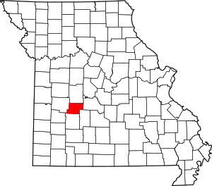 Map of Missouri highlighting Hickory County | |
| Village | ||
| Townships | ||
| Unincorporated communities | ||
| Footnotes | ‡This populated place also has portions in an adjacent county or counties | |