Armyansk
Armyansk (Ukrainian: Армянськ, Russian: Армянск, Armenian: Արմյանսկ, Crimean Tatar: Ermeni Bazar) is a town of regional significance in northern Crimea, a territory recognized by a majority of countries as part of Ukraine, but de facto under control and administration of Russia. Armyansk serves as the administrative center of Armyansk municipality, one of the regions Crimea is divided into. It is located on the Isthmus of Perekop. Population: 21,987 (2014 Census).[1]
Armiansk | |
|---|---|
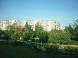 Apartment buildings in Armyansk | |
 Flag  Coat of arms | |
.svg.png) Armiansk Location of Armyansk within the Crimea 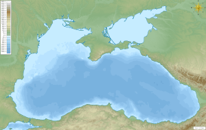 Armiansk Armiansk (Black Sea) | |
| Coordinates: 46°6′53″N 33°41′26″E | |
| Country | Disputed: |
| Republic | |
| Region | Armyansk municipality |
| Area | |
| • Total | 16.2 km2 (6.3 sq mi) |
| Elevation | 5 m (16 ft) |
| Population (2014) | |
| • Total | 21,987 |
| • Density | 1,375.68/km2 (3,563.0/sq mi) |
| Time zone | UTC+3 (MSK) |
| Postal code | 96012 — 96016 |
| Area code(s) | +7-36567 |
| Former name | Armyanskiy Bazar |
| Climate | Cfa |
| Website | http://armgov.ru/ |
History
At the beginning of the 18th century Armenians and Greeks who had come from the nearby city of Or Qapı (present-day Perekop) founded Armyansk. The first name of the town was Ermeni Bazar (Crimean Tatar for the "Armenian market"). In 1921 it was renamed Armyansk.
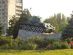
On 2 March 2014, early in the 2014 Crimean Crisis, Russian Naval Infantry units without cockades or rank insignia set up a checkpoint in Armyansk to check cars driving in and out of the Crimea region.[2]
Economy and Industry
- Krym Titan, Ti metallurgy, TiO2, TiCl2 TiCl4 and many other chemicals
The main employer in the city and the area is Crimean Titan (Russian: Крымский Титан ; Ukrainian Кримський Титан ), which specializes in the refining of Titanium dioxide for use in paints, plastics, and other products.
Transport
In ancient times, the city was located on the important road to Crimea. Now this road connects Kherson Oblast to Autonomous Republic of Crimea ![]()
Referred sources
- Russian Federal State Statistics Service (2014). "Таблица 1.3. Численность населения Крымского федерального округа, городских округов, муниципальных районов, городских и сельских поселений" [Table 1.3. Population of Crimean Federal District, Its Urban Okrugs, Municipal Districts, Urban and Rural Settlements]. Федеральное статистическое наблюдение «Перепись населения в Крымском федеральном округе». ("Population Census in Crimean Federal District" Federal Statistical Examination) (in Russian). Federal State Statistics Service. Retrieved January 4, 2016.
- https://www.youtube.com/watch?v=NUu27U6yy7g&list=UUTiGJ-vJfgwBs-EmfJc3jzg
External links
- Armyansk.Info project (in Russian)
- The murder of the Jews of Armyansk during World War II, at Yad Vashem website.
| Cities | Coat of arms of Armyansk municipality | |
|---|---|---|
| Urban-type settlements |
| |
| Raions | |||||
|---|---|---|---|---|---|
| Municipalities |
| ||||
| Cities |
| ||||
| |||||
| Wikimedia Commons has media related to Armyansk. |