Anjaw district
Anjaw District (Pron:/ˈændʒɔ:/) is an administrative district in the state of Arunachal Pradesh in north-east India. It is a newly created district, having been split from Lohit district on 16 February 2004 under the Arunachal Pradesh Re-organization of Districts Amendment Bill.[1] The district borders China on the north. Hawai, at an altitude of 1296 m above sea level, is the district headquarters, located on the banks of the Lohit River, a tributary of the Brahmaputra River. It is the easternmost district in India.[2] The easternmost community in Anjaw is the village of Dong.[3]

Anjaw district | |
|---|---|
District of Arunachal Pradesh | |
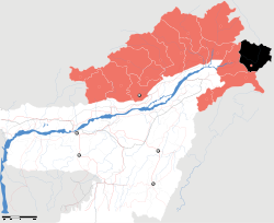 Location of Anjaw district in Arunachal Pradesh | |
| Country | India |
| State | Arunachal Pradesh |
| Headquarters | Hawai, Arunachal Pradesh |
| Government | |
| • Lok Sabha constituencies | Arunachal East |
| • Vidhan Sabha constituencies | Hayuliang |
| Area | |
| • Total | 6,190 km2 (2,390 sq mi) |
| Population (2011) | |
| • Total | 21,089 |
| • Density | 3.4/km2 (8.8/sq mi) |
| Demographics | |
| • Literacy | 59.4% |
| • Sex ratio | 805 |
| Time zone | UTC+05:30 (IST) |
| Website | anjaw |
Anjaw is the second least populous district in India (out of 640).
Geography
Rivers
The main rivers are the following:[2]
- Lohit River (called Telu by local Mishmis)
- Lam River
- Tidding River
- Dalai River
- Krowti River
- Dichu River
- Lati River
- Klung River
- Dav River
- Telua River
- Ampani River
- Sarti River
Transport
The 2,000-kilometre-long (1,200 mi) proposed Mago-Thingbu to Vijaynagar Arunachal Pradesh Frontier Highway along the McMahon Line,[4][5][6][7] (will intersect with the proposed East-West Industrial Corridor Highway) and will pass through this district, alignment map of which can be seen here and here.[8]
Economy
Divisions
There is one Arunachal Pradesh Legislative Assembly constituency located in this district: Hayuliang. It is part of the Arunachal East Lok Sabha constituency.[10]
The district has seven administrative units:
Demographics
According to the 2011 census Anjaw district has a population of 21,089, roughly equal to the nation of Palau.[11] This gives it a ranking of 639th in India (out of a total of 640). The district has a population density of 3 inhabitants per square kilometre (7.8/sq mi). Its population growth rate over the decade 2001–2011 was 13.77%. Anjaw has a sex ratio of 805 females for every 1000 males, and a literacy rate of 59.4%.
Tribes
The Mishmi, and the Zakhring[12] (formerly called Meyor) are the main tribes in the district.
Tribal population is 16,451 (77.72%) as per the 2011 census, with the largest tribes being Idu/Taraon Mishmi (9,991), Kaman/Miju Mishmi (5,021), Degaru Mishmi (472), and Meyor (472).
Languages
According to the 2011 Census: Mishmi (72.61%), Hindi (7.06%), Gorkhali (5.29%), Tibetan (2.29%), Bengali (2.13%), Punjabi (1.55%), Dogri (1.17%), Adi (0.90%), and Mizo (0.88%).[13]
Religion
As per the 2011 Census: Hindu - 61.83%, Native faith - 28.99%, Muslim - 3.09%, Buddhist - 3.04%.
Among the tribals, major religions are Hinduism (57.67%), Native faith (37.07%), Buddhism (3.15%), and Islam (0.99%).
Among the non-tribals, the composition is Hinduism (76.36%), Islam (10.43%), Sikh (5.66%), Christian (3.54%), and Buddhism (2.65%).[14]
Flora and fauna
The district is rich in wildlife. Rare mammals such as Mishmi takin, Red goral, Gongshan muntjac, Leaf muntjac occurs while among birds there is the rare Sclater's Monal. A pine, Pinus merkusii is found only in this district in the entire northeastern India.[15] A flying squirrel, new to science has also its range in this district. It has been named as Mishmi Hills Giant Flying Squirrel, Petaurista mishmiensis.[16]
References
- Law, Gwillim (25 September 2011). "Districts of India". Statoids. Retrieved 11 October 2011.
- "Anjaw District". Archived from the original on 14 November 2006. Retrieved 27 October 2006.
- Gokhale, Nitin A. (20 August 2001). "Dong". Outlook India. Retrieved 16 December 2012.CS1 maint: ref=harv (link)
- "Top officials to meet to expedite road building along China border". Dipak Kumar Dash. timesofindia.indiatimes.com. Retrieved 27 October 2014.
- "Narendra Modi government to provide funds for restoration of damaged highways". dnaindia.com. Retrieved 27 October 2014.
- "Indian Government Plans Highway Along Disputed China Border". Ankit Panda. thediplomat.com. Retrieved 27 October 2014.
- "Govt planning road along McMohan line in Arunachal Pradesh: Kiren Rijiju". Live Mint. Retrieved 26 October 2014.
- "China warns India against paving road in Arunachal". Ajay Banerjee. tribuneindia.com. Retrieved 26 October 2014.
- "Anjaw". indiangos.com. Archived from the original on 12 March 2007. Retrieved 2006-10-27.
- "Assembly Constituencies allocation w.r.t District and Parliamentary Constituencies". Chief Electoral Officer, Arunachal Pradesh website. Archived from the original on 13 August 2011. Retrieved 21 March 2011.
- US Directorate of Intelligence. "Country Comparison:Population". Retrieved 1 October 2011.
Palau 20,956 July 2011 est.
- "Zakhring". Ethnologue.com. Archived from the original on 11 November 2006. Retrieved 27 October 2006.
- http://censusindia.gov.in/2011census/C-16.html Table C-16
- http://censusindia.gov.in/2011census/C-series/C-14.html
- Choudhury, Anwaruddin (2008) Survey of mammals and birds in Dihang-Dibang biosphere reserve, Arunachal Pradesh. Final report to Ministry of Environment & Forests, Government of India. The Rhino Foundation for nature in NE India, Guwahati, India. 70pp.
- Choudhury,Anwaruddin (2009). One more new flying squirrel of the genus Petaurista Link, 1795 from Arunachal Pradesh in north-east India. The Newsletter and Journal of the RhinoFoundation for nat. in NE India 8: 26–34, plates.
External links
| Wikimedia Commons has media related to Anjaw district. |
Places adjacent to Anjaw district | ||||||||||
|---|---|---|---|---|---|---|---|---|---|---|
| ||||||||||
| Topics |
|
|---|---|
| Administration |
|
| Divisions |
|
| Districts | |
| Major Towns |
|
| Historical Places | |
Portal: India | |