Tezu
Tezu is a census town and the headquarters of Lohit district in the Indian state of Arunachal Pradesh. It is the fourth largest town in Arunachal Pradesh and one of its most developed. The major Mishmi God is Ringyajabmalu and the major Mishmi festival is known as Tamladu puja.{{Citation needed|date=January 2010} } It is celebrated each year on 15 February. People from all communities and all walks of life are invited to join in the celebrations. The Holy Parshuram Kund is also nearby and thousands of Hindu pilgrims from all over India, and also from neighbouring countries, come to take a holy dip and wash away the sins of millions of births. This is accompanied with a fair at Tezu and takes place every year during the month of January. The major agricultural products are mustard, ginger and oranges.
Tezu | |
|---|---|
Town | |
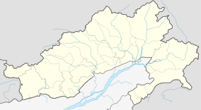 Tezu Location in Arunachal Pradesh, India  Tezu Tezu (India) | |
| Coordinates: 27.92°N 96.17°E | |
| Country | |
| State | Arunachal Pradesh |
| District | Lohit |
| Established | 1946 |
| Government | |
| • Type | Democratic |
| • Body | Independent politician, as per 2019 elections |
| Area rank | 5th after Aalo, Pasighat, naharlagun, Itanagar |
| Elevation | 185 m (607 ft) |
| Population (2011) | |
| • Total | 18,184 |
| • Rank | 5th |
| • Density | 17/km2 (40/sq mi) |
| Time zone | UTC+5:30 (IST) |
| ISO 3166 code | IN-AR |
| Vehicle registration | AR-11 |
Tezu is one of the 60 constituencies of Legislative Assembly of Arunachal Pradesh. The current MLA (May 2019) of Tezu constituency is Karikho Kri. He is an independent candidate.[1]
Geography
Tezu is located at 27.92°N 96.17°E.[2] It has an average elevation of 185 metres (606 feet). It is situated on the bank of River Lohit.
Local cultural festivals
Tamladu, the main festival of the Digaru and Miju Mishmi community is celebrated with much gaiety at Tezu and all over the Lohit district. Other festivals such as Mopin (Adi festival), Sangken (Khamti & Singhpo tribe), Reh (Idu Mishmi festival), and Losar (Monpa festival) are also celebrated.
Other than this, Durga Puja (Dusshera), Kali Puja, Ganesh Chaturthi, etc. are also celebrated with much gaiety.
Climate
| Climate data for Tezu (1961–1990, extremes 1969–1992) | |||||||||||||
|---|---|---|---|---|---|---|---|---|---|---|---|---|---|
| Month | Jan | Feb | Mar | Apr | May | Jun | Jul | Aug | Sep | Oct | Nov | Dec | Year |
| Record high °C (°F) | 31.8 (89.2) |
30.3 (86.5) |
35.5 (95.9) |
36.1 (97.0) |
40.0 (104.0) |
40.0 (104.0) |
38.9 (102.0) |
38.3 (100.9) |
39.7 (103.5) |
40.5 (104.9) |
34.1 (93.4) |
30.1 (86.2) |
40.5 (104.9) |
| Average high °C (°F) | 23.2 (73.8) |
23.6 (74.5) |
26.6 (79.9) |
27.8 (82.0) |
30.5 (86.9) |
31.9 (89.4) |
31.6 (88.9) |
32.9 (91.2) |
32.1 (89.8) |
31.0 (87.8) |
27.9 (82.2) |
24.8 (76.6) |
28.7 (83.7) |
| Daily mean °C (°F) | 14.7 (58.5) |
16.2 (61.2) |
19.6 (67.3) |
21.8 (71.2) |
25.2 (77.4) |
26.8 (80.2) |
26.6 (79.9) |
27.3 (81.1) |
26.4 (79.5) |
25.1 (77.2) |
21.0 (69.8) |
16.4 (61.5) |
22.3 (72.1) |
| Average low °C (°F) | 7.5 (45.5) |
10.4 (50.7) |
13.9 (57.0) |
16.5 (61.7) |
19.5 (67.1) |
22.7 (72.9) |
23.3 (73.9) |
23.5 (74.3) |
22.6 (72.7) |
19.3 (66.7) |
13.3 (55.9) |
8.6 (47.5) |
16.8 (62.2) |
| Record low °C (°F) | 1.1 (34.0) |
1.2 (34.2) |
7.1 (44.8) |
6.9 (44.4) |
9.9 (49.8) |
17.1 (62.8) |
17.1 (62.8) |
19.3 (66.7) |
18.9 (66.0) |
7.5 (45.5) |
3.5 (38.3) |
0.6 (33.1) |
0.6 (33.1) |
| Average rainfall mm (inches) | 46.3 (1.82) |
76.0 (2.99) |
144.3 (5.68) |
326.0 (12.83) |
290.9 (11.45) |
462.9 (18.22) |
710.7 (27.98) |
429.5 (16.91) |
343.9 (13.54) |
181.5 (7.15) |
20.0 (0.79) |
31.3 (1.23) |
3,063.3 (120.60) |
| Average rainy days | 4.3 | 6.8 | 9.6 | 13.7 | 13.7 | 17.4 | 20.1 | 14.5 | 12.5 | 6.8 | 2.1 | 2.5 | 124.0 |
| Average relative humidity (%) | 81 | 80 | 75 | 77 | 78 | 83 | 87 | 84 | 83 | 76 | 73 | 77 | 80 |
| Source: India Meteorological Department[3][4] | |||||||||||||


Transport
The recently constructed airport at Tezu will be the first civilian airport of Arunachal Pradesh. On Sep 22, 2017 the first successful test flight was conducted. Other nearest airports are at Mohanbari (154 km) and Guwahati (Lokpriya Gopinath Bordoloi International Airport). Tezu is linked with the adjacent state Assam by road. Arunachal Pradesh State Transport Services (APSTS) and other privately owned vehicles provide seamless connectivity to Assam. Most of the vehicles provide connectivity to Tinsukia, Assam. The nearest railway station is at Tinsukia (NTSK) which is linked to major parts of country like Guwahati, Delhi, Kolkata, Bangalore, etc. A proposal to connect Tezu through broadgauge line from Murkongselek via Pasighat and extending up to Parshuram Kund was made. A preliminary engineering-traffic survey for this track has been completed.
The newly constructed Lohit Bridge (2.9 KM) over the Lohit River at Alobarighat has also eased the connectivity of Tezu and other nearby towns with Assam. This bridge has helped Tezu in getting directly connected to Guwahati through bus service.
The strategic 2 lane Dr. Bhupen Hazarika Setu or Dhola-Sadiya bridge (9.15 KM) on Brahmaputra, which has reduce travel time between Assam and Arunachal Pradesh by four hours, has been operational since May 26th 2017.It is very crucial for defence purposes and is the longest river bridge in India.
Demographics
As per 2011 Indian census,[5] Tezu had a population of 18,184 of which 9,743 are males while 8,441 are females. Population of children with age 0-6 is 2104 which is 11.57% of total population of Tezu. Tezu has an average literacy rate of 83.98%, higher than the state average of 65.38% and national average of 74.04%. Male literacy rate is around 88.29%, and female literacy rate is 78.94%. The female sex ratio is 866 against state average of 938. Moreover, child sex ratio in Tezu is around 968 compared to the state average of 972.
.jpg)
Hindus consists around 75.57% of the total population while Muslim, Christian and Sikh consists 7.43%, 8.24% and 0.29% respectively. Buddhism is around 5.41% and other religions are 2.91% of the total population.
Tibetan diaspora
Tezu also has a sizeable population of Tibetan community of about 1500 mostly residing in a settlement called by local name as Lama Camp, Tibetans settled here since the 1960s after fleeing Chinese persecution in their homeland Tibet, till date they have maintained their own custom and tradition, they have built monasteries, health centre, nursing homes, schools etc. with funds from the government and other sources. Lama Camp is located in Tindolong about 6 km (4 mi) from Tezu Bazaar and has 5 camps each camp represent different regions of Tibet mainly Kham, Kongpo, Tsari and Pemako.
Media and communications
State-owned All India Radio has a local station in Tezu which transmits various programs of mass interest. Also, the local TV channel - Matai Communication broadcasts local news, shows and programs.

Educational institutions
- Government Higher School, Tezu
- Government Secondary School, Tezu
- Kendriya Vidyalaya, Tezu
- Krick & Boury Memorial School
- Indira Gandhi Government College
- Teacher's Training Institute (B.Ed College)
- Vivekananda kendriya vidyalaya,Tezu
- VKV Tafragam,Tezu
- Arun Jyoti school
- Lohit Valley School
- Government secondary school Telluliang
- VKV School
References
- "Tezu MLA". Archived from the original on 19 August 2016. Retrieved 14 August 2016.
- Falling Rain Genomics, Inc - Tezu
- "Station: Tezu Climatological Table 1961–1990" (PDF). Climatological Normals 1961–1990. India Meteorological Department. July 2010. pp. 801–802. Archived from the original (PDF) on 16 February 2020. Retrieved 17 February 2020.
- "Extremes of Temperature & Rainfall for Indian Stations (Up to 2012)" (PDF). India Meteorological Department. December 2016. p. M22. Archived from the original (PDF) on 5 February 2020. Retrieved 17 February 2020.
- "Census of India 2001: Data from the 2001 Census, including cities, villages and towns (Provisional)". Census Commission of India. Archived from the original on 16 June 2004. Retrieved 1 November 2008.