Bhismaknagar
Bhismaknagar (also known as Kundilnagara) is an archeological site in Indian state of Arunachal Pradesh. It is located near Roing in Lower Dibang Valley district.[1]
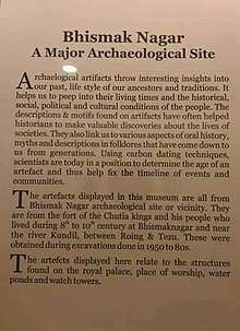 Museum history sign | |
 Location of Bhismaknagar in India 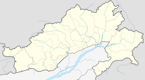 Location of Bhismaknagar in Arunachal Pradesh, India | |
| Alternative name | Kundilnagara, Sadhayapur |
|---|---|
| Location | Lohit district, Arunachal Pradesh, India |
| Coordinates | 28°02′48.2″N 96°0′20.7″E |
| Type | Settlement |
| Length | 4.5 km |
| Width | 2.5 km |
| History | |
| Material | Bricks, Stone, Soil |
| Founded | 8th century |
| Abandoned | 16th century |
Etymology
The name Bhismaknagar was coined by researchers who discovered the ruins in the 1970s. It was probably named as a result of sanskritization of a legendary king of the Chutias named Bhirmukka. As per Buranjis, the founder of the medieval Chutia kingdom Birpal called himself a descendant of king Bhirmukka. The Deodhai Buranji reads,
“Sadiya Korjaku-Desha Chutika-Bansha Bhirmukka
Dhatu Dravya Tu Lebhe Na Hatwa Janpadanaya”— Chutia Vanshawali, Deodhai Buranji
Historically, it was popularly known as Kundil-nagara(being situated on the banks of Kundil river), Sadhayapura(the rulers being Sadhayapur-ishwar) and Che-lung in Tai Buranji(meaning Bar-nagar in Assamese and Great City in English).
Location
It is located in Dibang Valley district. The campus of the old city is spread over an area of 2500 acres.
History
Bhismaknagar is an important ancient archeological site. It was built by a Chutia king during 8th century and late rebuilt by another Chutiya king named Gaurinarayan.[2] Bhismaknagar must have been a strong hold of the Chutias (12th-16th centuries) but the excavations has been throwing new light on its much earlier antiquities, which confirms the presence of an earlier Chutia kingdom(founded by one named Asambhinna) as stated in Assam chronicles(7th century).[3][4] Bhismaknagar has been identified with Sadhayapuri (or Svadhayapuri), the political centre of the Chutiya Kingdom.[5]It was probably repaired by the Chutia king Lakshminarayan as bricks with the name Sri Sri Lakshmi-Narayana were found in the site.[6] Being located along the bank of river Kundil, it was also popularly known as Kundilnagara.
Architecture
Fabricated from the burnt bricks gave this fort an impressive and remarkable top view and thus explores the dexterity of people of ancient era. This fort can still be signified as an astonishing work of art.
The city is spread over an area of 10 square km. It is surrounded by a wall 4.5 meters high and 6 meters wide made using granite stone(6-9 courses)[7] and bricks on the east, west and south directions. In the north, the Mishmi hills provided a natural barrier. Although very less excavation has been carried out by the Arunachal government, preliminary excavations have revealed three tanks and two gates in the eastern and western directions.[8]
The Bhismaknagar central complex extended over an area of 1860 square meters and displays three halls, six ingresses and two extension rooms. There is also a 2 meters high stone wall inside the complex. The architecture of the fort displays the medieval culture. While quarrying the fort the enormous pieces of work of art like potteries, terracotta figurines, terracotta plaques and decorative tiles were preserved.
Gallery
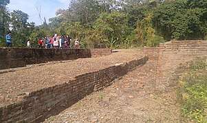 These are the ruins of the Chutia Royal Palace Bhismaknagar.
 Another section of the palace
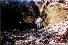 A section of the wall of Bhismaknagar with a height of 4.5 meters.
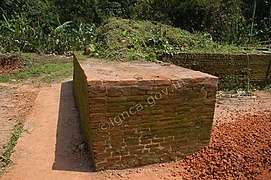 A section of wall in Bhismaknagar
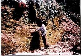 A section of the wall of Bhismaknagar with a height of 4.5 meters.
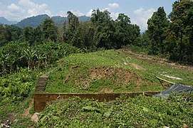 Bhismaknagar wall section
 This shows the three compartments of the royal palace each covering about 5000 sq. feet.
 A separate structure inside the fortified walls.
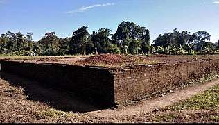 Central structure of Bhismaknagar.
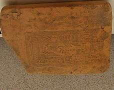 A brick found in Bhismaknagar Fort with the Chutia king Lakshminarayan's name inscribed in it.
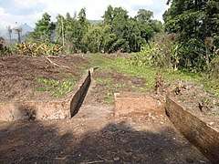 A section of a foundation of a building inside the complex
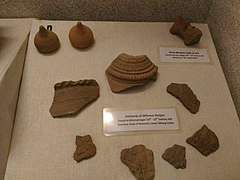 Potsherds found in Bhismaknagar.
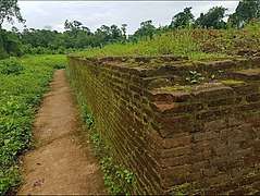 A section of the central building of Bhismaknagar.
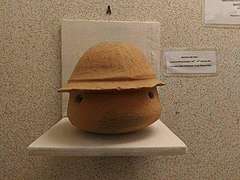 Mud pot with holes.
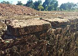 Brick of Bhismaknagar.
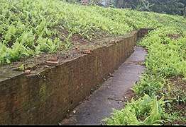 A section of the central building of the complex
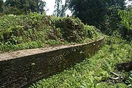 A section of wall in Bhismaknagar
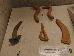 Various artifacts found in Bhismaknagar.
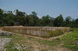 Bhismaknagar complex
References
- "Bhismaknagar". Government of Arunachal Pradesh. Archived from the original on 11 June 2017.
- "Bhismaknagar Fort". India Mapped. Retrieved 24 January 2019.
- The early medieval Chutia kingdom was founded by Asambhinna in about 640 A.D., p. 65-67
- "Bhismaknagar". Government of Arunachal Pradesh. Archived from the original on 11 June 2017. Retrieved 20 July 2017.
- Momin, Mignonette; Mawlong, Cecile A.; Qādrī, Fuz̤ail Aḥmad (2004). Society and Economy in North-East India. Regency Publications. p. 47. ISBN 9788189233402.
- Neog, Maheswar, A Ruling dynasty of Arunachal: Annals of the Bhandarkar Oriental Research Institute Vol. 58/59, Diamond Jubilee Volume (1977-1978), p.817
- Gait, Edward. A history of Assam(2nd Edition). 1962, p. 16.
- Raikar, Yashawant. Archeology in Arunachal Pradesh. 1980, p. 19.