Area of Outstanding Natural Beauty
An Area of Outstanding Natural Beauty (AONB) is an area of countryside in England, Wales or Northern Ireland which has been designated for conservation due to its significant landscape value. Areas are designated in recognition of their national importance, by the relevant public body: Natural England, Natural Resources Wales, or the Northern Ireland Environment Agency. In place of AONB, Scotland uses the similar national scenic area (NSA) designation. Areas of Outstanding Natural Beauty enjoy levels of protection from development similar to those of UK national parks, but unlike with national parks the responsible bodies do not have their own planning powers. They also differ from national parks in their more limited opportunities for extensive outdoor recreation.[1]

History
The idea for what would eventually become the AONB designation was first put forward by John Dower in his 1945 Report to the Government on National Parks in England and Wales. Dower suggested there was need for protection of certain naturally beautiful landscapes which were unsuitable as national parks owing to their small size and lack of wildness. Dower's recommendation for the designation of these "other amenity areas" was eventually embodied in the National Parks and Access to the Countryside Act 1949 as the AONB designation.[2]
Purpose
The purpose of an AONB designation is to conserve and enhance the natural beauty of the designated landscape.[3]
There are two secondary aims: meeting the need for quiet enjoyment of the countryside and having regard for the interests of those who live and work there. To achieve these aims, AONBs rely on planning controls and practical countryside management. As they have the same landscape quality, AONBs may be compared to the national parks of England and Wales. National parks are well known to many inhabitants of the UK; by contrast, there is evidence to indicate many residents in AONBs may be unaware of the status. However, the National Association of AONBs is working to increase awareness of AONBs in local communities,[4] and in 2014 successfully negotiated to have the boundaries of AONBs in England shown on Google Maps.[5]
Statistical overview

There are 46 AONBs in Britain (33 wholly in England, four wholly in Wales, one that straddles the Anglo-Welsh border and eight in Northern Ireland). The first AONB was designated in 1956 in the Gower Peninsula, South Wales. The most recently confirmed is the Tamar Valley AONB in 1995,[6] although the existing Clwydian Range AONB was extended in 2012 to form the Clwydian Range and Dee Valley AONB, and the Strangford Lough and Lecale Coast AONBs were merged and redesignated as a single AONB in 2010.[7]
AONBs vary greatly in terms of size, type and use of land, and whether they are partly or wholly open to the public. The smallest AONB is the Isles of Scilly (1976), 16 km2 (6.2 sq mi), and the largest is the Cotswolds[8] (1966, extended 1990[9]), 2,038 km2 (787 sq mi). The AONBs of England and Wales together cover around 18% of the countryside in the two countries. The AONBs of Northern Ireland together cover about 70% of Northern Ireland's coastline.[2]
Legal status and organization
AONBs in England and Wales were originally created under the same legislation as the national parks, the National Parks and Access to the Countryside Act 1949. Unlike AONBs, national parks have special legal powers to prevent unsympathetic development. AONBs in general remain the responsibility of their local authorities by means of special committees which include members appointed by the minister and by parishes, and only very limited statutory duties were imposed on local authorities within an AONB by the original 1949 Act. However, further regulation and protection of AONBs in England and Wales was added by the Countryside and Rights of Way (CRoW) Act 2000, under which new designations are now made,[10][11] and the government has recently in the National Planning Policy Framework (March 2012) stated that AONBs and national parks have equal status when it comes to planning decisions on landscape issues. Two of the AONBs (the Cotswolds and the Chilterns), which extend into a large number of local authority areas, have their own statutory bodies, known as conservation boards.
All English and Welsh AONBs have a dedicated AONB officer and other staff. As required by the CRoW Act, each AONB has a management plan that sets out the characteristics and special qualities of the landscape and how they will be conserved and enhanced. The AONBs are collectively represented by the National Association for Areas of Outstanding Natural Beauty (NAAONB), an independent registered charity acting on behalf of AONBs and their partners, which uses the slogan Landscapes for Life.[12]
AONBs in Northern Ireland was designated originally under the Amenity Lands (NI) Act 1965; subsequently under the Nature Conservation and Amenity Lands (NI) Order 1985.[13]
Threats
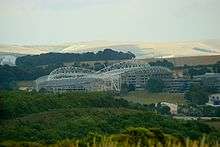
There are growing concerns among environmental and countryside groups that AONB status is increasingly under threat from development. The Campaign to Protect Rural England said in July 2006 that many AONBs were under greater threat than ever before.[14] Three particular sites were cited: the Dorset AONB threatened by a road plan, the threat of a football stadium in the Sussex Downs AONB, and, larger than any other, a £1 billion plan by Imperial College London to build thousands of houses and offices on hundreds of acres of AONB land on the Kent Downs at Wye.[15] In September 2007 government approval was finally given for the development of a new football ground for Brighton and Hove Albion within the boundaries of the Sussex Downs AONB, after a fierce fight by conservationists. The subsequent development, known as Falmer Stadium, was officially opened in July 2011. The Weymouth Relief Road in Dorset was constructed between 2008 and 2011, after environmental groups lost a High Court challenge to prevent its construction.[16]
Writing in 2006, Professor Adrian Phillips listed threats facing AONBs. He wrote that the apparent big threats were uncertainty over future support for land management, increasing development pressures, the impacts of globalization, and climate change. More subtle threats include creeping sub-urbanization and "horsiculture".[2]
Celebration
Poet Laureate Simon Armitage wrote a poem "Fugitives", commissioned by the National Association of AONBs, which he read on Arnside Knott on 21 September 2019 to launch the celebration of the 70th anniversary of the National Parks and Access to the Countryside Act.[17][18][19]
List of Areas of Outstanding Natural Beauty
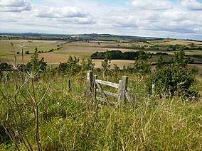
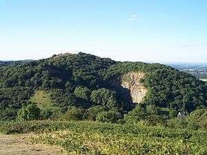
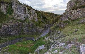
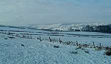
England
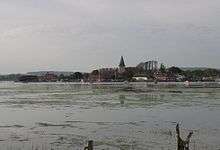
_edit.jpg)


Former Areas
The establishment of the New Forest National Park in 2005 meant the subsumption of South Hampshire Coast AONB into it. East Hampshire and Sussex Downs AONBs were replaced in 2010 by the South Downs National Park.
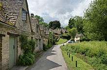
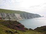
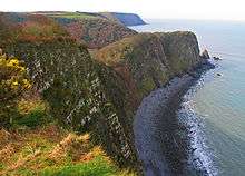
Wales
| AONB | Photo | Established | Area | Local authorities |
|---|---|---|---|---|
| Anglesey |  | 1967 | 221 km2 (85 sq mi) | Anglesey |
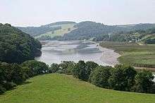
| Clwydian Range and Dee Valley | 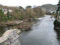 | 1985 | 389 km2 (150 sq mi) | Denbighshire, Flintshire, Wrexham |
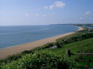
| Gower | .jpg) | 1956 | 188 km2 (73 sq mi) | Swansea |
| Llŷn | 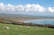 | 1956 | 155 km2 (60 sq mi) | Gwynedd |
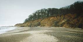
| Wye Valley (partly in England) | 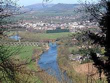 | 1971 | 326 km2 (126 sq mi) | Gloucestershire, Herefordshire, Monmouthshire |
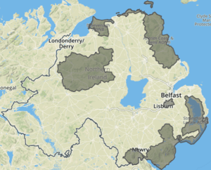
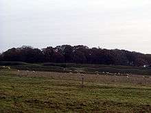
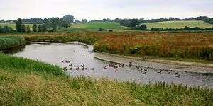
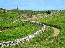
Northern Ireland
| AONB | Photo | Established | Area | Local authorities |
|---|---|---|---|---|
| Antrim Coast and Glens |  | 1989 | 724 km2 (280 sq mi) | Causeway Coast and Glens, Mid and East Antrim |
| Binevenagh | 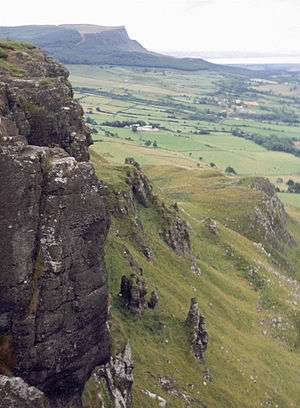 | 1966[lower-alpha 1] | 138 km2 (53 sq mi) | Causeway Coast and Glens |
| Causeway Coast | .JPG) | 1989 | 42 km2 (16 sq mi) | Causeway Coast and Glens |
| Lagan Valley |  | 1965 | 39 km2 (15 sq mi) | Belfast, Lisburn and Castlereagh |
| Mourne Mountains | 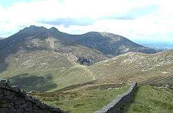 | 1986 | 570 km2 (220 sq mi) | Armagh City, Banbridge and Craigavon, Newry, Mourne and Down |
| Ring of Gullion | 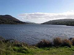 | 1966[lower-alpha 2] | 154 km2 (59 sq mi) | Newry, Mourne and Down |
| Sperrins |  | 1968 | 1,181 km2 (456 sq mi) | Causeway Coast and Glens, Derry and Strabane, Fermanagh and Omagh, Mid Ulster |
| Strangford and Lecale[7] |  | 1967[lower-alpha 3] | 525 km2 (203 sq mi) | Ards and North Down, Newry, Mourne and Down |
Notes
- as North Derry AONB, extended and redesignated as Binevenagh AONB in 2006
- redesignated as Ring of Gullion in 1991
- Lecale Coast AONB. Strangford Lough AONB designated 1972. Redesignated as a single AONB in 2010.
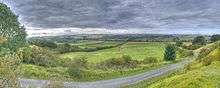
Proposed Areas
The following are formal proposals for new AONBs submitted to Natural England[20]:
- Cambs Ouse Valley
- Churnet Valley
- Forest of Dean
- Herefordshire Marches
- Northants Ironstone Uplands
- Yorkshire Wolds
The 2019 Landscape Review Report additionally favourably mentions proposals not listed in Natural England's list: from Sandstone Ridge and the Vale of Belvoir.[21]
See also
- Conservation in the United Kingdom
- European Landscape Convention
- Landscape-scale conservation
- National parks of England and Wales
- National parks of Northern Ireland
References
- "Areas of outstanding natural beauty (AONBs): designation and management - GOV.UK". www.naturalengland.org.uk. Retrieved 16 February 2018.
- "NAAONB". Archived from the original on 29 August 2017. Retrieved 16 February 2018.
- "Areas of outstanding natural beauty (AONBs): designation and management". gov.uk.
- "NAAONB". Archived from the original on 13 September 2014. Retrieved 16 February 2018.
- "Suffolk Coast & Heaths AONB" (PDF). Archived from the original (PDF) on 28 September 2018. Retrieved 16 February 2018.
- "Tamar Valley - What is the Tamar Valley AONB?". www.tamarvalley.org.uk. Retrieved 16 February 2018.
- "Northern Ireland Environment Agency". Retrieved 16 February 2018.
- Cotswolds AONB Archived 14 September 2014 at the Wayback Machine
- "Cotswolds AONB" (PDF). Retrieved 16 February 2018.
- Staffordshire Moorlands District Council Archived 11 September 2014 at the Wayback Machine
- "High Weald AONB". Archived from the original on 28 September 2018. Retrieved 16 February 2018.
- "Landscapes for Life". Association for AONBs. Retrieved 27 September 2019.
- Northern Ireland Environment Agency Archived 2 September 2014 at the Wayback Machine
- "CPRE : News releases : Outstandingly beautiful, still seriously threatened". 26 September 2006. Archived from the original on 26 September 2006. Retrieved 16 February 2018.
- "save-wye.org". save-wye.org. Archived from the original on 7 May 2009. Retrieved 30 June 2013.
- "Relief road opens after 60 years". 17 March 2011. Retrieved 16 February 2018 – via www.bbc.co.uk.
- "Celebrating our special landscapes". Arnside and Silverdale Area of Outstanding Natural Beauty. 23 September 2019. Retrieved 27 September 2019.
- "Poem commissioned to celebrate national parks". Ecologist. 25 September 2019. Retrieved 27 September 2019.
- Armitage, Simon. "Fugitives" (PDF). Retrieved 27 September 2019.
- Glover, Julian (September 2019). "Landscape Review - Final Report" (PDF). DEFRA. p. 153. Retrieved 23 January 2020.
- Glover, Julian (September 2019). "Landscape Review - Final Report" (PDF). DEFRA. p. 121. Retrieved 23 January 2020.
External links
- National Association of AONBs website
- Charity Commission. Area of Outstanding Natural Beauty, registered charity no. 1158871.
- "Guidance: Areas of outstanding natural beauty (AONBs): designation and management". gov.uk. Natural England.
| East of England | | |
|---|---|---|
| East Midlands | ||
| North East | ||
| North West | ||
| South East |
| |
| South West |
| |
| West Midlands | ||
| Yorkshire and Humber | ||
| ||
| ||
Areas marked † are proposed | ||