Borough of Swale
Swale is a local government district with borough status in Kent, England and is bounded by Medway to the west, Canterbury to the east, Ashford to the south and Maidstone to the south west. Its council is based in Sittingbourne. The district is named after the narrow channel called The Swale, that separates the mainland of Kent from the Isle of Sheppey, and which occupies the central part of the district.
Borough of Swale | |
|---|---|
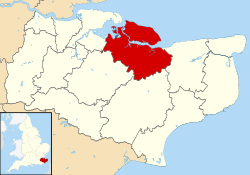 Swale shown within Kent | |
| Sovereign state | United Kingdom |
| Constituent country | England |
| Region | South East England |
| Non-metropolitan county | Kent |
| Status | Non-metropolitan district |
| Admin HQ | Sittingbourne |
| Incorporated | 1 April 1974 |
| Government | |
| • Type | Non-metropolitan district council |
| • Body | Swale Borough Council |
| • Leadership | Leader & Cabinet (Conservative) |
| • MPs | Helen Whately (C) Gordon Henderson (C) |
| Area | |
| • Total | 144.2 sq mi (373.4 km2) |
| Area rank | 106th (of 317) |
| Population (mid-2019 est.) | |
| • Total | 150,082 |
| • Rank | 140th (of 317) |
| • Density | 1,000/sq mi (400/km2) |
| • Ethnicity[1] | 96.1% White 1.3% S.Asian 1.1% Black 1.0% Mixed Race |
| Time zone | UTC0 (GMT) |
| • Summer (DST) | UTC+1 (BST) |
| ONS code | 29UM (ONS) E07000113 (GSS) |
| OS grid reference | TQ9018863720 |
| Website | www |
The district was formed in 1974 under the Local Government Act 1972, from the Borough of Faversham; the Borough of Queenborough-in-Sheppey, which covered the whole of Sheppey; the Sittingbourne and Milton Urban District; and Swale Rural District.
Most of the southern half of the Borough lies within the Kent Downs Area of Outstanding Natural Beauty, whilst Sittingbourne and the Isle of Sheppey forms the concluding part of the Thames Gateway growth area.[2]
There are four towns in the borough: Sittingbourne and Faversham on the mainland, and Sheerness and Queenborough on Sheppey.
Economy
Swale is a mainly rural borough, containing a high proportion of the UK's apple, pear, cherry and plum orchards (the North Kent Fruit Belt), as well as many of its remaining hop gardens.
Sheerness is a busy port and previously produced steel. Sittingbourne has a variety of smaller industrial sites.
Transport
The Roman Watling Street passed through the area, as witness the straightness of the A2 main road, now by-passed by the M2 motorway.
There are two railway lines in Swale: the Chatham Main Line and the Sheerness Line, which meet at Sittingbourne.
Governance
Parishes
The district contains the following civil parishes:
- Bapchild
- Bobbing
- Borden
- Boughton-under-Blean
- Bredgar
- Conyer
- Danaway
- Doddington
- Dunkirk
- Eastchurch
- Eastling
- Faversham
- Goodnestone
- Graveney
- Hartlip
- Hernhill
- Iwade
- Leysdown
- Lower Halstow
- Lynsted
- Kemsley
- Milstead
- Milton Regis
- Minster-on-Sea
- Murston
- Newington
- Newnham
- Norton, Buckland and Stone
- Oare
- Ospringe
- Rodmersham
- Rushenden
- Selling
- Sheldwich, Badlesmere and Leaveland
- Stalisfield
- Teynham
- Throwley
- Tonge
- Tunstall
- Upchurch
- Warden
References
- Office for National Statistics: Neighbourhood Statistics: Swale
- "Swale". Protecting Kent's Countryside. CPRE Kent. Retrieved 14 August 2015.
External links
| Wikimedia Commons has media related to Swale. |
