A465 road
The A465, the Neath to Abergavenny Trunk Road,[1] is in Wales. The section westwards from Abergavenny is more commonly known as the Heads of the Valleys Road because it links the northern heads of the South Wales Valleys. Approximately following the southern boundary of the Brecon Beacons National Park, the Ordnance Survey Pathfinder guide describes it as the unofficial border between rural and industrial South Wales.[2] The A465 provides an alternative route between England and the counties in South West Wales and to the ferries to Ireland.[3]
| |
|---|---|
.jpg) | |
| Route information | |
| Maintained by English local authorities and South Wales Trunk Road Agency | |
| Length | 66 mi (106 km) |
| Major junctions | |
| West end | Llandarcy 51.6492°N 3.8486°W |
| East end | Bromyard, Herefordshire 52.1870°N 2.5139°W |
| Location | |
| Primary destinations | Neath Merthyr Tydfil Abergavenny Hereford |
| Road network | |

Route
The A465 runs southwest from Bromyard towards the River Lugg, from where it runs concurrently with the A4103 for a short distance before entering Hereford. After a short distance on the A49, it crosses the River Wye, the River Monnow and the border into Wales. The A465 meets the A40 trunk road in Abergavenny and continues west through the heads of the valleys region past Brynmawr, Ebbw Vale, Tredegar, Rhymney, Merthyr Tydfil, Hirwaun, Glynneath and Aberdulais.

Even before the construction of the Heads of the Valleys road began in the 1960s, there were concerns and complaints regarding the capacity and safety of a single carriageway, three-lane design. The Abergavenny–Neath trunk road opened in 1964.[4]
Until 1996, the A465 ran for most of its length between Glynneath and Aberdulais along a narrow single carriageway road, now redesignated as the B4242. The high collision rate on this stretch was the main factor in leading to the construction of the dual carriageway between these points. The section of the A465 from Hirwaun to Llandarcy is all dual carriageway.[5][6]
The highest point (signposted) of 1,350 feet (410 m) is on the Ebbw Vale section which is now dual carriageway and slip roads between Dowlais Top and Tredegar via Rhymney. At Dowlais Top there are link roads such as the A4060, which runs down to the south end of Merthyr Tydfil and links with the A470, and the A4054 which goes through Merthyr Vale and Aberfan. Another link is the A4102 which leads into Dowlais and Merthyr Tydfil town centre. The A465 passes Prince Charles Hospital in Merthyr Tydfil and then continues to Cefn-coed-y-cymmer and the A470 link. It then continues down the floor of the Vale of Neath, bypassing Resolven, Neath and Skewen, before terminating at junction 43 of the M4 at Llandarcy.
Major upgrade
In 1990, a regional traffic study identified the need for improvements to the A465. In 1994, alternatives were presented for public consultation for the improvement of the 25-mile length between Abergavenny and Hirwaun, connecting the existing A465 dual carriageway link from Swansea to the A40, which is an important part of the route to the M50. In July 1995 the then Secretary of State for Wales announced the preferred route. This mainly consisted of widening the existing road to provide a dual carriageway standard with grade-separated junctions (and extra climbing lanes on certain hills) between Abergavenny and Hirwaun. The design was developed and a draft line order was published in 1997. This was tested at public local inquiry in 1998 after which the Secretary of State for Wales announced the decision to proceed with the scheme in 1999.
Much of the land on the route is undulating, but despite this, the preferred route alignment is considered to be of high standard and as such allows most of the route to have the national speed limit.[7]
Initially, the upgrade was split into seven sections. Later, sections 6 and 7 were combined into a single scheme for the purposes of construction.
| Section | From / To | Commencement date | Completion date | Status |
|---|---|---|---|---|
| 1 | Abergavenny to Gilwern | February 2005 | May 2008 | Complete |
| 2 | Gilwern to Brynmawr | December 2014[8] | Due by '2019/2020'[9] | Under construction |
| 3 | Brynmawr to Tredegar | January 2013 | September 2015 | Complete |
| 4 | Tredegar to Dowlais Top | March 2002 | November 2004 | Complete |
| 5 | Dowlais Top to A470 | Early 2020[10] | Due by end 2023[10] | Planned |
| 6 | A470 Junction to Hirwaun | Early 2020[10] | Due by end 2023[10] | Planned |
The section between Llandarcy and Hirwaun is already dual carriageway. Construction works began on section 4 (Tredegar to Dowlais Top) in early spring 2002, and were completed by November 2004. Construction of section 1 (Abergavenny to Gilwern) began in February 2005. This section is a largely on-line upgrade of the existing single-carriageway road. This section was completed on 22 May 2008.
The contract for Section 3 – Brynmawr to Tredegar was awarded to Carillion in March 2010 with planning commencing soon after, it was announced in August 2012 that approval for the scheme to commence had been given and that construction should commence by the end of 2012 with completion due by early 2015.[11]
Planning for Section 2 – Gilwern to Brynmawr started in June 2011 and construction began in January 2015 and was expected to last until 2017.[12]. Construction is continuing in 2020.[13]
The National Transport Plan, published in March 2010, expected Brynmawr to Tredegar to be completed by 2014 and Gilwern to Brynmawr started by the same date. The remaining sections from Dowlais Top to the A470, and from the A470 to Hirwaun were to be completed by 2020.[14] Speaking in the Senedd in August 2010, the First Minister said completion of the A465 upgrade was the ultimate solution to the high number of casualties on the road.[15]
As of December 2019, construction of sections 5 and 6 has not begun and the business case for the project will be reviewed before a final decision is made.[16]
See also
References
- "A465 HEADS OF THE VALLEYS DUALLING SECTION 3: BRYNMAWR TO TREDEGAR" (PDF). Carillion plc. Archived from the original (PDF) on 2 April 2015. Retrieved 2015-03-10.
- OS Pathfinder Guide, Brecon Beacons and Glamorgan. Ordnance Survey 1994.
- Welsh Government - A465 (Heads of the Valleys Road) - Dualling Scheme Archived 16 May 2013 at the Wayback Machine
- http://hansard.millbanksystems.com/written_answers/1960/feb/17/heads-of-the-valleys-road#S5CV0617P0_19600217_CWA_25
- HANSARD 1803–2005 → 1990s → 1992 → June 1992 → 8 June 1992 → Written Answers (Commons) → WALES
- http://eclecs.blogspot.com/2006/07/where-is-resolfen.html Cymdeithas Hanes Resolfen History Society
- http://www.highwaycodeuk.co.uk/changes-and-answers/new-higher-speed-limits-for-lorries-in-england-and-wales
- "Archived copy". Archived from the original on 21 February 2015. Retrieved 2015-02-21.CS1 maint: archived copy as title (link)
- "A465: Gilwern to Brynmawr". Welsh Government. Retrieved 22 December 2019.
- "A465 section 5 and 6 Dowlais Top to Hirwaun". Welsh Government. Retrieved 21 December 2019.
- "Archived copy". Archived from the original on 16 June 2016. Retrieved 6 June 2020.CS1 maint: archived copy as title (link)
- "Archived copy". Archived from the original on 9 January 2013. Retrieved 7 October 2012.CS1 maint: archived copy as title (link)
- https://www.bbc.co.uk/news/uk-wales-51211915
- "National Transport Plan map" (PDF). Welsh Assembly Government. 29 March 2010. Archived from the original (pdf) on 2 April 2010. Retrieved 5 December 2010.
- Williams, Emma (12 August 2010). "Major road is accident blackspot". Merthyr Express. Retrieved 5 December 2010.
- Clark, Rhodri (6 December 2019), "'Climate change' reappraisal puts dualling scheme under pressure", Highways Magazine, archived from the original on 21 December 2019, retrieved 21 December 2019
External links
| Wikimedia Commons has media related to A465 road. |
A roads in Zone 4 of the Great Britain road numbering scheme | ||
|---|---|---|
| ||
| ||
| Managed by the North and Mid Wales Trunk Road Agent |
|  |
|---|---|---|
| Managed by the South Wales Trunk Road Agent |
| |
| Related topics and further information | ||
Transport in Caerphilly County Borough | |||||
|---|---|---|---|---|---|
| Road | 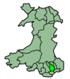 | ||||
| Bus operators | |||||
| Bus stations | |||||
| Railway operators | |||||
| Railway stations |
| ||||
| Cycling |
| ||||
| Walking | |||||
| Waterways | |||||
Transport in Neath Port Talbot county borough | ||
|---|---|---|
| Road |  | |
| Bus |
| |
| Cycling | ||
| Railway lines | ||
| Railway stations | ||
| Sea |
| |
| Canals | ||
Transport in Rhondda Cynon Taf | ||
|---|---|---|
| Roads | 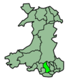 | |
| Bus | ||
| Cycling | ||
| Railway lines | ||
| Railway stations | ||
Transport in Monmouthshire | ||
|---|---|---|
| Road | 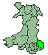 | |
| Bus | ||
| National Cycle Network |
| |
| Railway lines | ||
| Railway stations | ||
| Waterways | ||