Gilwern
Gilwern is a village in Monmouthshire, Wales. It lies beside the River Usk and the Monmouthshire and Brecon Canal and was at one time an important industrial centre.
| Gilwern | |
|---|---|
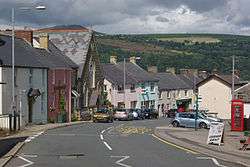 Main road in Gilwern | |
 Gilwern Location within Monmouthshire | |
| Principal area | |
| Ceremonial county | |
| Country | Wales |
| Sovereign state | United Kingdom |
| Police | Gwent |
| Fire | South Wales |
| Ambulance | Welsh |
| UK Parliament | |
Location
Gilwern is a village in Monmouthshire about 3.5 miles (6 km) west of the market town of Abergavenny and just off the main "Heads of the Valleys" A465 road. It is close to the River Usk and the Monmouthshire and Brecon Canal.[1] Gilwern Hill lies to the south of the village. It is partly tree-clad and has a mast on top.[2] The name of the village translates from the Welsh Y Gilwern (from cil-gwern) as "the recess (or bend) of the alders", probably a reference to its position at the point where the Clydach Gorge opens out into the Usk Valley and the River Clydach flows into a sharp bend in the River Usk.[3] The village is within the Llanelly parish ward of Monmouthshire County Council. The church of Llanelly, dedicated to St Elli, is on the hillside above the village, and parts date back to the 12th century.[4]
Industrial history and attractions
Gilwern stands on the edge of the Brecon Beacons National Park. The local area has a history of iron and lime production.[5] The Monmouthshire and Brecon Canal, which has a wharf at Gilwern, was built to transport coal, limestone and iron products from the surrounding area using a network of tramways and railroads. The Clydach Railroad and the Llam-march Tramroad both serviced the wharf with materials gathered and produced further up the Clydach Gorge. Both are still visible, the former being a road and the latter a footpath between Gilwern and Clydach. The canal crosses the River Clydach on the Gilwern Aqueduct, an embankment over 90 feet high, just next to Gilwern Wharf.[4] The Navigation Inn and the Bridgend Inn stand on either side of the canal just beyond the aqueduct.[2]
The Usk Valley Walk passes through Gilwern.
References
- Concise Road Atlas of Britain. AA. 2016. p. 28. ISBN 978-0-7495-7743-8.
- Fisher, Stuart (2013). The Canals of Britain: A Comprehensive Guide. A&C Black. p. 141. ISBN 978-1-4081-0524-5.
- "Guide to Welsh origins of place-names" (PDF). Ordnance Survey. Retrieved 29 April 2016.
- "Gilwern". Abergavenny, Monmouthshire. Retrieved 29 April 2016.
- "Clydach Gorge". Historic Landscape Characterisation. Glamorgan-Gwent Archaeological Trust. Retrieved 29 April 2016.
External links
| Wikimedia Commons has media related to Gilwern. |
| Authority control |
|
|---|