A478 road
The A478 road is in Wales; a major route linking Tenby, Pembrokeshire, just touching the very west of Carmarthenshire,[2] to the junction with the A487 at Cardigan, Ceredigion.
| |
|---|---|
| Route information | |
| Length | 31.8 mi[1] (51.2 km) |
| Major junctions | |
| North end | Cardigan |
| South end | Tenby |
| Location | |
| Primary destinations | Cardigan Tenby |
| Road network | |
The road crosses the Preseli Hills and, for almost all of its route, winds through farmland.[3]
History
A road between Cardigan and Narberth was recorded between 1536 and 1642. The 1555 Highways Act made parishes responsible for the roads that crossed them. Most were unsuitable for wheeled traffic. Turnpike trusts were set up in the late 18th and early 19th centuries to manage road maintenance. At least part of this road came under the Whitland Trust. However, by the mid-19th century, some trusts were badly managed or abused, exacerbating rural poverty and in part leading to the Rebecca riots in the 1840s, some of the earliest of which were on this road, particularly at Cilymaenllwyd (Efailwen). The trusts were reformed in 1844.[4]
The northern two-thirds of the A478 was a drovers' road, used for transporting goods and livestock to and from West Wales and Ireland. In the 18th and 19th centuries, Cardigan was a port, the commercial centre of the region and the most important port in South Wales, exporting slate, oats, barley, and butter.[5] In 1815, it possessed 314 ships totaling 12,554 long tons (12,755 t). This was seven times more than Cardiff and three times more than Swansea. It had a thriving shipbuilding industry, with over 200 vessels being built both in Cardigan and downstream in the village of Llandudoch (St Dogmaels).[6] When Cardigan was connected to the Carmarthen and Cardigan Railway in 1886, the decline of the port was hastened. The river silted up and larger vessels could no longer reach the port, which had largely become inactive by the early part of the 20th century.[7]
The route
Starting from the roundabout with the A487 south of Cardigan, the A478 soon crosses the county boundary into Pembrokeshire at Glanpwllafon, to continue through Pen-y-bryn and Bridell. Then over the River Plysgog and after Rhoshill crosses the B4332 Eglwyswrw-Cenarth road. The road then climbs the northern slopes of the eastern end of the Preseli Hills through Blaenffos village, bridging the River Nevern (near its source) at Riverlea, to Crymych village.
Still at an altitude of over 200 metres (660 ft), the A478 passes through Pentre Galar hamlet, crosses the county boundary to Carmarthenshire and passes a viewpoint near the summit of Carn Wen, where it reaches its highest altitude of 260 metres (850 ft).[8] The scars of extensive quarrying at Carn Wen (also known as Garnwen) are clearly visible from the road; quarrying for aggregate resumed there in 2013. Passing through Glandy Cross and Efailwen (the location of the first of the Rebecca Riots) the A478 crosses the county boundary back into Pembrokeshire, passing through Llandissilio to the railway station at Clunderwen.
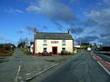
The A478 crosses the A40 trunk road between Llanddewi Velfrey and Penblewin, to the west of St Clears, at the Penblewin roundabout and passes through Narberth town centre where it meets the B4314. After Narberth, the road passes through Camp Hill and Templeton, then crosses the A4115 near Templeton Airfield. After passing the Folly Farm Adventure Park and Zoo and continuing through Begelly (Welsh: Begeli) it crosses the A477 road on a roundabout. The B4316, a left turn, is to Saundersfoot railway station and an alternative way to Saundersfoot. Continuing on the A478 and passing through Pentlepoir, Wooden and Moreton at the roundabout at Twycross it reconnects with the other end of the B4316; the preferred route to Saundersfoot. The A478 continues to New Hedges and soon the coast is reached near Tenby harbour. The A478 ends at the junctions with the A4139 and Tenby High Street.
Traffic
The majority of traffic on the A478 is local, agricultural and, in season, tourist traffic. In 2012, Pembrokeshire County Council said the A478 at New Hedges, near Tenby, carried an average of 9,900 vehicles a day.[9] There were 10 deaths as a result of road accidents on the A478 between 1999 and 2010, compared with the county's total of 80 road deaths for that period.[10]
See also
- British road numbering scheme
References
| Wikimedia Commons has media related to A478 road (Wales). |
- "Driving directions to Norton/A478". Google Maps. Google. Retrieved 27 July 2014.
- http://www.walesdirectory.co.uk/maps/Map_of_Carmarthenshire.htm
- "Roader's Digest: SABRE". Retrieved 1 August 2014.
- "Dyfed Archaeological Trust: Turnpike and pre-turnpike roads" (PDF). p. 9. Retrieved 17 August 2019.
- http://cardigan-maritime.com/through-the-ages/ports-and-trades.html%7Caccessdate=17%5B%5D October 2014
- http://www.dyfedarchaeology.org.uk/HLC/lowerteifivalley/cardigan.htm
- http://www.gtj.org.uk/en/articles/cardigan-port/ Cardigan Port Archived 5 August 2011 at the Wayback Machine at Gathering the Jewels.
- OS Landranger Series: Cardigan & Mynydd Preseli Map 145 (2007)
- "Pembrokeshire County Council Correspondence: 09.11.12". Retrieved 1 May 2014.
- "Every death on every road in Great Britain". BBC News. Retrieved 1 August 2014.
A roads in Zone 4 of the Great Britain road numbering scheme | ||
|---|---|---|
| ||
| ||
Transport in Carmarthenshire | |||||||
|---|---|---|---|---|---|---|---|
| Roads | 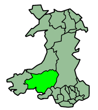 | ||||||
| Bus | |||||||
| Cycling |
| ||||||
| Railway lines | |||||||
| Railway stations |
| ||||||
| Air | |||||||
Transport in Pembrokeshire | ||
|---|---|---|
| Roads | 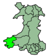 | |
| Cycling |
| |
| Railway lines | ||
| Railway stations | ||
| Air | ||
| Sea | ||