32nd parallel north

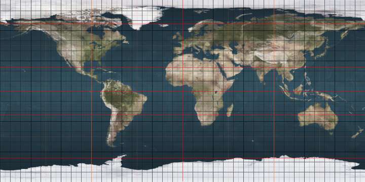
The 32nd parallel north is a circle of latitude that is 32 degrees north of the Earth's equatorial plane. It crosses Africa, Asia, the Pacific Ocean, North America and the Atlantic Ocean.

32°
32nd parallel north
In the United States, the parallel defines part of the border between New Mexico and Texas.
Sign marking the 32nd parallel north at Yusui, Kagoshima Prefecture, Japan.

In the United States, the parallel defines part of the border between New Mexico and Texas. It was the proposed route of the Texas Pacific Railroad.

From 27 August 1992 to 4 September 1996, the parallel defined the limit of the southern no-fly zone in Iraq as part of Operation Southern Watch. This limit was then moved to the 33rd parallel north.[1]

At this latitude the sun is visible for 14 hours, 15 minutes during the summer solstice and 10 hours, 3 minutes during the winter solstice.[2]

Around the world

Starting at the Prime Meridian and heading eastwards, the parallel 32° north passes through:

Co-ordinates Country, territory or sea Notes
32°0′N 0°0′E  Algeria Passing just north of Ouargla
32°0′N 9°8′E  Tunisia
32°0′N 10°47′E  Libya
32°0′N 15°21′E Mediterranean Sea Gulf of Sirte
32°0′N 19°58′E  Libya
32°0′N 24°49′E Mediterranean Sea
32°0′N 34°44′E  Israel Passing through Tel Aviv's Ben Gurion Airport
32°0′N 35°0′E West Bank Controlled by  Israel and  Palestine
32°0′N 35°32′E  Jordan Passing just north of Amman
32°0′N 39°0′E  Saudi Arabia
32°0′N 40°6′E  Iraq Passing through Najaf
32°0′N 47°42′E  Iran
32°0′N 60°50′E  Afghanistan
32°0′N 69°18′E  Pakistan Balochistan - for about 16 km
Khyber Pakhtunkhwa
Punjab
32°0′N 74°50′E  India Punjab
Himachal Pradesh
32°0′N 78°44′E  People's Republic of China Tibet
Qinghai
Tibet (for about 12 km)
Qinghai (for about 6 km)
Tibet (for about 4 km)
Qinghai (for about 4 km)
Tibet
Sichuan
Chongqing
Shaanxi
Hubei
Henan
Anhui
Jiangsu — passing just south of Nanjing
32°0′N 121°45′E East China Sea
32°0′N 130°11′E  Japan Island of Kyūshū:
Kagoshima Prefecture
Miyazaki Prefecture
32°0′N 131°30′E Pacific Ocean
32°0′N 116°51′W  Mexico Baja California
Sonora
32°0′N 113°12′W  United States Arizona
New Mexico
New Mexico / Texas border
Texas — passing through the cities of Midland and Hillsboro
Louisiana
Mississippi
Alabama
Georgia — passing through the city of Savannah
32°0′N 80°50′W Atlantic Ocean Passing just south of  Bermuda
Passing just south of the Desertas Islands, Madeira,  Portugal
32°0′N 9°22′W  Morocco
32°0′N 2°56′W  Algeria

See also

References

  1. "Containment: The Iraqi no-fly zones". BBC News. 29 December 1998. Retrieved 4 February 2012.
  2. "Duration of Daylight/Darkness Table for One Year". aa.usno.navy.mil. Retrieved 11 June 2014.
This article is issued from Wikipedia. The text is licensed under Creative Commons - Attribution - Sharealike. Additional terms may apply for the media files.