Zwolle, Louisiana
| Zwolle, Louisiana | |
|---|---|
| Town | |
| Town of Zwolle | |
 Old Zwolle Train Station on Main Street | |
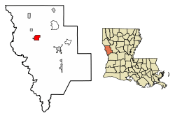 Location of Zwolle in Sabine Parish, Louisiana. | |
 Zwolle, Louisiana Location of Zwolle in Sabine Parish, Louisiana.  Zwolle, Louisiana Zwolle, Louisiana (the US) | |
| Coordinates: 31°38′06″N 93°38′33″W / 31.63500°N 93.64250°W | |
| Country |
|
| State |
|
| Parish | Sabine |
| Government | |
| • Mayor | G.J. "Pie" Martinez |
| Area[1] | |
| • Total | 4.98 sq mi (12.90 km2) |
| • Land | 4.56 sq mi (11.82 km2) |
| • Water | 0.42 sq mi (1.09 km2) |
| Population (2010) | |
| • Total | 1,759 |
| • Estimate (2016)[2] | 1,950 |
| • Density | 427.44/sq mi (165.03/km2) |
| Time zone | UTC-6 (CST) |
| • Summer (DST) | UTC-5 (CDT) |
| Zip Code | 71486 |
| Area Code | 318 |
| FIPS code | 22-83685 |
Zwolle (Za-wall-ee)[3] is a small town in Sabine Parish, Louisiana, United States. The population was 1,759 at the 2010 census, down from 1,783 in 2000.
History
The first inhabitants of the bowl-shaped area of land upon which the town of Zwolle is situated were the Mound Builders. Lured here for protection from storms, the "bowl" offered them protection. Prehistoric people built the dome-shaped mounds that line the banks of Bayou Scie and Bayou San Miguel, which form a hollow circle around the townsite. As Mound Builders, they were ancestors of North American Indians who owned and inhabited the territory when the Europeans arrived.
Later, the area was colonized by Spain, which sent the earliest non-Indians to the territory. Las Cabezas, a Spanish mission church was built at Bayou Scie. Spanish soldiers and Native people intermarried over many generations, and colonial Spanish (not Mexican Spanish) was still spoken in the area until the 1970s.
The first English-speaking settlers arrived in Sabine Parish in 1824, via Natchitoches. These pioneers came chiefly from Mississippi, Alabama, Georgia, and the Carolinas. In 1871, many more of these settlers moved in and acquired land under the homestead act. [4]
Arthur Stilwell built the Kansas City Southern Railroad (KCS) from Kansas City to Port Arthur, Texas. He had reached Van Buren, Arkansas in 1893 when he ran out of funds. Stilwell went to Zwolle, the Netherlands and met with a rich coffee merchant Jan De Goeijen. About 1896, Stilwell and De Goeijen were plotting a route to extend the KCS railway to the Gulf of Mexico. While visiting the area destined to become Zwolle, De Goeijen was impressed with St. Joseph Catholic Church. St. Joseph Catholic Church, established 1881, was a product of the early Spanish missions. De Goeijen sold a $3,000,000 stock issue for Stilwell's railroad and he was permitted to name the place after his hometown and birthplace of Zwolle, a riverside city of currently over 120,000 population in the Netherlands.[5]
On 7/14/1896, Teofilo “T.” Laroux, a community leader and descendant of the early families donated 20 acres to the KCS for a railroad depot and town to be built. Paul M. Potts, a prominent cotton farmer donated an additional 22.05 acres on 10/15/1896. The Zwolle townsite was developed by the Arkansas Townsite Company and the official town charter was granted June 12, 1898. The original depot at the Zwolle Station opened October 26, 1896 and served until the present depot was reconstructed in about 1914 by the KCS.
The advent of the railroad brought new prosperity to the town and altered its destiny. Zwolle’s strategic location made it possible for the small town to flourish as a transportation center for lumber, oil and cotton production. Though no longer a functioning railroad depot, it remains significant to the history and posterity of the town. On 12/23/1970, the Depot was gifted to the Town of Zwolle by the KCS. The depot was placed on the National Register of Historic Places by the United States Department of the Interior on 8/7/1989. In 2000, James Q. Salter made the depot his office while writing the town history book, “Zwolle, Louisiana: Our Story”.
Geography
Zwolle is located at 31°38′6″N 93°38′33″W / 31.63500°N 93.64250°W (31.635134, -93.642560).[6] According to the United States Census Bureau, the town has a total area of 3.7 square miles (9.5 km²), of which 3.2 square miles (8.4 km²) is land and 0.4 square mile (1.1 km²) (11.99%) is water.
Demographics
| Historical population | |||
|---|---|---|---|
| Census | Pop. | %± | |
| 1900 | 276 | — | |
| 1910 | 973 | 252.5% | |
| 1920 | 909 | −6.6% | |
| 1930 | 1,264 | 39.1% | |
| 1940 | 1,500 | 18.7% | |
| 1950 | 1,555 | 3.7% | |
| 1960 | 1,326 | −14.7% | |
| 1970 | 2,169 | 63.6% | |
| 1980 | 2,602 | 20.0% | |
| 1990 | 1,779 | −31.6% | |
| 2000 | 1,783 | 0.2% | |
| 2010 | 1,759 | −1.3% | |
| Est. 2016 | 1,950 | [2] | 10.9% |
| U.S. Decennial Census[7] | |||
As of the 2010 United States Census, there were 1,759 people residing in the town. The racial makeup of the town was 48.7% Black, 28.1% White, 14.1% Native American, 0.1% Asian and 3.5% from two or more races. 5.5% were Hispanic or Latino of any race.
As of the census[8] of 2000, there were 1,783 people, 630 households, and 437 families residing in the town. The population density was 552.6 people per square mile (213.1/km²). There were 725 housing units at an average density of 224.7 per square mile (86.7/km²). The racial makeup of the town was 6.37% White, 47.17% African American, 16.38% Native American, 1.07% from other races, and 2.02% from two or more races. Hispanic or Latino of any race were 33.17% of the population.
There were 630 households out of which 39.4% had children under the age of 18 living with them, 36.8% were married couples living together, 27.9% had a female householder with no husband present, and 30.5% were non-families. 27.5% of all households were made up of individuals and 12.9% had someone living alone who was 65 years of age or older. The average household size was 2.73 and the average family size was 3.36.
In the town, the population was spread out with 35.5% under the age of 18, 9.0% from 18 to 24, 23.8% from 25 to 44, 17.0% from 45 to 64, and 14.6% who were 65 years of age or older. The median age was 30 years. For every 100 females, there were 82.3 males. For every 100 females age 18 and over, there were 75.3 males.
The median income for a household in the town was $15,843, and the median income for a family was $17,326. Males had a median income of $25,625 versus $14,922 for females. The per capita income for the town was $9,042. About 37.7% of families and 40.5% of the population were below the poverty line, including 52.8% of those under age 18 and 35.9% of those age 65 or over.
Education
Zwolle High School, Intermediate, and Zwolle Elementary School are combined into one building. The school has 1,500 students.
Culture
Zwolle Tamale Fiesta
The Zwolle Tamale Fiesta is the town's signature festival. Originating in the late 1970s, the fiesta celebrates the Native American and Spanish heritage rooted in the town's origins. The fiesta takes its name from the tamale and alludes to the town's local notoriety for what is arguably a spicier version of the Mississippi Delta-style boiled tamale, which is believed to have been made in the area since the early 1700s.[9]
The festival was traditionally held on the campus of Zwolle High School on the 2nd weekend of October, kicking off on Thursday night and concluding on Sunday. The practice continued until the early 2000s when the town completed a festival grounds area. The Fiesta relocated to the grounds and scaled back to conclude on Saturday night. Attractions include cultural exhibitions, a parade, a ball, a small-scale carnival and most recently, a mud bog competition.
Loggers and Forestry Festival
Founded in 1995, the Loggers and Forestry Festival pays tribute to workers in the community's horticulture industry - the cornerstone of the local economy. Each year, while a queen is decided via a pageant, the oldest-living logger residing in the town is named king.
The Loggers and Forestry festival is held on the town's festival grounds and bears many similarities to the Tamale Fiesta, to include several of its signature events. The festival is typically held in early May. It is the town's second largest local event.
Notable people
- Former Lieutenant Governor William J. "Bill" Dodd (1909-1991) graduated from Zwolle High School.
- D. L. Dykes, Jr., pastor of the First United Methodist Church in Shreveport, began his ministerial career at the denominational church in Zwolle.
- Michael Cutright of the 1989 Denver Nuggets, played basketball at Zwolle High School and still resides in the area.[10]
- Michael McClanahan, 2014/2015 President of the Baton Rouge Chapter of the NAACP is married to Patricia McClanahan.[11]
References
- ↑ "2016 U.S. Gazetteer Files". United States Census Bureau. Retrieved Jul 2, 2017.
- 1 2 "Population and Housing Unit Estimates". Retrieved June 9, 2017.
- ↑ The Pelican Guide to Louisiana. Pelican Publishing. p. 39. ISBN 978-1-4556-1023-5.
- ↑ www.toledo-bend.com "A Look At Zwolle's Early History" Archived September 26, 2007, at the Wayback Machine.
- ↑ www.zwollela.net "The Story of Zwolle Louisiana" Archived February 19, 2008, at the Wayback Machine.
- ↑ "US Gazetteer files: 2010, 2000, and 1990". United States Census Bureau. 2011-02-12. Retrieved 2011-04-23.
- ↑ "Census of Population and Housing". Census.gov. Archived from the original on May 11, 2015. Retrieved June 4, 2015.
- ↑ "American FactFinder". United States Census Bureau. Archived from the original on September 11, 2013. Retrieved 2008-01-31.
- ↑ "Archived copy". Archived from the original on April 13, 2010. Retrieved May 3, 2010.
- ↑ http://www.thedraftreview.com/index.php?option=com_content&view=article&id=2429:michael-cutright&catid=27:1989-nba-draft
- ↑ http://www.naacpbr.org/branch-leadership.html
External links
Municipalities and communities of Sabine Parish, Louisiana, United States | ||
|---|---|---|
| Towns | 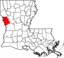 | |
| Villages | ||
| CDPs | ||
| Other unincorporated communities | ||