Zaragoza Airport
| Zaragoza Airport Aeropuerto de Zaragoza | |||||||||||||||
|---|---|---|---|---|---|---|---|---|---|---|---|---|---|---|---|
 | |||||||||||||||
| Summary | |||||||||||||||
| Airport type | Public and military | ||||||||||||||
| Owner | ENAIRE | ||||||||||||||
| Operator | Aena | ||||||||||||||
| Location | Zaragoza, Spain | ||||||||||||||
| Elevation AMSL | 263 m / 863 ft | ||||||||||||||
| Coordinates | 41°39′58″N 01°02′30″W / 41.66611°N 1.04167°WCoordinates: 41°39′58″N 01°02′30″W / 41.66611°N 1.04167°W | ||||||||||||||
| Website | aena-aeropuertos.es | ||||||||||||||
| Map | |||||||||||||||
 ZAZ Location within Spain | |||||||||||||||
| Runways | |||||||||||||||
| |||||||||||||||
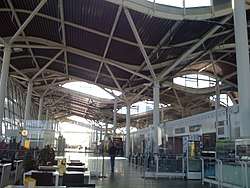
Zaragoza Airport (Aragonese and Spanish: Aeropuerto de Zaragoza; IATA: ZAZ, ICAO: LEZG) is an international airport near Zaragoza, Spain. It is located 16 km (9.9 miles) west of Zaragoza, 270 km (170 miles) west of Barcelona, and 262 km (163 miles) northeast of Madrid. In addition to serving as a commercial airport, Zaragoza is the home of the Spanish Air Force 15th Group.
History

.jpg)
During the Cold War, the United States Air Force used the facility as Zaragoza Air Base.
The construction work on Zaragoza Airport began in September 1954 with the enlargement and improvement of the existing Spanish Air Force Base located there. United States Navy engineers upgraded the facility for temporary or intermediate use as a war standby base. The first U.S. construction project included strengthening the existing 3,024 m (9,921 ft) runway and adding 304 m (1,000 ft) overruns at each end. Work on a new concrete runway, 61 by 3,718 metres (200 ft × 12,200 ft), with 61 m (200 ft) overruns at each end, began in 1956 and was completed in 1958.
Zaragoza was one of three major USAF Cold War airbases in Spain, the others being Torrejón Air Base near Madrid and Morón Air Base near Seville.
The airport was also used by NASA as a contingency landing site for the Space Shuttle in the case of a Transoceanic Abort Landing (TAL). Zaragoza was chosen as a NASA Space Shuttle TAL site due to its long runway, which needs be longer than 7,500 feet, and its pleasant weather. The base also has a military-grade navigation system called a TACAN—"Tactical Air Navigation"—that can adapt to the special guidance devices NASA used with its shuttles.
Airlines and destinations
Passenger
| Airlines | Destinations |
|---|---|
| Air Europa | Palma de Mallorca Seasonal: Lanzarote, Tenerife-South |
| Air Nostrum | Seasonal charter: Paris-Charles de Gaulle |
| Ryanair[1] | Bergamo, Charleroi, London–Stansted Seasonal: Beauvais, Lanzarote, Palma de Mallorca |
| Privilege Style | Seasonal charter: Tallinn[2] |
| Volotea | Seasonal: Ibiza, Menorca, Munich, Palma de Mallorca, Venice |
| Vueling | Palma de Mallorca, Tenerife-South Seasonal: Ibiza |
| Wizz Air | Bucharest, Cluj-Napoca |
Cargo
Access
Currently, the airport is connected to the city center by a bus line (501), which goes from the Puerta del Carmen square, downtown, to the airport, also stopping at the city’s main railway station: Zaragoza-Delicias. The station is an important hub for long-distance trains, AVE high-speed trains and the commuter line of Cercanías Zaragoza, which takes passengers underground through the city and overground in the metropolitan area.
Statistics
| Year | Passengers (change) | Movements (change) | Cargo tons (change) |
|---|---|---|---|
| 2008 | 594,952 (+16.2%) | 14,584 (-1.2%) | 21,439 (+6.4%) |
| 2009 | 528,313 (-11.2%) | 12,746 (-12.6%) | 36,936 (+72.3%) |
| 2010 | 605,912 (+14.7%) | 12,711 (-0.3%) | 42,545 (+15.3%) |
| 2011 | 751,097 (+24.0%) | 11,970 (-5.9%) | 48,609 (+14.3%) |
| 2012 | 551,406 (-26.6%) | 9,268 (-22.6%) | 71,094 (+46.1%) |
| 2013 | 457,284 (-17.1%) | 7,597 (-18.3%) | 71,661 (+0.7%) |
| 2014 | 418,576 (-8.5%) | 7,039 (-7.3%) | 86,311 (+20.4%) |
| 2015 | 423,873 (+1,3%) | 7,050 (+0,1%) | 85,741 (-0,8%) |
| 2016 | 419,529 (-1,0%) | 7,269 (+3,1%) | 110,564 (+29,0%) |
| 2017 | 438,035 (+4.4%) | 7,965 (+9.6%) | 142,185 (+29.1%) |
References
External links
- Official website (in English) (in Spanish)
- Accident history for ZAZ at Aviation Safety Network
- Airport information for LEZG at Great Circle Mapper. Source: DAFIF (effective October 2006).
- Current weather for LEZG at NOAA/NWS
- Airport information for LEZG at World Aero Data. Data current as of October 2006.Source: DAFIF.