Yuzhong District
| Yuzhong 渝中区 | |
|---|---|
| District | |
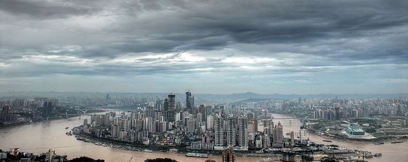 Skyline of Yuzhong | |
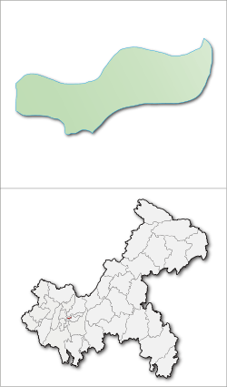 Yuzhong in Chongqing | |
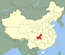
| Country | China |
| Region | Chongqing |
| Area | |
| • Total | 23 km2 (9 sq mi) |
| Population (2010) | 630,090 |
| • Density | 27,395.22/km2 (70,953.3/sq mi) |
| Time zone | UTC+8 (China Standard) |
Yuzhong District (Chinese: 渝中区; pinyin: Yúzhōng Qū) is the central district and heart of Chongqing municipality. It is the capital of the municipality and is also the political, economical, and entertainment center of the city of Chongqing.[1] Located in the central portion of Yuzhong is the Jiefangbei CBD, a leading business and financial centre of western China.
Surrounded on three sides by water (somewhat resembling a duck's head), Yuzhong is effectively a peninsula. Due to the limited space, its hilly nature, and the fact that it is the main central business district for Chongqing, Yuzhong contains some of the tallest skyscrapers in China and is the most densely populated district in the municipality.
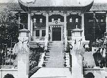
During the Second Sino-Japanese War, the relocated headquarters of the Nationalist Government were located in Yuzhong.
Administrative divisions
| Name | Chinese (S) | Hanyu Pinyin | Population (2010)[2] | Area (km2) | Density (pop/area) |
|---|---|---|---|---|---|
| Qixinggang Subdistrict | 七星岗街道 | Qīxīnggǎng Jiēdào | 68,872 | 0.75 | 91829.33 |
| Jiefangbei Subdistrict | 解放碑街道 | Jiěfàngbēi Jiēdào | 64,629 | 0.62 | 104341.93 |
| Lianglukou Subdistrict | 两路口街道 | Liǎnglùkǒu Jiēdào | 51,811 | 0.67 | 77329.85 |
| Shangqingsi Subdistrict | 上清寺街道 | Shàngqīngsì Jiēdào | 55,903 | 1.73 | 32313.87 |
| Caiyuanba Subdistrict | 菜园坝街道 | Càiyuánbà Jiēdào | 38,380 | 1.56 | 24602.56 |
| Nanjimen Subdistrict | 南纪门街道 | Nánjìmén Jiēdào | 46,862 | 0.53 | 88418.87 |
| Wanglongmen Subdistrict | 望龙门街道 | Wànglóngmén Jiēdào | 41,358 | 0.56 | 73853.57 |
| Chaotianmen Subdistrict | 朝天门街道 | Cháotiānmén Jiēdào | 27,338 | 0.69 | 39620.29 |
| Daxigou Subdistrict | 大溪沟街道 | Dàxīgōu Jiēdào | 66,319 | 1.44 | 46054.86 |
| Daping Subdistrict | 大坪街道 | Dàpíng Jiēdào | 81,658 | 3.24 | 25203.09 |
| Hualongqiao Subdistrict | 化龙桥街道 | Huàlóngqiáo Jiēdào | 15,806 | 4.76 | 3320.59 |
| Shiyoulu Subdistrict | 石油路街道 | Shíyóulù Jiēdào | 71,154 | 2.52 | 28235.71 |
Economy
Yuzhong District in Chongqing's economic center. In 2015, the region's GDP reached 95.8 billion Yuan, the per capita GDP reached 147,524 Yuan},[3] retail sales reached 141.6 billion Yuan. The number of commercial banks in the district and municipal financial institutions reached 18. HSBC, Standard Chartered, Bank of East Asia and other international settled. The largest western China commercial area, Jiefangbei central business district,[4] has brought together 90% of the domestic financial institutions in Chongqing, 2/3 in Chongqing foreign banks and insurance agencies, 3/4 world top 500 enterprises in Chongqing and foreign consular offices.
Education
Chongqing Bashu Secondary School, once called Bashu Middle School (巴蜀中学) is a secondary school located in the Huanghuayuan area.[5] Founded in 1933, it educates students aged 12–18. Its motto is 公正诚朴 (Selflessness, Justice, Honesty and Simplicity).
Transport
Metro
Yuzhong is currently served by three metro lines operated by Chongqing Rail Transit:
- Xiaoshizi 6 , Jiaochangkou 2 , Qixinggang, Lianglukou 3 , Eling, Daping 2 , Shiyoulu
- Jiaochangkou 1 , Linjiangmen, Huanghuayuan, Daxigou, Zengjiayan, Niujiaotuo 3 , Liziba, Fotuguan, Daping 1
- Lianglukou 1 , Niujiaotuo 2
- Xiaoshizi 1
References
- ↑ "Yuzong". Encyclopædia Britannica. Retrieved 23 September 2014.
- ↑ shi, Guo wu yuan ren kou pu cha ban gong; council, Guo jia tong ji ju ren kou he jiu ye tong ji si bian = Tabulation on the 2010 population census of the people's republic of China by township / compiled by Population census office under the state; population, Department of; statistics, employment statistics national bureau of (2012). Zhongguo 2010 nian ren kou pu cha fen xiang, zhen, jie dao zi liao (Di 1 ban. ed.). Beijing Shi: Zhongguo tong ji chu ban she. ISBN 978-7-5037-6660-2.
- ↑ http://www.shijiejingji.net
- ↑ Ritz Tours (1 April 2013). "Chongqing YuZhong (Central Business District) Promotional Video". YouTube. Retrieved 23 September 2014.
- ↑ Chongqing Bashu Secondary School Archived August 13, 2014, at the Wayback Machine., China.
External links
- (in English) Chongqing Yuzhong District Government website
- (in simplified Chinese) Chongqing Yuzhong District Government website


Coordinates: 29°33′38″N 106°34′24″E / 29.560454°N 106.573400°E