Kaizhou District
| Kaizhou 开州区 | |
|---|---|
| District | |
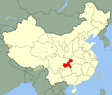
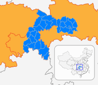
 Location of Kaizhou in Chongqing | |
| Country | People's Republic of China |
| Municipality | Chongqing |
| Area | |
| • Total | 3,959 km2 (1,529 sq mi) |
| Population (2010) | |
| • Total | 1,160,300 |
| • Density | 290/km2 (760/sq mi) |
| Time zone | UTC+8 (China Standard) |
| Kaizhou District | |||||||
| Simplified Chinese | 开州区 | ||||||
|---|---|---|---|---|---|---|---|
| Traditional Chinese | 開州區 | ||||||
| Postal | Kaihsien | ||||||
| |||||||
| Kai County | |||||||
| Simplified Chinese | 开县 | ||||||
| Traditional Chinese | 開縣 | ||||||
| |||||||
Kaizhou District (Chinese: 开州区), formerly known as Kai County or Kaixian (Chinese: 开县) is a district under the jurisdiction of Chongqing Municipality, in southwestern China, bordering Sichuan province to the west. It has an area of 3,959 square km. As of the end of 2009, it had a population of 1.62 million. It is located 330 kilometers from the urban centre of Chongqing proper.
The county has a history dating back some 1800 years.
In 1373, during the Ming Dynasty, it adopted the name Kaizhou.
Until 2004 the county was one of the poorest in the municipality, home to some 10% of Chongqing municipality residents that lived in poverty. The government has attempted to remedy this in recent years.[1]
Administration
| Name | Chinese (S) | Hanyu Pinyin | Population (2010)[2] | Area (km2) |
|---|---|---|---|---|
| Zhendong Subdistrict | 镇东街道 | Zhèndōng Jiēdào | 18,819 | 26.5 |
| Fengle Subdistrict | 丰乐街道 | Fēnglè Jiēdào | 19,851 | 25 |
| Baihe Subdistrict | 白鹤街道 | Báihè Jiēdào | 40,937 | 79.2 |
| Hanfeng Subdistrict | 汉丰街道 | Hànfēng Jiēdào | 85,107 | 52 |
| Wenfeng Subdistrict | 文峰街道 | Wénfēng Jiēdào | 69,747 | 23.9 |
| Yunfeng Subdistrict | 云枫街道 | Yúnfēng Jiēdào | 41,674 | 23.74 |
| Zhaojia Subdistrict | 赵家街道 | Zhàojiā Jiēdào | 39,910 | 152 |
| Guojia town | 郭家镇 | Guōjiā Zhèn | 31,394 | 79 |
| Wenquan town | 温泉镇 | Wēnquán Zhèn | 39,402 | 149 |
| Tieqiao town | 铁桥镇 | Tiěqiáo Zhèn | 42,085 | 115 |
| Nanya town | 南雅镇 | Nányǎ Zhèn | 28,382 | 70 |
| Heqian town | 和谦镇 | Héqiān Zhèn | 20,632 | 80 |
| Zhen'an town | 镇安镇 | Zhèn'ān Zhèn | 15,452 | 56.67 |
| Zhuxi town | 竹溪镇 | Zhúxī Zhèn | 22,900 | 84 |
| Qukou town | 渠口镇 | Qúkǒu Zhèn | 14,437 | 68 |
| Houba town | 厚坝镇 | Hòubà Zhèn | 17,358 | 49 |
| Gaoqiao town | 高桥镇 | Gāoqiáo Zhèn | 23,608 | 78 |
| Yihe town | 义和镇 | Yìhé Zhèn | 26,313 | 61 |
| Dajin town | 大进镇 | Dàjìn Zhèn | 32,213 | 251 |
| Changsha town | 长沙镇 | Chángshā Zhèn | 47,170 | 136 |
| Linjiang town | 临江镇 | Línjiāng Zhèn | 71,149 | 123.2 |
| Dunhao town | 敦好镇 | Dūnhǎo Zhèn | 36,863 | 144 |
| Zhonghe town | 中和镇 | Zhōnghé Zhèn | 43,318 | 89 |
| Yuexi town | 岳溪镇 | Yuèxī Zhèn | 47,802 | 186 |
| Nanmen town | 南门镇 | Nánmén Zhèn | 40,941 | 158 |
| Heyan town | 河堰镇 | Héyàn Zhèn | 19,589 | 154 |
| Jiulongshan town | 九龙山镇 | Jiǔlóngshān Zhèn | 32,696 | 135 |
| Baiqiao town | 白桥镇 | Báiqiáo Zhèn | 13,796 | 84 |
| Tianhe town | 天和镇 | Tiānhé Zhèn | 14,818 | 67 |
| Jinfeng town | 金峰镇 | Jīnfēng Zhèn | 13,355 | 57 |
| Tanjia town | 谭家镇 | Tánjiā Zhèn | 15,261 | 125 |
| Wushan town | 巫山镇 | Wūshān Zhèn | 19,829 | 117 |
| Dade town | 大德镇 | Dàdé Zhèn | 31,548 | 118 |
| Baiquan town | 白泉镇 | Báiquán Zhèn | 8,229 | 196 |
| Guanmian Township | 关面乡 | Guānmiàn Xiāng | 7,127 | 146.5 |
| Manyue Township | 满月乡 | Mǎnyuè Xiāng | 10,057 | 148.7 |
| Wutong Township | 五通乡 | Wǔtōng Xiāng | 10,057 | 60.67 |
| Maliu Township | 麻柳乡 | Máliǔ Xiāng | 17,451 | 96 |
| Zishui Township | 紫水乡 | Zǐshuǐ Xiāng | 20,396 | 94 |
| Sanhuikou Township | 三汇口乡 | Sānhuìkǒu Xiāng | 13,190 | 77.28 |
References
- ↑ 开县概况. Kaizhou. Retrieved 1 May 2012.
- ↑ shi, Guo wu yuan ren kou pu cha ban gong; council, Guo jia tong ji ju ren kou he jiu ye tong ji si bian = Tabulation on the 2010 population census of the people's republic of China by township / compiled by Population census office under the state; population, Department of; statistics, employment statistics national bureau of (2012). Zhongguo 2010 nian ren kou pu cha fen xiang, zhen, jie dao zi liao (Di 1 ban. ed.). Beijing Shi: Zhongguo tong ji chu ban she. ISBN 978-7-5037-6660-2.
External links

Coordinates: 31°12′40″N 108°24′25″E / 31.2111°N 108.407°E