Ylikiiminki
| Ylikiiminki | ||
|---|---|---|
| Former municipality | ||
| Ylikiimingin kunta | ||
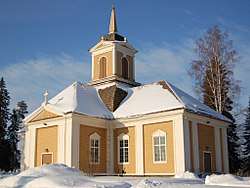 Ylikiiminki Church, built in 1786. | ||
| ||
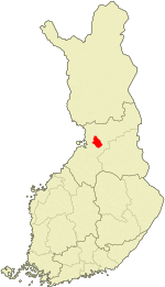 Location of Ylikiiminki in Finland | ||
| Coordinates: 65°02′N 026°09′E / 65.033°N 26.150°ECoordinates: 65°02′N 026°09′E / 65.033°N 26.150°E | ||
| Country | Finland | |
| Region | Northern Ostrobothnia | |
| Sub-region | Oulu Arc sub-region | |
| Charter | 1867 | |
| Consolidated | 2009 | |
| Area[1] | ||
| • Total | 1,063.9 km2 (410.8 sq mi) | |
| • Land | 1,040.66 km2 (401.80 sq mi) | |
| • Water | 23.24 km2 (8.97 sq mi) | |
| Population (2008-12-31)[2] | ||
| • Total | 3,512 | |
| • Density | 3.37/km2 (8.7/sq mi) | |
| Time zone | UTC+2 (EET) | |
| • Summer (DST) | UTC+3 (EEST) | |
| Website | www.ylikiiminki.fi | |

Ylikiiminki (Swedish: Överkiminge) is a former municipality of Finland. It was consolidated with the city of Oulu on 1 January 2009.
It was located in the province of Oulu and is part of the Northern Ostrobothnia region. The municipality had a population of 3,512 (31 December 2008)[2] and covered a land area of 1,040.66 km2 (401.80 sq mi).[1] The population density was 3.37 inhabitants per square kilometre (8.7/sq mi). The municipality was unilingually Finnish.
Neighbour municipalities were Haukipudas, Kiiminki, Muhos, Oulu, Pudasjärvi, Utajärvi and Yli-Ii. Oulujoki municipality that was closed in 1965 was also neighbour municipality.
References
- 1 2 "Area by municipality as of 1 January 2008" (PDF) (in Finnish and Swedish). Land Survey of Finland. Archived from the original (PDF) on 2011-08-07. Retrieved 27 March 2010.
- 1 2 "Population by municipality as of 31 December 2008". Population Information System (in Finnish and Swedish). Population Register Center of Finland. Archived from the original on 2010-12-02. Retrieved 27 March 2010.
External links
![]()
- Municipality of Ylikiiminki – official site
| Municipalities |  | |
|---|---|---|
| Former | ||
This article is issued from
Wikipedia.
The text is licensed under Creative Commons - Attribution - Sharealike.
Additional terms may apply for the media files.