Vaala
| Vaala | ||
|---|---|---|
| Municipality | ||
| Vaalan kunta | ||
 Mist rising from Oulujoki river in Vaala | ||
| ||
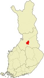 Location of Vaala in Finland | ||
| Coordinates: 64°33′N 026°50′E / 64.550°N 26.833°ECoordinates: 64°33′N 026°50′E / 64.550°N 26.833°E | ||
| Country |
| |
| Region | Northern Ostrobothnia | |
| Sub-region | Oulu Arc sub-region | |
| Charter | 1954 | |
| Government | ||
| • Municipality manager | Tytti Seppänen | |
| Area (2018-01-01)[1] | ||
| • Total | 1,764.04 km2 (681.10 sq mi) | |
| • Land | 1,302.50 km2 (502.90 sq mi) | |
| • Water | 461.45 km2 (178.17 sq mi) | |
| Area rank | 54th largest in Finland | |
| Population (2018-08-31)[2] | ||
| • Total | 2,911 | |
| • Rank | 228th largest in Finland | |
| • Density | 2.23/km2 (5.8/sq mi) | |
| Population by native language[3] | ||
| • Finnish | 99.3% (official) | |
| • Swedish | 0.1% | |
| • Others | 0.6% | |
| Population by age[4] | ||
| • 0 to 14 | 15.5% | |
| • 15 to 64 | 59.3% | |
| • 65 or older | 25.2% | |
| Time zone | UTC+2 (EET) | |
| • Summer (DST) | UTC+3 (EEST) | |
| Municipal tax rate[5] | 21% | |
| Urbanisation | 40.9% | |
| Unemployment rate | 20.6% | |
| Website |
www | |

Vaala is a municipality in Finland. It is located in the Northern Ostrobothnia region. Established in 1954 (predecessor municipality Säräisniemi, established in 1867), the municipality has a population of 2,911 (31 August 2018)[2] and covers an area of 1,764.04 square kilometres (681.10 sq mi) of which 461.45 km2 (178.17 sq mi) is water.[1] The population density is 2.23 inhabitants per square kilometre (5.8/sq mi). Previously Vaala was part of the Kainuu region but was transferred to Northern Ostrobothnia on 1 January 2016.[6]
Oulujärvi, the fourth largest lake of Finland is located partly in Vaala.
The municipality is unilingually Finnish.
Vaala is also an old Finnish word, which means the phase in a river just before rapids.
References
- 1 2 "Area of Finnish Municipalities 1.1.2018" (PDF). National Land Survey of Finland. Retrieved 30 January 2018.
- 1 2 "Ennakkoväkiluku kuukausittain sukupuolen mukaan alueittain, elokuu 2018" (in Finnish). Statistics Finland. Retrieved 21 October 2018.
- ↑ "Population according to language and the number of foreigners and land area km2 by area as of 31 December 2008". Statistics Finland's PX-Web databases. Statistics Finland. Retrieved 29 March 2009.
- ↑ "Population according to age and gender by area as of 31 December 2008". Statistics Finland's PX-Web databases. Statistics Finland. Retrieved 28 April 2009.
- ↑ "List of municipal and parish tax rates in 2011". Tax Administration of Finland. 29 November 2010. Retrieved 13 March 2011.
- ↑ "Vaala siirtyy Kainuusta Pohjois-Pohjanmaahan vuoden 2016 alusta" (in Finnish). Helsinki: Ministry of Finance. 5 February 2015. Retrieved 3 January 2016.
External links

- Municipality of Vaala – Official website
| Municipalities |  | |
|---|---|---|
| Former | ||
This article is issued from
Wikipedia.
The text is licensed under Creative Commons - Attribution - Sharealike.
Additional terms may apply for the media files.