Piippola
| Piippola | ||
|---|---|---|
| Village, former municipality | ||
| Piippolan kunta | ||
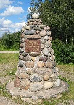 Monument in Piippola, Finland, marking "The Center of Finland", erected in 1958 | ||
| ||
 Location of Piippola in Finland | ||
| Coordinates: 64°11′N 025°58′E / 64.183°N 25.967°ECoordinates: 64°11′N 025°58′E / 64.183°N 25.967°E | ||
| Country | Finland | |
| Region | Northern Ostrobothnia | |
| Sub-region | Siikalatva sub-region | |
| Charter | 1865 | |
| Consolidated | 2009 | |
| Area[1] | ||
| • Total | 464.98 km2 (179.53 sq mi) | |
| • Land | 455.7 km2 (175.9 sq mi) | |
| • Water | 9.28 km2 (3.58 sq mi) | |
| Population (2015-12-31)[2] | ||
| • Total | 550 | |
| • Density | 1.21/km2 (3.1/sq mi) | |
| Time zone | UTC+2 (EET) | |
| • Summer (DST) | UTC+3 (EEST) | |

Piippola is a village and a former municipality of Finland.
Piippola is located in the province of Oulu and is part of the Northern Ostrobothnia region. The village has a population of 550 (31 December 2015).[2] The former municipality covered an area of 464.98 km2 (179.53 sq mi) of which 9.28 km2 (3.58 sq mi) is water.[1] The population density was 2.75 inhabitants per square kilometre (7.1/sq mi).
The municipality was unilingually Finnish.
The municipality was consolidated with Kestilä, Pulkkila and Rantsila on 1 January 2009 to form a new municipality of Siikalatva.[3]
References
- 1 2 "Area by municipality as of 1 January 2008" (PDF) (in Finnish and Swedish). Land Survey of Finland. Archived from the original (PDF) on 2011-08-07. Retrieved 27 March 2010.
- 1 2 "Taajamat väkiluvun ja väestöntiheyden mukaan 31 December 2015". Population Information System (in Finnish and Swedish). Population Register Center of Finland. Retrieved 6 May 2017.
- ↑ "Pohjois-Pohjanmaalle tulee uusi Siikalatvan kunta". YLE Uutiset (YLE News) (in Finnish). Yleisradio Oy. 2008-02-25. Retrieved 2008-08-03.
External links
![]()
- Municipality of Piippola– official site
- Municipality of Siikalatva – official site
| Municipalities |  | |
|---|---|---|
| Former | ||
This article is issued from
Wikipedia.
The text is licensed under Creative Commons - Attribution - Sharealike.
Additional terms may apply for the media files.