Yattalunga, South Australia
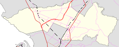
Yattalunga is a northern suburb of Adelaide, South Australia. It is the easterm in the City of Playford. Yattalunga is east of One Tree Hill, between the Gawler–One Tree Hill Road and the South Para River. The road runs near the top of the ridge separating the South Para River gorge from the Adelaide Plains.
The eastern part of Yattalunga includes most of the Para Wirra Recreation Park.
The name of the suburb is drawn from the name of a historic homestead,[1] which in turn was derived from Yertala or Yattala meaning cascade, waterfall of creek and unga or nga meaning place or locality in a local Australian Aboriginal language, according to state government records citing Norman Tindale in 1949.[2]
References
- ↑ "Placename Details: Yattalunga (LOCB)". Property Location Browser. Government of South Australia. 14 April 2015. SA0030859. Retrieved 5 February 2016.
- ↑ "Placename Details: Yattalunga (HMSD)". Property Location Browser. Government of South Australia. 6 February 2007. SA0030857. Retrieved 5 February 2016.
This article is issued from
Wikipedia.
The text is licensed under Creative Commons - Attribution - Sharealike.
Additional terms may apply for the media files.