Blakeview, South Australia
| Blakeview Adelaide, South Australia | |||||||||||||||
|---|---|---|---|---|---|---|---|---|---|---|---|---|---|---|---|
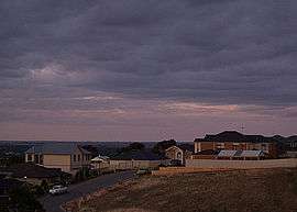 Looking into Blakeview from Craigmore Road at twilight | |||||||||||||||
| Population |
| ||||||||||||||
| Established | 1990 | ||||||||||||||
| Postcode(s) | 5114[3] | ||||||||||||||
| Location | 29 km (18 mi) N of Adelaide city centre[3] | ||||||||||||||
| LGA(s) | City of Playford | ||||||||||||||
| State electorate(s) | Elizabeth | ||||||||||||||
| Federal Division(s) | Wakefield (2011)[4] | ||||||||||||||
| |||||||||||||||
Blakeview is a northern suburb of Adelaide, South Australia. It is located in the City of Playford. Blakeview is predominantly a residential suburb, but also has two commercial areas and two education areas.
Geography
Blakeview is located to the northeast of Elizabeth and lies on the east side of Main North Road opposite Smithfield and Munno Para.[5] There is a commercial area facing Main North Road in the oldest part of the suburb which includes a Coles Express service station and medical services. The Blakes Crossing subdivision north of Craigmore Road also has a commercial area, which includes Woolworths and Aldi supermarkets.
Blakeview was gazetted as a suburb in 1990, taking territory from Smithfield and Munno Para.[6]
Demographics
The 2006 Census by the Australian Bureau of Statistics counted 4,294 persons in Blakeview on census night. Of these, 49.6% were male and 50.4% were female.[2]
The majority of residents (76.2%) are of Australian birth, with other common census responses being England (12.4%) and Scotland (2.2%).[2]
The age distribution of Blakeview residents is skewed towards a slightly younger population than the greater Australian population. 58% of residents were over 25 years in 2006, compared to the Australian average of 66.5%; and 42% were younger than 25 years, compared to the Australian average of 33.5%.[2]
Community
Schools
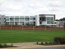
The southern education precinct in Blakeview includes Blakeview Primary School on Omega Drive, Trinity College Blakeview adjacent to it on Park Lake Boulevard, with Craigmore High School next along, and a preschool centre across the road.[7]
Blakes Crossing Christian College operated by Christian Community Ministries opened for reception to year 5 in 2014 and intends to gradually extend to year 12 and a total of 700 students.[8] At the beginning of 2014 it had only six students enrolled, using the Lend Lease land sales offices for classrooms until the school's own buildings could be constructed.[9] It is now sited in its own buildings, not far from the Blakes Crossing shopping precinct and parks.
Facilities and attractions
Parks
There are several parks and reserves throughout the suburb, especially along Smith Creek and Main Terrace. Many of the parks are provided with playground equipment.[5]
Transportation
Roads
Blakeview is serviced by Main North Road, connecting the suburb to Adelaide city centre.[5]
Public transport
Blakeview is serviced by several public transport services run by the Adelaide Metro to Elizabeth, Smithfield, Munno Para, Adelaide and a school bus to Roma Mitchell Secondary College.[10]
See also
| Wikimedia Commons has media related to Blakeview, South Australia. |
References
- ↑ Australian Bureau of Statistics (27 June 2017). "Blakeview (State Suburb)". 2016 Census QuickStats. Retrieved 14 January 2018.

- 1 2 3 4 Australian Bureau of Statistics (25 October 2007). "Blakeview (State Suburb)". 2006 Census QuickStats. Retrieved 20 April 2011.
- 1 2 "Blakeview, South Australia (Adelaide)". Postcodes-Australia. Postcodes-Australia.com. Retrieved 20 April 2011.
- ↑ "Find my electorate". Australian Electoral Commission. 15 April 2011. Archived from the original on 30 April 2011. Retrieved 20 April 2011.
- 1 2 3 Adelaide and surrounds street directory (47th ed.). UBD. 2009. ISBN 978-0-7319-2336-6.
- ↑ "Placename Details: Blakeview". Property Location Browser. Government of South Australia. 11 March 2009. SA0007230. Archived from the original on 12 October 2016. Retrieved 20 November 2016.
- ↑ "Australian Schools Directory". Australian Schools Directory. Retrieved 20 April 2011.
- ↑ "Blakes Crossing Christian College - About Us". 2013. Retrieved 1 October 2014.
- ↑ Kurtis Eichler. "Blakes Crossing Christian College opens in Blakeview with only six students". The Australian. News Ltd. Retrieved 1 October 2014.
- ↑ "Public Transport in Adelaide". Adelaide Metro official website. Dept. for Transport, Energy and Infrastructure, Public Transport Division. 12 January 2011. Archived from the original on 26 April 2011. Retrieved 20 April 2011.
External links
- "City of Playford". Official website. City of Playford. Retrieved 20 April 2011.