Yaroun
| Yaroun يارون | |
|---|---|
| City | |
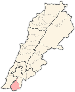
 Yaroun Location within Lebanon | |
| Coordinates: 33°05′N 35°25′E / 33.083°N 35.417°ECoordinates: 33°05′N 35°25′E / 33.083°N 35.417°E | |
| Grid position | 189/276 PAL |
| Country |
|
| Governorate | Nabatieh Governorate |
| District | Bint Jbeil District |
| Highest elevation | 800 m (2,600 ft) |
| Lowest elevation | 750 m (2,460 ft) |
| Time zone | UTC+2 (EET) |
| • Summer (DST) | UTC+3 (EEST) |
| Dialing code | +961 |
Yaroun (also spelled Yarun and in Arabic يارون)[1] is a Lebanese village located in the Caza of Bint Jbeil in the Nabatiye Governorate in Lebanon.
Geography
Yaroun occupies a hill with elevation ranging from 750 to 900 meters above sea level. The main agricultural products of Yaroun are olives, wheat, and tobacco.
Yaroun lies on the border with Israel. It overlooks Saliha and Kafr Bir'im in the Israeli part of the border.
History
In 1596, it was named as a village, Yarun an-Nasara, in the Ottoman nahiya (subdistrict) of Tibnin under the liwa' (district) of Safad, with a population of 37 Muslim households and 20 Muslim bachelors, and 39 Christian households and 11 Christian bachelors. The villagers paid taxes on a number of crops, such as wheat, barley, olive trees, vineyards, fruit trees, goats and beehives, in addition to "occasional revenues"; a total of 7,247 akçe.[2][3]
In 1674, western travellers saw remains of a monastery and church near by, with fragments from many columns,[4]
In 1781 Nasif al-Nassar was killed here by Jazzar Pasha when their two armies met.[5]
In 1838, Edward Robinson noted it as "a large village".[4] Ernest Renan visited Yaroun during his mission to Lebanon and described what he found in his book Mission de Phénicie (1865-1874). He found many antiquities at Yaroun.[6]
In 1881, the Palestine Exploration Fund's Survey of Western Palestine (SWP) described it: “A stone village, containing about 200 Metawileh and 200 Christians ; a Christian chapel in the village. The village is situated on the edge of a plain, with vineyards and arable land; to the west rises a basalt-top called el Burj, full of cisterns, and supposed to be the site of an ancient castle ; there are large stones strewn about ; there are three large birkets and many cisterns to supply water; one of the birkets is ruined."[7]
SWP also found here the remains of an ancient Church, with Greek inscriptions.[8]
By the 1945 statistics the population was counted with Saliha and Maroun al-Ras, and totalled 1070 Muslims[9] with 11,735 dunams of land, according to an official land and population survey.[10] Of this, 7,401 dunams were allocated to cereals, 422 dunams were irrigated or used for orchards,[11] while 58 dunams were built-up (urban) area.[12]
Religion
Yaroun is divided between Shia Muslims and Catholic Christians.
Social Life
While the majority of Yarounis visit Yaroun for the summer, approximately 60% to 70% of Yarouni natives reside outside of Lebanon, many wars happened in South Area of Lebanon and the Economic development is weak therefore Many Young Yarounis choose to relocate to the Capital City Beirut to Continue their Higher Educations because of the lack of universities in the South and after that they choose to Immigrate to the USA, Canada, Or Europe and some of them settle in the Gulf, and they visit their families back in Yaroun to keep ties with their relatives and bear in mind that immigrants have an Economic Impact on their families (Money Transfers or Allowances), and this will help their Families to pay their expenses and to let them stay in Yaroun.
Modern era
In July 2006, Yaroun, like many other villages that string Lebanon's southern border, such as Ain Ebel, Debel, Qaouzah, and Rmaich, were caught by the 2006 Lebanon War between Hezbollah and the Israeli army.[13]
On the 23 July, Israeli strikes killed 5 civilians in Yaroun, the victims were aged between 6 months and 75 years old.[14]
References
- ↑ From personal name, according to Palmer, 1881, p. 104
- ↑ Hütteroth and Abdulfattah, 1977, p. 179.
- ↑ Note that Rhode, 1979, p. 6 writes that the register that Hütteroth and Abdulfattah studied was not from 1595/6, but from 1548/9
- 1 2 Robinson and Smith, 1841, vol 3, p. 371
- ↑ Blanford, 2011, pp. 12-13
- ↑ Renan, 1864, pp. 680-2
- ↑ Conder and Kitchener, 1881, SWP I, p. 203
- ↑ Conder and Kitchener, 1881, SWP I, pp. 258-260
- ↑ Department of Statistics, 1945, p. 11
- ↑ Government of Palestine, Department of Statistics. Village Statistics, April, 1945. Quoted in Hadawi, 1970, p. 71
- ↑ Government of Palestine, Department of Statistics. Village Statistics, April, 1945. Quoted in Hadawi, 1970, p. 121
- ↑ Government of Palestine, Department of Statistics. Village Statistics, April, 1945. Quoted in Hadawi, 1970, p. 171
- ↑ USATODAY.com - Archbishop tells church to stay in Lebanon: 'You'll make it'
- ↑ HRW, 2007, pp. 109
Bibliography
- Blanford, Nicholas (2011). Warriors of God: Inside Hezbollah's Thirty-Year Struggle Against Israel. Random House Publishing Group. ISBN 9780679605164.
- Conder, C.R.; Kitchener, H.H. (1881). The Survey of Western Palestine: Memoirs of the Topography, Orography, Hydrography, and Archaeology. 1. London: Committee of the Palestine Exploration Fund.
- Department of Statistics (1945). Village Statistics, April, 1945. Government of Palestine.
- Hadawi, S. (1970). "Village Statistics of 1945: A Classification of Land and Area ownership in Palestine". Palestine Liberation Organization Research Centre.
- HRW (2007). Why They Died: Civilian Casualties in Lebanon During the 2006 War. Human Rights Watch.
- Hütteroth, Wolf-Dieter; Abdulfattah, Kamal (1977). Historical Geography of Palestine, Transjordan and Southern Syria in the Late 16th Century. Erlanger Geographische Arbeiten, Sonderband 5. Erlangen, Germany: Vorstand der Fränkischen Geographischen Gesellschaft. ISBN 3-920405-41-2.
- Palmer, E.H. (1881). The Survey of Western Palestine: Arabic and English Name Lists Collected During the Survey by Lieutenants Conder and Kitchener, R. E. Transliterated and Explained by E.H. Palmer. Committee of the Palestine Exploration Fund.
- Rhode, H. (1979). Administration and Population of the Sancak of Safed in the Sixteenth Century. Columbia University.
- Renan, E. (1864). Mission de Phénicie (in French). Paris: Imprimerie impériale.
- Robinson, E.; Smith, E. (1841). Biblical Researches in Palestine, Mount Sinai and Arabia Petraea: A Journal of Travels in the year 1838. 3. Boston: Crocker & Brewster.
External links
- Survey of Western Palestine, Map 4: IAA, Wikimedia commons
- Yaroun, Localiban
Capital: Bint Jbeil | ||
| Towns and villages |
|  |
| Notable landmarks | ||
| Other sites | ||