Debel, Lebanon
| Debel/Dibil دبل | |
|---|---|
| Village | |
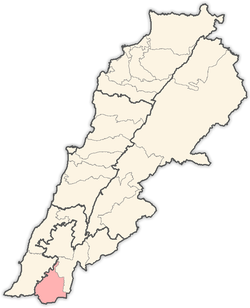
 Debel/Dibil Location within Lebanon | |
| Coordinates: 33°07′N 35°22′E / 33.117°N 35.367°ECoordinates: 33°07′N 35°22′E / 33.117°N 35.367°E | |
| Grid position | 184/280 PAL |
| Country |
|
| Governorate | Nabatieh |
| District | Bint Jbeil |
| Highest elevation | 650 m (2,130 ft) |
| Lowest elevation | 560 m (1,840 ft) |
| Time zone | UTC+2 (EET) |
| • Summer (DST) | UTC+3 (EEST) |
| Dialing code | +961 |
Debel (also spelled Dibil, Arabic: دبل)[1] is a Lebanese village located in the caza of Bint Jbeil in the Nabatiye Governorate in Lebanon.
Geography
Debel occupies several hills with elevation ranging from 560 to 650 meters above sea level. The main agricultural products of Debel are olives and tobacco.
Demography
The people of Debel are Lebanese and are almost exclusively Maronites.
History
In 1596 it was named as a village, ‘“Dibil” in the Ottoman nahiya (subdistrict) of Tibnin under the liwa' (district) of Safad, with a population of 12 households and 6 bachelors, all Muslim. The villagers paid a fixed tax-rate of 25% on agricultural products, such as wheat, barley, summer crops, fruit trees, goats and beehives, in addition to "occasional revenues”; a total of 1,530 akçe.[2][3]
In 1852 Edward Robinson noted the village ("Dibl") on his travels in the region.[4]
Ernest Renan visited the area during his mission to Lebanon and described what he found in his book Mission de Phénicie (1865-1874). At Dibl he found Greek Inscriptions.[5]
In 1875 Victor Guérin visited, and described it as a village with 400 Maronite inhabitants. He also found here several inscriptions in Greek.[6] He further noted: "At this village there are some rock-cut tombs, in one of which there is an inscription. Many well-dressed stones are used, and turn up in digging. On one of these was a fragmentary inscription. Under some of the houses of the village there is a large piece of tesselated pavement of very good design. The colours are red, black, and white. There are some sarcophagi and some broken pillars. This was probably an early Christian site."[7]
In 1881 the Palestine Exploration Fund's Survey of Western Palestine (SWP) described Dibl: "A village, built of stone, containing about 500 Christians (Guerin says 400 Maronites) ; there is a Maronite chapel. It is situated on hill-side, with grapes, figs, olives, mulberries, and arable land. The water supply is from many good springs in the wady to the north-west of village, and cisterns and birket near the village."[8]
References
- ↑ from a personal name, according to Palmer, 1881, p. 71
- ↑ Hütteroth and Abdulfattah, 1977, p. 184
- ↑ Note that Rhode, 1979, p. 6 writes that the register that Hütteroth and Abdulfattah studied was not from 1595/6, but from 1548/9
- ↑ Robinson and Smith, 1856, p. 62
- ↑ Renan, 1864, pp. 674-5
- ↑ Guérin, 1880, p. 115
- ↑ Guérin, 1880, pp. 115-116; as translated by Conder and Kitchener, 1881, SWP I, pp. 221-222
- ↑ Conder and Kitchener, 1881, SWP I, p. 201
Bibliography
- Conder, C.R.; Kitchener, H.H. (1881). The Survey of Western Palestine: Memoirs of the Topography, Orography, Hydrography, and Archaeology. 1. London: Committee of the Palestine Exploration Fund.
- Guérin, V. (1880). Description Géographique Historique et Archéologique de la Palestine (in French). 3: Galilee, pt. 2. Paris: L'Imprimerie Nationale.
- Hütteroth, Wolf-Dieter; Abdulfattah, Kamal (1977). Historical Geography of Palestine, Transjordan and Southern Syria in the Late 16th Century. Erlanger Geographische Arbeiten, Sonderband 5. Erlangen, Germany: Vorstand der Fränkischen Geographischen Gesellschaft. ISBN 3-920405-41-2.
- Palmer, E.H. (1881). The Survey of Western Palestine: Arabic and English Name Lists Collected During the Survey by Lieutenants Conder and Kitchener, R. E. Transliterated and Explained by E.H. Palmer. Committee of the Palestine Exploration Fund.
- Renan, E. (1864). Mission de Phénicie (in French). Paris: Imprimerie impériale.
- Rhode, H. (1979). Administration and Population of the Sancak of Safed in the Sixteenth Century. Columbia University.
- Robinson, E.; Smith, E. (1856). Later Biblical Researches in Palestine and adjacent regions: A Journal of Travels in the year 1852. London: John Murray.
External links
- Survey of Western Palestine, Map 4: IAA, Wikimedia commons
- Debl, Localiban
Capital: Bint Jbeil | ||
| Towns and villages |
|  |
| Notable landmarks | ||
| Other sites | ||