Xueshan
| Xueshan | |
|---|---|
| Snow Mountain | |
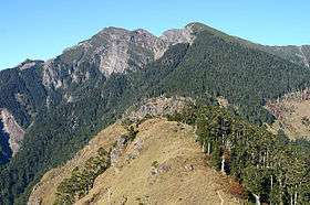 Snow Mountain as seen from Xueshan E. peak | |
| Highest point | |
| Elevation | 3,886 m (12,749 ft) [1] |
| Prominence | 1,932 m (6,339 ft) [1] |
| Listing |
Ultra 100 Peaks of Taiwan |
| Coordinates | 24°23′00″N 121°13′48″E / 24.38333°N 121.23000°ECoordinates: 24°23′00″N 121°13′48″E / 24.38333°N 121.23000°E [1] |
| Geography | |
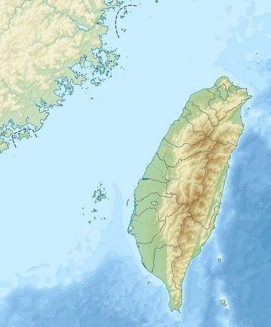 Xueshan The location of Xueshan (Shei-Pa National Park) | |
| Location |
Heping District, Taichung/ Tai'an, Miaoli County, Taiwan |
| Parent range | Xueshan Range |
| Climbing | |
| Easiest route | Maintained trail, snow/ice climb during some winter months |
| Xueshan (Snow Mountain) | |||||||||||||||
| Chinese | 雪山 | ||||||||||||||
|---|---|---|---|---|---|---|---|---|---|---|---|---|---|---|---|
| |||||||||||||||
Xueshan or Hsuehshan (Chinese: 雪山; pinyin: Xuě Shān; literally: "Snow Mountain") a mountain in Heping District, Taichung, Taiwan. It is the second highest mountain in Taiwan and in East Asia, at 3,886 m (12,749 ft) above sea level. It is located in the Shei-Pa National Park and it is visible in good weather from hills near Taiwan's capital Taipei.
In the late 19th and early 20th centuries, it was known to Westerners as Mt. Sylvia.[2] In 1923 (see Taiwan under Japanese rule), the mountain gained the name Tsugitakayama (次高山), literally the "Second Highest Mountain", because in the Japanese Empire at that time, only Yushan (also in Taiwan) was higher. They are both ahead of Mt. Fuji in terms of height. It was designated part of the Tsugitaka-Taroko National Park by the Governor-General of Taiwan on 12 December 1937.
Climbing Xueshan
Xueshan is a part of the Shei-Pa National Park and so climbers are required to apply for a park entry permit. This can be done 7–30 days in advance. After that a police mountain entry permit must be applied for. This can be done at the police station in Wuling Farm on the spot.
There are two cabins on the trail. The first, Qika Cabin, is at the 2.0 kilometres (1.2 mi) mark. The second, 369 Cabin, is at the 6.9 kilometres (4.3 mi) mark. Both cabins are very basic containing bunker style beds. Hikers must bring their own sleeping and cooking gear.
The peak is at the 10.9 kilometres (6.8 mi) mark.
Gallery
 Xueshan Main Peak
 Shengleng Trail (Holy Ridge Trail)
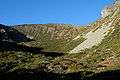 Cirque or Landslide Valley #1
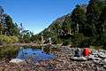 Cuei Pond
See also
References
- 1 2 3 "Central and Eastern China, Taiwan and Korea" Peaklist.org. Retrieved 2011-11-24.
- ↑ see, for example:
%20-%20General%20Map%20of%20Formosa.jpg)
Bibliography
- Campbell, William (1896). "The island of Formosa: Its past and future". Scottish Geographical Magazine. 12 (8): 385–399. doi:10.1080/00369229608732903.
- Davidson, James W. (1903). The Island of Formosa, Past and Present : history, people, resources, and commercial prospects : tea, camphor, sugar, gold, coal, sulphur, economical plants, and other productions. London and New York: Macmillan. OL 6931635M.
| Wikimedia Commons has media related to Xueshan. |