Taroko National Park
| Taroko National Park | |
|---|---|
|
IUCN category II (national park) | |
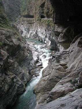 Tunnel of Nine Turns | |
 Map of Taroko national park | |
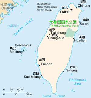
| Location | Taiwan |
| Nearest city | Hualien City |
| Coordinates | 24°10′N 121°20′E / 24.167°N 121.333°ECoordinates: 24°10′N 121°20′E / 24.167°N 121.333°E |
| Area | 920 km2 (360 sq mi) |
| Established | 28 November 1986 |
Taroko National Park (Chinese: 太魯閣國家公園; pinyin: Tàilǔgé Gúojiā Gōngyuán; Pe̍h-ōe-jī: Thài-ló͘-koh Kok-ka Kong-hn̂g) is one of the nine national parks in Taiwan and was named after the Taroko Gorge, the landmark gorge of the park carved by the Liwu River. The park spans Taichung Municipality, Nantou County, and Hualien County.
History
The park was originally established as the Tsugitaka-Taroko National Park (Japanese: 次高タロコ国立公園 Hepburn: Tsugitaka Taroko kokuritsu kōen) by the Governor-General of Taiwan on 12 December 1937 when Taiwan was part of the Empire of Japan. After the Empire of Japan's defeat in World War II, the Republic of China took over Taiwan in consequence. The ROC government subsequently abolished the park on 15 August 1945. It was not until 28 November 1986 that the park was reestablished.[1]
Origin of the name
The name, Taroko (formally as Truku), means "human being" in the Truku language of the Truku indigenous tribe.
Geology
Taroko Gorge and its surrounding area are well known for their abundant supply of marble, leading to its nickname, "The Marble Gorge". The rock now seen in Taroko began over 200 million years ago as sediment on the bottom of the ocean. As the sediment collected, it was subject to increasingly large amounts of pressure which eventually hardened it into limestone. Over the past 100 million years, tectonic compression between the Philippine Sea Plate and the Eurasian Plate supplied additional pressure that metamorphosed the limestone into marble. Uplifting forces from the plate collision pushed this rock above the surface of the ocean to where we see it today. The region is still being uplifted by approximately 0.5 cm (half-centimeter) per year.[2]
The gorge itself was carved into the marble by the erosive power of the Liwu River.[3]
In addition, there is known to be jade in this gorge. This jade is only found in Taiwan and it supplies the jade market in Hualien. These mountains can be seen rafting (a common activity during summer months in Taroko Gorge) through the rivers.
The Tupido Tribe Trail was built by the Batto Bulego family of Taroko some 120 years ago, and now only parts of its ruins remain on the Tienhsyang Taiti mesa (天祥台地). Four generations of the family resided there until the Japanese army massacred the tribe and banished the survivors in 1914.[4]
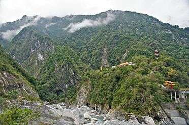
Sights include:
- Tunnel of Nine Turns (九曲洞 Chiouchüe Tung, pictured at right) (Currently closed as of March 2017)
- Eternal Spring Shrine (pictured below)
- Yentzihkou, Swallow Grotto (燕子口)
- Chinheng Kungyuan, Park (靳珩公園)
- Tsihmuchiao, The Bridge of the Kind Mother (慈母橋)
- Tienhsyang
- Chueilu Tuanyah Precipice (錐麓斷崖)
- Lioufang Chiao Bridge (流芳橋)
- Hill of Tayuling the Great (大禹嶺)
- Puloh Wan (布洛灣)
- Qingshui Cliffs
- Shakadang Trail
- Changuang Temple
- Baiyang Waterfalls Trail
Transportation
Taroko National Park is accessible West from Xincheng Station of the Taiwan Railways Administration.
Gallery
 Taroko
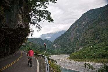 Bicycling uphill
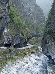 Bicyclists share narrow roads with motor vehicles
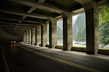 Protection from waterfalls
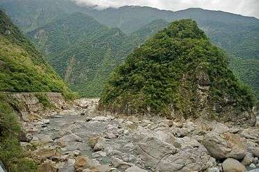 Gorge views
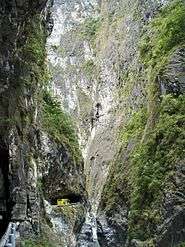 Taroko
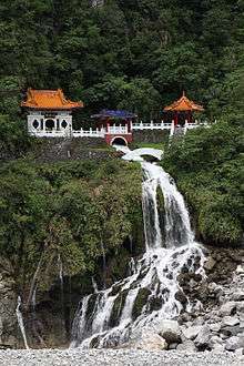 Eternal Spring Shrine, Taroko National Park, Hualien on the east coast.
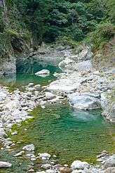 Shakahtang Ho river
 Liwu River
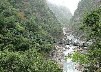 A suspension footbridge
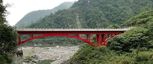 Bridge of 100 Lions
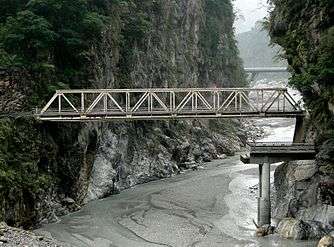 Changchun Bridge
.jpg)
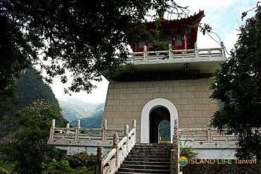 Taroko Bell Tower
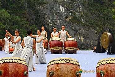 Taroko Music Festival
See also
References
- ↑ Wei-han, Chen (15 June 2017). "Mining companies to face make-up reviews: Cabinet". Taipei Times. Retrieved 15 June 2017.
- ↑ "Landform and Geology". Taroko National Park Official Website. Archived from the original on 2007-07-01. Retrieved 2007-07-04.
- ↑ Petley, D.N. (1998). "Geomorphological mapping for hazard assessment in a neotectonic terrain". The Geographical Journal. 164 (2): 183–201. doi:10.2307/3060369. JSTOR 3060369.
- ↑ Ho Yi (22 Mar 2006). "Avoiding the throng in Taroko park". Taipei Times. p. 13. Retrieved 2009-08-14.
External links
| Wikimedia Commons has media related to Taroko National Park. |