Xixiang County
| Xixiang County 西乡县 | |
|---|---|
| County | |
 Location in Hanzhong | |
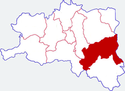
.png) Hanzhong in Shaanxi | |
| Coordinates (Xixiang railway station): 32°59′35″N 107°45′25″E / 32.993°N 107.757°ECoordinates: 32°59′35″N 107°45′25″E / 32.993°N 107.757°E[1] | |
| Country | People's Republic of China |
| Province | Shaanxi |
| Prefecture-level city | Hanzhong |
| Area | |
| • Total | 3,204 km2 (1,237 sq mi) |
| Population | |
| • Total | 341,812 |
| • Density | 110/km2 (280/sq mi) |
| Time zone | UTC+8 (China standard time) |
| Postal code | 723500 |
| Licence plates | 陕F |
| Website |
www |
Xixiang County (simplified Chinese: 西乡县; traditional Chinese: 西鄉縣; pinyin: Xīxiāng Xiàn) is a county under the administration of Hanzhong City, in the southwest of Shaanxi province, China,[2] bordering Sichuan province to the southwest. Its administrative center, Xixiang, formerly known as Hsihsiang, lies on the Muma River.[3] The county contains fourteen towns, eleven townships, and covers an area of 3,240 km2 (1,250 sq mi).
Transportation
Xixiang is served by the Yangpingguan–Ankang Railway. The Muma River supports small boat traffic.[3]
Economy
In the 19th century and early 20th century the area produced silk which was exported to Gansu.[3]
Notes
- ↑ "Xixiang Railway Station Huochang". Google Maps. Retrieved 18 June 2018.
- ↑ Xixiang Xian (Approved) at GEOnet Names Server, United States National Geospatial-Intelligence Agency
- 1 2 3 Teichman, Eric (1921). Travels Of A Consular Officer In North-West China. Cambridge, England: Cambridge University Press. pp. 34&ndash, 35. OCLC 257595152.
This article is issued from
Wikipedia.
The text is licensed under Creative Commons - Attribution - Sharealike.
Additional terms may apply for the media files.