Laurentian Hills
| Laurentian Hills | |
|---|---|
| Town (lower-tier) | |
| Town of Laurentian Hills | |
 Municipal offices in Point Alexander | |
 Laurentian Hills | |
| Coordinates: 46°08′N 77°33′W / 46.133°N 77.550°WCoordinates: 46°08′N 77°33′W / 46.133°N 77.550°W | |
| Country |
|
| Province |
|
| County | Renfrew |
| Established | January 1, 2000 |
| Government | |
| • Mayor | John Reinwald |
| • Federal riding | Renfrew—Nipissing—Pembroke |
| • Prov. riding | Renfrew—Nipissing—Pembroke |
| Area[1] | |
| • Land | 640.48 km2 (247.29 sq mi) |
| Population (2011)[1] | |
| • Total | 2,811 |
| • Density | 4.4/km2 (11/sq mi) |
| Time zone | UTC-5 (EST) |
| • Summer (DST) | UTC-4 (EDT) |
| Postal Code | K0J 1J0 |
| Area code(s) | 613 |
| Website | www.laurentianhills.ca |
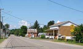
Main Street in Chalk River.
Laurentian Hills is a municipality in Eastern Ontario, Canada, on the Ottawa River in Renfrew County. It surrounds (by land) Deep River on the Ontario side of the river. The town is home to the Nuclear Power Demonstration. The municipality was formed on January 1, 2000, when the United Townships of Rolph, Buchanan, Wylie and McKay and the Village of Chalk River were merged.[2]
Communities
The town comprises the communities of Chalk River, Meilleurs Bay, Moor Lake, Point Alexander, Rolphton, and Wylie.
Demographics
According to the Canada 2011 Census:[1]
- Population: 2,811
- % Change (2006–2011): 0.8
- Dwellings: 1,264
- Area (km².): 640.48
- Density (persons per km².): 4.4
Population trend:[3]
- Population in 2011: 2811
- Population in 2006: 2789
- Population in 2001: 2750
- Population in 1996:
- Chalk River: 974
- Rolph, Buchanan, Wylie and McKay: 1810
- Population in 1991:
- Chalk River: 874
- Rolph, Buchanan, Wylie and McKay: 1656
Trivia
An Ontario Historical Plaque in front of the School House Museum was erected by the province to commemorate the role of Steamboating on the Upper Ottawa in Ontario's heritage.[4]
See also
References
- Mercer, Jennifer. "Staying the Run: A History of Rolph, Buchanan, Wylie and McKay Townships."
- 1 2 3 "Laurentian Hills census profile". 2011 Census of Population. Statistics Canada. Retrieved 2012-02-13.
- ↑ "Municipal Profiles". County of Renfrew. Retrieved 2009-01-15.
- ↑ Statistics Canada: 1996, 2001, 2006 census
- ↑ "Ontario Plaque". Archived from the original on 2008-10-17. Retrieved 2009-01-07.
External links
- Laurentian Hills official website
- [http://www.bright-ideas-software.com/whisperedhistory/outsiders.htm Historical information about steamboating on the Ottawa River]
Places adjacent to Laurentian Hills | |
|---|---|
| Cities | 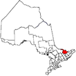 | |
|---|---|---|
| Towns | ||
| Townships | ||
| First Nations | ||
| Indian reserves | ||
| ||
This article is issued from
Wikipedia.
The text is licensed under Creative Commons - Attribution - Sharealike.
Additional terms may apply for the media files.