Wyeville, Wisconsin
| Wyeville, Wisconsin | |
|---|---|
| Village | |
 Looking west in downtown Wyeville on Wisconsin Highway 21 | |
 Location of Wyeville in Monroe County, Wisconsin. | |
| Coordinates: 44°1′40″N 90°23′9″W / 44.02778°N 90.38583°WCoordinates: 44°1′40″N 90°23′9″W / 44.02778°N 90.38583°W | |
| Country | United States |
| State | Wisconsin |
| County | Monroe |
| Area[1] | |
| • Total | 0.59 sq mi (1.53 km2) |
| • Land | 0.59 sq mi (1.53 km2) |
| • Water | 0 sq mi (0 km2) |
| Elevation[2] | 919 ft (280 m) |
| Population (2010)[3] | |
| • Total | 147 |
| • Estimate (2016)[4] | 147 |
| • Density | 249.2/sq mi (96.2/km2) |
| Time zone | UTC-6 (Central (CST)) |
| • Summer (DST) | UTC-5 (CDT) |
| Area code(s) | 608 |
| FIPS code | 55-89275[5] |
| GNIS feature ID | 1577062[2] |
Wyeville is a village in Monroe County, Wisconsin, United States. The population was 147 at the 2010 census.
History
Wyeville was originally named Necedah Junction because it was situated at the junction of the railroad line that ran toward Necedah. The local post office was called Wyeville, a variation of "Wythe", a county in Virginia. Eventually the name "Necedah Junction" was dropped and the community was called the same name as the post office.[6] It is located on Wisconsin Highway 21.[7] The railway junction became a crossing for the lines of the Chicago and North Western Railway and its subsidiary, the Omaha Road.[8] Until 1963 passengers of Twin Cities 400 and the Rochester 400 changed trains there.[9][10]
Geography


According to the United States Census Bureau, the village has a total area of 0.59 square miles (1.53 km2), all of it land.[1]
Demographics
| Historical population | |||
|---|---|---|---|
| Census | Pop. | %± | |
| 1930 | 140 | — | |
| 1940 | 219 | 56.4% | |
| 1950 | 195 | −11.0% | |
| 1960 | 220 | 12.8% | |
| 1970 | 203 | −7.7% | |
| 1980 | 163 | −19.7% | |
| 1990 | 154 | −5.5% | |
| 2000 | 146 | −5.2% | |
| 2010 | 147 | 0.7% | |
| Est. 2016 | 147 | [4] | 0.0% |
| U.S. Decennial Census[11] | |||
2010 census
As of the census[3] of 2010, there were 147 people, 62 households, and 38 families residing in the village. The population density was 249.2 inhabitants per square mile (96.2/km2). There were 70 housing units at an average density of 118.6 per square mile (45.8/km2). The racial makeup of the village was 95.9% White, 1.4% Native American, 0.7% from other races, and 2.0% from two or more races. Hispanic or Latino of any race were 1.4% of the population.
There were 62 households of which 25.8% had children under the age of 18 living with them, 50.0% were married couples living together, 6.5% had a female householder with no husband present, 4.8% had a male householder with no wife present, and 38.7% were non-families. 22.6% of all households were made up of individuals and 8.1% had someone living alone who was 65 years of age or older. The average household size was 2.37 and the average family size was 2.79.
The median age in the village was 43.5 years. 21.1% of residents were under the age of 18; 8.1% were between the ages of 18 and 24; 25.8% were from 25 to 44; 28.5% were from 45 to 64; and 16.3% were 65 years of age or older. The gender makeup of the village was 53.7% male and 46.3% female.
2000 census
As of the census[5] of 2000, there were 146 people, 56 households, and 39 families residing in the village. The population density was 245.7 people per square mile (95.5/km²). There were 60 housing units at an average density of 101.0 per square mile (39.3/km²). The racial makeup of the village was 93.84% White, 3.42% Native American, 2.74% from other races. Hispanic or Latino of any race were 2.74% of the population.
There were 56 households out of which 30.4% had children under the age of 18 living with them, 57.1% were married couples living together, 7.1% had a female householder with no husband present, and 28.6% were non-families. 25.0% of all households were made up of individuals and 19.6% had someone living alone who was 65 years of age or older. The average household size was 2.61 and the average family size was 3.15.
In the village, the population was spread out with 29.5% under the age of 18, 6.2% from 18 to 24, 30.8% from 25 to 44, 21.9% from 45 to 64, and 11.6% who were 65 years of age or older. The median age was 37 years. For every 100 females, there were 105.6 males. For every 100 females age 18 and over, there were 87.3 males.
The median income for a household in the village was $38,750, and the median income for a family was $44,531. Males had a median income of $33,750 versus $27,813 for females. The per capita income for the village was $14,344. There were 9.8% of families and 13.1% of the population living below the poverty line, including 25.5% of under eighteens and 9.5% of those over 64.
Notable people
- Kyle Kenyon, lawyer and legislator[12]
References
| Wikimedia Commons has media related to Wyeville, Wisconsin. |
- 1 2 "US Gazetteer files 2010". United States Census Bureau. Archived from the original on July 14, 2012. Retrieved 2012-11-18.
- 1 2 "US Board on Geographic Names". United States Geological Survey. 2007-10-25. Retrieved 2008-01-31.
- 1 2 "American FactFinder". United States Census Bureau. Retrieved 2012-11-18.
- 1 2 "Population and Housing Unit Estimates". Retrieved June 9, 2017.
- 1 2 "American FactFinder". United States Census Bureau. Archived from the original on September 11, 2013. Retrieved 2008-01-31.
- ↑ Chicago and North Western Railway Company (1908). A History of the Origin of the Place Names Connected with the Chicago & North Western and Chicago, St. Paul, Minneapolis & Omaha Railways. p. 141.
- ↑ 2001-2 Official Wisconsin State Highway Map
- ↑ Railway Track and Structures: RT & S. Simmons-Boardman Publishing Corporation. 1912. pp. 294–.
- ↑ Chicago and Northwestern Railway Timetable, 1962.
- ↑ Scribbins, Jim (2008) [1982]. The 400 Story. Minneapolis, Minnesota: University of Minnesota Press. ISBN 978-0-8166-5449-9. pp. 81, 98 (photograph of transfers), 203-06 (discontinuance).
- ↑ "Census of Population and Housing". Census.gov. Archived from the original on May 11, 2015. Retrieved June 4, 2015.
- ↑ 'Wisconsin Blue Book 1970,' Biographical Sketch of Kyle Kenyon, pg. 58
Municipalities and communities of Monroe County, Wisconsin, United States | ||
|---|---|---|
| Cities | 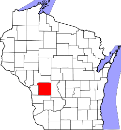 | |
| Villages | ||
| Towns | ||
| CDPs | ||
| Unincorporated communities | ||
| Indian reservation | ||
| Footnotes | ‡This populated place also has portions in an adjacent county or counties | |