Cashton, Wisconsin
| Cashton, Wisconsin | |
|---|---|
| Village | |
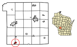 Location of Cashton in Monroe County, Wisconsin. | |
| Coordinates: 43°44′35″N 90°46′54″W / 43.74306°N 90.78167°WCoordinates: 43°44′35″N 90°46′54″W / 43.74306°N 90.78167°W | |
| Country | United States |
| State | Wisconsin |
| County | Monroe |
| Area[1] | |
| • Total | 5.72 sq mi (14.81 km2) |
| • Land | 5.25 sq mi (13.61 km2) |
| • Water | 0.47 sq mi (1.21 km2) |
| Elevation[2] | 1,362 ft (415 m) |
| Population (2010)[3] | |
| • Total | 1,102 |
| • Estimate (2016)[4] | 1,101 |
| • Density | 209.55/sq mi (80.92/km2) |
| Time zone | UTC-6 (Central (CST)) |
| • Summer (DST) | UTC-5 (CDT) |
| Area code(s) | 608 |
| FIPS code | 55-12950[5] |
| GNIS feature ID | 1562772[2] |
Cashton is a village in Monroe County, Wisconsin, United States. The population was 1,102 at the 2010 census.
Geography
Cashton is located at 43°44′35″N 90°46′54″W / 43.74306°N 90.78167°W (43.743057, -90.781578).[6]
According to the United States Census Bureau, the village has a total area of 1.32 square miles (3.42 km2), all of it land.[7]
Demographics
| Historical population | |||
|---|---|---|---|
| Census | Pop. | %± | |
| 1880 | 45 | — | |
| 1900 | 510 | — | |
| 1910 | 568 | 11.4% | |
| 1920 | 753 | 32.6% | |
| 1930 | 680 | −9.7% | |
| 1940 | 706 | 3.8% | |
| 1950 | 836 | 18.4% | |
| 1960 | 828 | −1.0% | |
| 1970 | 824 | −0.5% | |
| 1980 | 827 | 0.4% | |
| 1990 | 780 | −5.7% | |
| 2000 | 1,005 | 28.8% | |
| 2010 | 1,102 | 9.7% | |
| Est. 2016 | 1,101 | [4] | −0.1% |
| U.S. Decennial Census[8] | |||
2010 census
As of the census[3] of 2010, there were 1,102 people, 448 households, and 292 families residing in the village. The population density was 834.8 inhabitants per square mile (322.3/km2). There were 497 housing units at an average density of 376.5 per square mile (145.4/km2). The racial makeup of the village was 95.5% White, 0.9% African American, 2.9% from other races, and 0.7% from two or more races. Hispanic or Latino of any race were 4.4% of the population.
There were 448 households of which 34.8% had children under the age of 18 living with them, 47.8% were married couples living together, 9.4% had a female householder with no husband present, 8.0% had a male householder with no wife present, and 34.8% were non-families. 28.3% of all households were made up of individuals and 12.2% had someone living alone who was 65 years of age or older. The average household size was 2.46 and the average family size was 3.02.
The median age in the village was 34.7 years. 28.5% of residents were under the age of 18; 5.9% were between the ages of 18 and 24; 29.2% were from 25 to 44; 21.3% were from 45 to 64; and 15.3% were 65 years of age or older. The gender makeup of the village was 49.5% male and 50.5% female.
2000 census
As of the census[5] of 2000, there were 1,005 people, 415 households, and 271 families residing in the village. The population density was 973.3 people per square mile (376.7/km²). There were 463 housing units at an average density of 448.4 per square mile (173.6/km²). The racial makeup of the village was 99.00% White, 0.10% African American, 0.40% from other races, and 0.50% from two or more races. Hispanic or Latino of any race were 1.59% of the population.
There were 415 households out of which 33.5% had children under the age of 18 living with them, 52.3% were married couples living together, 8.9% had a female householder with no husband present, and 34.5% were non-families. 31.1% of all households were made up of individuals and 17.1% had someone living alone who was 65 years of age or older. The average household size was 2.41 and the average family size was 2.99.
In the village, the population was spread out with 27.8% under the age of 18, 6.5% from 18 to 24, 28.9% from 25 to 44, 19.0% from 45 to 64, and 17.9% who were 65 years of age or older. The median age was 36 years. For every 100 females, there were 93.3 males. For every 100 females age 18 and over, there were 88.1 males.
The median income for a household in the village was $30,938, and the median income for a family was $37,917. Males had a median income of $27,500 versus $18,274 for females. The per capita income for the village was $14,425. About 10.2% of families and 14.8% of the population were below the poverty line, including 21.1% of those under age 18 and 12.6% of those age 65 or over.
Notable people
- Leif Erickson, Justice of the Montana Supreme Court, was born in Cashton.
- Frank King, cartoonist of Gasoline Alley, was born in Cashton.
- Otto M. Peterson, Minnesota State Representative, was born in Cashton.
References
- ↑ "2016 U.S. Gazetteer Files". United States Census Bureau. Retrieved Jul 14, 2017.
- 1 2 "US Board on Geographic Names". United States Geological Survey. 2007-10-25. Retrieved 2008-01-31.
- 1 2 "American FactFinder". United States Census Bureau. Retrieved 2012-11-18.
- 1 2 "Population and Housing Unit Estimates". Retrieved June 9, 2017.
- 1 2 "American FactFinder". United States Census Bureau. Archived from the original on 2013-09-11. Retrieved 2008-01-31.
- ↑ "US Gazetteer files: 2010, 2000, and 1990". United States Census Bureau. 2011-02-12. Retrieved 2011-04-23.
- ↑ "US Gazetteer files 2010". United States Census Bureau. Archived from the original on 2012-07-14. Retrieved 2012-11-18.
- ↑ "Census of Population and Housing". Census.gov. Archived from the original on April 22, 2013. Retrieved June 4, 2015.
External links
Municipalities and communities of Monroe County, Wisconsin, United States | ||
|---|---|---|
| Cities | 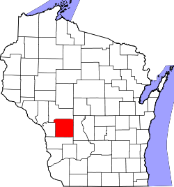 | |
| Villages | ||
| Towns | ||
| CDPs | ||
| Unincorporated communities | ||
| Indian reservation | ||
| Footnotes | ‡This populated place also has portions in an adjacent county or counties | |