Wredenhagen
| Wredenhagen | |
|---|---|
 Wredenhagen Location of Wredenhagen within Mecklenburgische Seenplatte district  | |
| Coordinates: 53°17′05″N 12°31′0″E / 53.28472°N 12.51667°ECoordinates: 53°17′05″N 12°31′0″E / 53.28472°N 12.51667°E | |
| Country | Germany |
| State | Mecklenburg-Vorpommern |
| District | Mecklenburgische Seenplatte |
| Municipal assoc. | Röbel-Müritz |
| Government | |
| • Mayor | Marianne Schmidtke |
| Area | |
| • Total | 28.09 km2 (10.85 sq mi) |
| Elevation | 68 m (223 ft) |
| Population (2017-12-31)[1] | |
| • Total | 448 |
| • Density | 16/km2 (41/sq mi) |
| Time zone | CET/CEST (UTC+1/+2) |
| Postal codes | 17209 |
| Dialling codes | 039925 |
| Vehicle registration | MÜR |
| Website |
www.amt-roebel- mueritz.de |

Dorfstr.

Church
Wredenhagen is a municipality in the Mecklenburgische Seenplatte district, in Mecklenburg-Vorpommern, Germany.
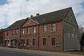 Dorfstr. 69
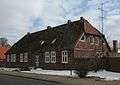 Dorfstr. 70
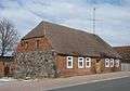 Dorfstr. 75
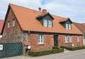 Diekstrat 2
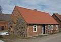 Diekstrat 5
References
This article is issued from
Wikipedia.
The text is licensed under Creative Commons - Attribution - Sharealike.
Additional terms may apply for the media files.