Dargun
| Dargun | ||
|---|---|---|
 Model of Dargun Abbey and Palace prior to destruction in WW2 | ||
| ||
 Dargun Location of Dargun within Mecklenburgische Seenplatte district 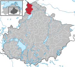 | ||
| Coordinates: 53°53′N 12°50′E / 53.883°N 12.833°ECoordinates: 53°53′N 12°50′E / 53.883°N 12.833°E | ||
| Country | Germany | |
| State | Mecklenburg-Vorpommern | |
| District | Mecklenburgische Seenplatte | |
| Government | ||
| • Mayor | Karl-Heinz Graupmann | |
| Area | ||
| • Total | 117.15 km2 (45.23 sq mi) | |
| Elevation | 10 m (30 ft) | |
| Population (2017-12-31)[1] | ||
| • Total | 4,410 | |
| • Density | 38/km2 (97/sq mi) | |
| Time zone | CET/CEST (UTC+1/+2) | |
| Postal codes | 17159 | |
| Dialling codes | 039959 | |
| Vehicle registration | DM | |
| Website | www.dargun.de | |

Dargun is a town in the Mecklenburgische Seenplatte district, in Mecklenburg-Western Pomerania, Germany. It is situated 12 km (7 mi) km west of Demmin. It is famous for Dargun Palace, a former Cistercian abbey.
History
From 1815 to 1918 Dargun was part of the Grand Duchy of Mecklenburg-Schwerin.
References
External links
![]()
| Authority control |
|---|
This article is issued from
Wikipedia.
The text is licensed under Creative Commons - Attribution - Sharealike.
Additional terms may apply for the media files.