Carpin
| Carpin | |
|---|---|
 Carpin Location of Carpin within Mecklenburgische Seenplatte district 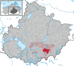 | |
| Coordinates: 53°20′N 13°14′E / 53.333°N 13.233°ECoordinates: 53°20′N 13°14′E / 53.333°N 13.233°E | |
| Country | Germany |
| State | Mecklenburg-Vorpommern |
| District | Mecklenburgische Seenplatte |
| Municipal assoc. | Neustrelitz-Land |
| Government | |
| • Mayor | Regina Sendel |
| Area | |
| • Total | 63.64 km2 (24.57 sq mi) |
| Elevation | 80 m (260 ft) |
| Population (2017-12-31)[1] | |
| • Total | 869 |
| • Density | 14/km2 (35/sq mi) |
| Time zone | CET/CEST (UTC+1/+2) |
| Postal codes | 17237 |
| Dialling codes | 039821 |
| Vehicle registration | MST |
| Website | www.amtneustrelitz-land.de |
Carpin is a municipality in the Mecklenburgische Seenplatte district, in Mecklenburg-Vorpommern, Germany.
Geography
The municipality of Carpin lies within the Feldberg Lake District Nature Park, the southern part of the offshoot of the Müritz National Park with its 101 metre high Galgenberg hill and the lake of Schweingartensee east of Neustrelitz. The region is characterised by other lakes in the Mecklenburg Lake District, such as the Schweingartensee and Lake Carpin, as well as a gently rolling countryside which is densely wooded in the west. The highest point in the municipal territory lies in the Serrahn Hills at 113.7 m above sea level (NHN).
References
| Authority control |
|---|
This article is issued from
Wikipedia.
The text is licensed under Creative Commons - Attribution - Sharealike.
Additional terms may apply for the media files.