Winfield Township, DuPage County, Illinois
| Winfield Township | |
|---|---|
| Township | |
 Location in DuPage County | |
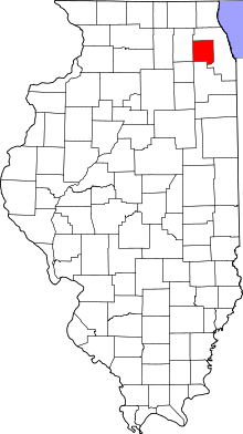 DuPage County's location in Illinois | |
| Coordinates: 41°51′23″N 88°12′15″W / 41.85639°N 88.20417°WCoordinates: 41°51′23″N 88°12′15″W / 41.85639°N 88.20417°W | |
| Country |
|
| State |
|
| County | DuPage |
| Settled | November 6, 1849 |
| Government | |
| • Supervisor | Dona L. Smith |
| Area | |
| • Total | 36.19 sq mi (93.7 km2) |
| • Land | 34.8 sq mi (90 km2) |
| • Water | 1.39 sq mi (3.6 km2) 3.84% |
| Elevation | 709 ft (216 m) |
| Population (2010) | |
| • Estimate (2016)[1] | 46,727 |
| • Density | 1,328.6/sq mi (513.0/km2) |
| Time zone | UTC-6 (CST) |
| • Summer (DST) | UTC-5 (CDT) |
| ZIP codes | 60185, 60187, 60190, 60504, 60510, 60555, 60563 |
| FIPS code | 17-043-82413 |
Winfield Township is one of nine townships in DuPage County, Illinois, USA. As of the 2010 census, its population was 46,233 and it contained 15,856 housing units.[2] It is the least populous of the DuPage County Townships.
Geography
According to the 2010 census, the township has a total area of 36.19 square miles (93.7 km2), of which 34.8 square miles (90 km2) (or 96.16%) is land and 1.39 square miles (3.6 km2) (or 3.84%) is water.[2]
Cities, towns, villages
- Aurora (northeast edge)
- Batavia (partial)
- Naperville (partial)
- Warrenville (northwest three-quarters)
- West Chicago (partial)
- Wheaton (partial)
- Winfield (partial)
Unincorporated towns
- Geneva Road at 41°53′17″N 88°09′05″W / 41.888084°N 88.151459°W
- Warrenhurst at 41°49′22″N 88°12′51″W / 41.822807°N 88.214237°W
(This list is based on USGS data and may include former settlements.)
Adjoining Townships
- Wayne Township, DuPage County (north)
- Bloomingdale Township, DuPage County (northeast)
- Milton Township, DuPage County (east)
- Lisle Township, DuPage County (southeast)
- Naperville Township, DuPage County (south)
- Aurora Township, Kane County (southwest)
- Geneva Township, Kane County (west)
- Batavia Township, Kane County (west)
- St. Charles Township, Kane County (northwest)
Cemeteries
The township contains these seven cemeteries: Assumption, Big Woods, Calvary, Glen Oak, Oakwood, Pioneer and Warrenville.
Major highways
Airports and landing strips
- Central Dupage Heliport
- DuPage Airport (south three-quarters)
Lakes
- Loveless Lake
- Spring Lake
Landmarks
- DuPage County Forest Preserve - Kline Creek Farm
- DuPage County Forest Preserve - Roy C Blackwell Preserve
- Fermi National Accelerator Laboratory
- Illinois Department of Corrections Youth Center (north quarter)
Demographics
| Historical population | |||
|---|---|---|---|
| Census | Pop. | %± | |
| Est. 2016 | 46,727 | [1] | |
| U.S. Decennial Census[3] | |||
School districts
- Community High School District 94
- Winfield Elementary School District 34
- West Chicago Elementary School District 33
- Community Unit School District 200
- Indian Prairie Community Unit School District 204
Political districts
- Illinois's 13th congressional district
- Illinois's 14th congressional district
- Illinois's 6th congressional district
- State House District 95
- State House District 96
- State Senate District 48
References
- "Winfield Township, DuPage County, Illinois". Geographic Names Information System. United States Geological Survey. Retrieved 2010-01-10.
- United States Census Bureau 2008 TIGER/Line Shapefiles
- United States National Atlas
- 1 2 "Population and Housing Unit Estimates". Retrieved June 9, 2017.
- 1 2 "Population, Housing Units, Area, and Density: 2010 - County -- County Subdivision and Place -- 2010 Census Summary File 1". United States Census. Retrieved 2013-05-28.
- ↑ "Census of Population and Housing". Census.gov. Retrieved June 4, 2016.
External links
Places adjacent to Winfield Township, DuPage County, Illinois | |
|---|---|
Municipalities and communities of DuPage County, Illinois, United States | ||
|---|---|---|
| Cities | ||
| Villages |
| |
| Townships | ||
| Unincorporated communities | ||
| Ghost towns/Neighborhoods | ||
| Footnotes | ‡This populated place also has portions in an adjacent county or counties | |
This article is issued from
Wikipedia.
The text is licensed under Creative Commons - Attribution - Sharealike.
Additional terms may apply for the media files.