Downers Grove Township, DuPage County, Illinois
| Downers Grove Township | |
|---|---|
| Township | |
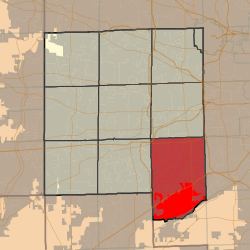 Location in DuPage County | |
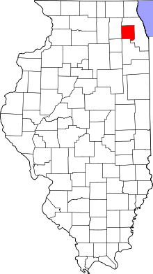 DuPage County's location in Illinois | |
| Coordinates: 41°45′15″N 87°58′32″W / 41.75417°N 87.97556°WCoordinates: 41°45′15″N 87°58′32″W / 41.75417°N 87.97556°W | |
| Country |
|
| State |
|
| County | DuPage |
| Settled | November 6, 1849 |
| Government | |
| • Supervisor | Mark S. Thoman (R) |
| Area | |
| • Total | 50.93 sq mi (131.9 km2) |
| • Land | 49.56 sq mi (128.4 km2) |
| • Water | 1.36 sq mi (3.5 km2) 2.67% |
| Elevation | 758 ft (231 m) |
| Population (2010) | |
| • Estimate (2016)[1] | 148,570 |
| • Density | 2,961.9/sq mi (1,143.6/km2) |
| Time zone | UTC-6 (CST) |
| • Summer (DST) | UTC-5 (CDT) |
| ZIP codes | 60439, 60480, 60514-60517, 60521, 60523, 60527, 60559, 60561 |
| FIPS code | 17-043-20604 |
Downers Grove Township is one of nine townships in DuPage County, Illinois, USA. As of the 2010 census, its population was 146,795 and it contained 60,438 housing units.[2] It is the largest township in the county, both in terms of area and population.
History
Downers Grove Township is named for Pierce Downer, who settled in the neighborhood about 1830.[3]
In the mid 1800's Dexter Stanley donated land to build the Oak Hill Cemetery. Along with the adjacent Oak Crest Cemetery, both are still used today as Township maintained Cemeteries.[4]
Geography
According to the 2010 census, the township has a total area of 50.93 square miles (131.9 km2), of which 49.56 square miles (128.4 km2) (or 97.31%) is land and 1.36 square miles (3.5 km2) (or 2.67%) is water.[2]
Cities, towns, villages
- Bolingbrook (partial)
- Burr Ridge (west three-quarters)
- Clarendon Hills
- Darien
- Downers Grove (southeast three-quarters)
- Hinsdale (partial)
- Lemont (partial)
- Oak Brook (partial)
- Westmont (south three-quarters)
- Willowbrook
- Woodridge (partial)
Unincorporated towns
- Fullersburg at 41°49′05″N 87°55′06″W / 41.818087°N 87.918394°W
- Lace at 41°45′07″N 87°58′03″W / 41.751975°N 87.967560°W
- Palisades at 41°42′49″N 87°56′01″W / 41.713643°N 87.933669°W
(This list is based on USGS data and may include former settlements.)
Extinct towns
(These towns are listed as "historical" by the USGS.)
Cemeteries
The township contains these ten cemeteries: Cass, Clarendon Hills, Downers Grove, Fullersburg, Hinsdale Animal, Oak Crest, Oak Hill, Pierce Downer, Saint Johns Lutheran, Saint Mary of Gostyn and Saint Patricks Catholic.
Major highways
Airports and landing strips
- Argonne Heliport
- Brookeridge Airpark
- Darien-Woodridge Fire Department Heliport
- Madison Avenue Venture Heliport
- Midwest Heliport
Rivers
Lakes
- Bruce Lake
- Golfview Lake
- Maple Lake
- Picadilly Lake
- Ruth Lake
Landmarks
- Argonne National Laboratory
- Dupage County Waterfall Glen Forest Preserve
Demographics
| Historical population | |||
|---|---|---|---|
| Census | Pop. | %± | |
| Est. 2016 | 148,570 | [1] | |
| U.S. Decennial Census[5] | |||
School districts
Elementary School Districts: Butler 53, Cass 63, Center Cass 66, 180, Darien 61, Downers Grove Grade 58, Gower 62, Hinsdale 181, Lemont-Bromberek 113A, Maercker 60 High School Districts: CHSD 99, Hinsdale Township 86, Lemont Township 210 Unit School Districts: Westmont Community Unit School District 201
Political districts
- Illinois' 6th Congressional District
- Illinois' 8th Congressional District
- Illinois' 11th Congressional District
- State House District 47
- State House District 81
- State House District 82
- State Senate District 24
- State Senate District 41
References
- "Downers Grove Township, DuPage County, Illinois". Geographic Names Information System. United States Geological Survey. Retrieved 2010-01-10.
- United States Census Bureau 2008 TIGER/Line Shapefiles
- United States National Atlas
- 1 2 "Population and Housing Unit Estimates". Retrieved June 9, 2017.
- 1 2 "Population, Housing Units, Area, and Density: 2010 - County -- County Subdivision and Place -- 2010 Census Summary File 1". United States Census. Retrieved 2013-05-28.
- ↑ Gannett, Henry (1905). The Origin of Certain Place Names in the United States. Govt. Print. Off. p. 108.
- ↑ "Cemeteries". Downers Grove Township. Downers Grove, Illinois. 2011. Retrieved 7 November 2014.
- ↑ "Census of Population and Housing". Census.gov. Retrieved June 4, 2016.
External links
Places adjacent to Downers Grove Township, DuPage County, Illinois | |
|---|---|
Municipalities and communities of DuPage County, Illinois, United States | ||
|---|---|---|
| Cities | ||
| Villages |
| |
| Townships | ||
| Unincorporated communities | ||
| Ghost towns/Neighborhoods | ||
| Footnotes | ‡This populated place also has portions in an adjacent county or counties | |