Winchester, Kansas
| Winchester, Kansas | |
|---|---|
| City | |
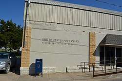 Post office in Winchester (2014) | |
 Location within Jefferson County and Kansas | |
 KDOT map of Jefferson County (legend) | |
| Coordinates: 39°19′18″N 95°16′5″W / 39.32167°N 95.26806°WCoordinates: 39°19′18″N 95°16′5″W / 39.32167°N 95.26806°W | |
| Country | United States |
| State | Kansas |
| County | Jefferson |
| Platted | 1857 |
| Area[1] | |
| • Total | 0.36 sq mi (0.93 km2) |
| • Land | 0.35 sq mi (0.91 km2) |
| • Water | 0.01 sq mi (0.03 km2) |
| Elevation | 1,178 ft (359 m) |
| Population (2010)[2] | |
| • Total | 551 |
| • Estimate (2016)[3] | 530 |
| • Density | 1,500/sq mi (590/km2) |
| Time zone | UTC-6 (CST) |
| • Summer (DST) | UTC-5 (CDT) |
| ZIP code | 66097 |
| Area code | 913 |
| FIPS code | 20-79800 [4] |
| GNIS ID | 0478344 [5] |
Winchester is a city in Jefferson County, Kansas, United States. As of the 2010 census, the city population was 551.[6]
History
Winchester was laid out in 1857.[7] It was named after Winchester, Virginia.[8]
The first post office in Winchester was established in March 1858.[9]
Geography
Winchester is located at 39°19′18″N 95°16′5″W / 39.32167°N 95.26806°W (39.321658, -95.268142).[10] According to the United States Census Bureau, the city has a total area of 0.36 square miles (0.93 km2), of which, 0.35 square miles (0.91 km2) is land and 0.01 square miles (0.03 km2) is water.[1]
Demographics
| Historical population | |||
|---|---|---|---|
| Census | Pop. | %± | |
| 1880 | 413 | — | |
| 1890 | 429 | 3.9% | |
| 1910 | 456 | — | |
| 1920 | 386 | −15.4% | |
| 1930 | 418 | 8.3% | |
| 1940 | 415 | −0.7% | |
| 1950 | 355 | −14.5% | |
| 1960 | 458 | 29.0% | |
| 1970 | 492 | 7.4% | |
| 1980 | 570 | 15.9% | |
| 1990 | 613 | 7.5% | |
| 2000 | 579 | −5.5% | |
| 2010 | 551 | −4.8% | |
| Est. 2016 | 530 | [3] | −3.8% |
| U.S. Decennial Census | |||
Winchester is part of the Topeka, Kansas Metropolitan Statistical Area.
2010 census
As of the census[2] of 2010, there were 551 people, 229 households, and 140 families residing in the city. The population density was 1,574.3 inhabitants per square mile (607.8/km2). There were 261 housing units at an average density of 745.7 per square mile (287.9/km2). The racial makeup of the city was 98.4% White, 1.3% Native American, and 0.4% from two or more races. Hispanic or Latino of any race were 0.9% of the population.
There were 229 households of which 27.9% had children under the age of 18 living with them, 40.6% were married couples living together, 12.2% had a female householder with no husband present, 8.3% had a male householder with no wife present, and 38.9% were non-families. 34.1% of all households were made up of individuals and 20.1% had someone living alone who was 65 years of age or older. The average household size was 2.28 and the average family size was 2.91.
The median age in the city was 42.8 years. 22.3% of residents were under the age of 18; 7.8% were between the ages of 18 and 24; 21.7% were from 25 to 44; 22.4% were from 45 to 64; and 25.6% were 65 years of age or older. The gender makeup of the city was 48.5% male and 51.5% female.
2000 census
As of the census[4] of 2000, there were 579 people, 210 households, and 149 families residing in the city. The population density was 1,958.6 people per square mile (745.2/km²). There were 221 housing units at an average density of 747.6 per square mile (284.4/km²). The racial makeup of the city was 97.06% White, 2.25% Native American, 0.17% Asian, 0.17% from other races, and 0.35% from two or more races. Hispanic or Latino of any race were 1.73% of the population.
There were 210 households out of which 35.7% had children under the age of 18 living with them, 54.8% were married couples living together, 11.9% had a female householder with no husband present, and 28.6% were non-families. 25.2% of all households were made up of individuals and 13.8% had someone living alone who was 65 years of age or older. The average household size was 2.56 and the average family size was 3.07.
In the city, the population was spread out with 26.4% under the age of 18, 9.7% from 18 to 24, 23.8% from 25 to 44, 17.6% from 45 to 64, and 22.5% who were 65 years of age or older. The median age was 38 years. For every 100 females, there were 90.5 males. For every 100 females age 18 and over, there were 82.8 males.
The median income for a household in the city was $37,143, and the median income for a family was $41,500. Males had a median income of $35,313 versus $19,659 for females. The per capita income for the city was $14,568. About 9.0% of families and 10.3% of the population were below the poverty line, including 14.2% of those under age 18 and 8.9% of those age 65 or over.
Education
Schools
Nortonville is served by USD 339 Jefferson County North. School unification consolidated Nortonville and Winchester schools forming USD 339. Jefferson County North High School is located in Winchester. The Jefferson County North High School mascot is Jefferson County Chargers.[11]
Winchester High School was closed through school unification. The Winchester High School mascot was Winchester Eagles.[12]
Libraries
Notable persons
- Bob Lyon - Kansas State Senator.
- Al Reynolds - college and professional football guard.
- Jerry Robertson - baseball player.
References
- 1 2 "US Gazetteer files 2010". United States Census Bureau. Retrieved 2012-07-06.
- 1 2 "American FactFinder". United States Census Bureau. Retrieved 2012-07-06.
- 1 2 "Population and Housing Unit Estimates". Retrieved June 9, 2017.
- 1 2 "American FactFinder". United States Census Bureau. Retrieved 2008-01-31.
- ↑ "US Board on Geographic Names". United States Geological Survey. 2007-10-25. Retrieved 2008-01-31.
- ↑ "2010 City Population and Housing Occupancy Status". U.S. Census Bureau. Retrieved April 6, 2012.
- ↑ Blackmar, Frank Wilson (1912). Kansas: A Cyclopedia of State History, Volume 2. Standard Publishing Company. p. 925.
- ↑ Kansas State Historical Society (1916). Biennial Report of the Board of Directors of the Kansas State Historical Society. Kansas State Printing Plant. p. 210.
- ↑ "Kansas Post Offices, 1828-1961, page 2 (archived)". Kansas Historical Society. Archived from the original on October 9, 2013. Retrieved 11 June 2014.
- ↑ "US Gazetteer files: 2010, 2000, and 1990". United States Census Bureau. 2011-02-12. Retrieved 2011-04-23.
- ↑ "Jefferson County North USD 339". USD 339. Retrieved 4 January 2017.
- ↑ "Eagles Take Easton Scalps", The Leavenworth Times, 10 February 1965, p.10.
External links
| Wikimedia Commons has media related to Winchester, Kansas. |
- City
- Schools
- USD 339, local school district
- Maps
- Winchester City Map, KDOT
Municipalities and communities of Jefferson County, Kansas, United States | ||
|---|---|---|
| Cities | 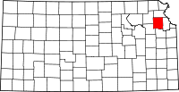 | |
| CDP | ||
| Unincorporated communities | ||
| Townships | ||