Dunavant, Kansas
Dunavant is an unincorporated community in Jefferson County, Kansas, United States.[1]
History
.jpg)
A post office was opened in Dunavant in 1888, and remained in operation until it was discontinued in 1932.[2]
In 1910, Dunavant's population was 85 people. In 1912, Dunavant had a money order Post Office and a telegraph office, and was on a branch of the Missouri Pacific Railroad.[3]
Battle of Hickory Point
In 1856, James H. Lane, leader of a small band of Free-State men, besieged a group of Proslavery men in the log buildings near Dunavant at Hickory Point. The Proslavery men had attacked Valley Falls (then called Grasshopper Falls). Lane sent to Lawrence for artillery to drive the men out. Reinforcements led by Col. James A. Harvey arrived the next day, and the skirmish ended with 4 Proslavery men wounded, 1 killed, and 5 Free-State men injured. A Kansas Historical Marker for the Battle of Hickory Point stands a half mile away, on today's U.S. Route 59.
Also nearby, just 1/4 mi. from the Battle of Hickory Point marker, is the farm on which painter John Steuart Curry was born.[4] Later in life, John Steuart Curry would become known for his painting of abolitionist John Brown at the Kansas State Capitol, and also for his painting Law vs. Mob Rule at the Department of Justice in Washington, DC, in which a judge in black robes protects a man from a lynch mob.[5]
Geography
Dunavant is located at 39°18′07″N 95°19′58″W / 39.30194°N 95.33278°W. Its elevation is 1,155 ft (352 m).[1]
Notable people
- John Steuart Curry, painter
References
- 1 2 U.S. Geological Survey Geographic Names Information System: Dunavant
- ↑ "Kansas Post Offices, 1828-1961 (archived)". Kansas Historical Society. Archived from the original on October 9, 2013. Retrieved 11 June 2014.
- ↑ "Dunavant - KS-Cyclopedia - 1912". Retrieved 2012-02-19.
- ↑ "Panoramio - Photo of Hickory Point". Retrieved 2012-02-19.
- ↑ Kennedy, Roger G.; David Larkin (2009). When art worked. New York: Rizzoli. pp. 63–64. ISBN 978-0-8478-3089-3.
External links
- Plum Grove Cemetery, Dunavant, Kansas
- Historical marker for Battle of Hickory Point, located 1/4 mil E of John Steuart Curry's birthplace, on U.S. Route 59
- Photographs taken W of Dunevant, Kansas
Municipalities and communities of Jefferson County, Kansas, United States | ||
|---|---|---|
| Cities | 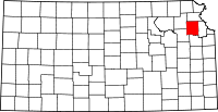 | |
| CDP | ||
| Unincorporated communities | ||
| Townships | ||
Coordinates: 39°18′07″N 95°19′58″W / 39.30194°N 95.33278°W